
Centre-Val de Loire facts for kids
Quick facts for kids Centre-Val de Loire |
|||
| Region | |||
|
|||
| Country | |||
|---|---|---|---|
| Préfecture | Orléans | ||
| Area | 39,150.9 km² (15,116 sq mi) | ||
| Population | 2,577,435 (2014) | ||
| Density | 66 /km² (171 /sq mi) | ||
| Subdivisions | 6 departments 20 arrondissements 102 cantons 1783 communes |
||
| President | François Bonneau | ||
| Timezone | CET (UTC+1) | ||
| - summer (DST) | CEST (UTC+2) | ||
| ISO 3166-2 | FR-CVL | ||


Centre-Val de Loire is one of the 18 regions of France. It's located in the middle of the country. The capital city of the region is Orléans, but its biggest city is Tours.
This region was created in 2014. It was formed from three older areas: Touraine, Orléanais, and Berry.
Contents
Geography of Centre-Val de Loire

The Centre-Val de Loire region is the seventh largest region in France. It covers an area of about 39,150.9 km2 (15,116 sq mi). It is in north-central France.
It shares borders with six other regions:
- Normandy to the northwest.
- Île-de-France to the north.
- Bourgogne-Franche-Comté to the east.
- Auvergne-Rhône-Alpes to the southeast.
- Nouvelle-Aquitaine to the south.
- Pays de la Loire to the west.
Distances to Major Cities
Here are the distances from Orléans, the region's capital, to some other important cities:
- Paris, the capital of France, is 132 km (82 mi) away.
- Bordeaux is 462 km (287 mi) away.
- Lyon is 466 km (290 mi) away.
- Marseille is 759 km (472 mi) away.
- Montpellier is 626 km (389 mi) away.
- Nice is 915 km (569 mi) away.
- Strasbourg is 584 km (363 mi) away.
- Toulouse is 555 km (345 mi) away.
Rivers in the Region
The Centre-Val de Loire region has many rivers. The longest river in France, the Loire, flows through it. It is about 1,013 km (629 mi) long.
Other important rivers in the region include:
- Eure - 229 km (142 mi) long.
- Loir - 317 km (197 mi) long.
- Cher - 368 km (229 mi) long.
- Loing - 142 km (88 mi) long.
- Indre - 279 km (173 mi) long.
Highest Points and Mountains
Most of the Centre-Val de Loire region is made up of large flat areas called plains and low plateaus.
The highest point in the region is a place called Le Magnoux. It is 501 m (1,644 ft) high. You can find it in the southern part of the Cher department.
Here are the highest points in each of the region's departments:
| Department | Mountain or Highest Point | Elevation |
|---|---|---|
| Cher | Le Magnoux | 501 m (1,644 ft) |
| Eure-et-Loir | Butte de Rougemont | 287 m (942 ft) |
| Indre | Terrior Randoin | 457 m (1,499 ft) |
| Indre-et-Loire | Signal de la Ronde | 186 m (610 ft) |
| Loir-et-Cher | Bois des Vallèes | 256 m (840 ft) |
| Loiret | Col des Étourneaux | 273 m (896 ft) |
Departments of Centre-Val de Loire
The Centre-Val de Loire region is divided into 6 smaller areas called departments. Each department has its own main city, called a Prefecture.
| ISO 3166-2 |
Shield | Department | Prefecture | Arr. | Cant. | Comm. | Population (2014) |
Area (km²) |
Density (Inh./km²) |
|---|---|---|---|---|---|---|---|---|---|
| FR-18 | Cher | Bourges | 3 | 19 | 290 | 310,270 | 7,235.0 | 42.9 | |
| FR-28 | Eure-et-Loir | Chartres | 4 | 15 | 375 | 433,762 | 5,880.0 | 73.8 | |
| FR-36 | Indre | Châteauroux | 4 | 13 | 243 | 226,175 | 6,790.6 | 33.3 | |
| FR-37 | Indre-et-Loire | Tours | 3 | 19 | 273 | 603,924 | 6126.7 | 98.6 | |
| FR-41 | Loir-et-Cher | Blois | 3 | 15 | 276 | 333,567 | 6,343.4 | 52.6 | |
| FR-45 | Loiret | Orléans | 3 | 21 | 326 | 669,737 | 6,775.2 | 98.9 | |
| Total of the Region | 20 | 102 | 1,783 | 2,577,435 | 39,150.9 | 65.8 | |||
Arr. = Arrondissements (smaller areas within departments)
Cant. = Cantons (groups of towns)
Comm. = Communes (towns or villages)
Population and Main Cities
As of 1 January 2014[update], the Centre-Val de Loire region had a population of 2,577,435 people. This means there were about 65.8 people living in each square kilometer.

Here are the main cities in the region with more than 20,000 inhabitants in 2014:
| INSEE code |
City | Department | Population (2014) |
|---|---|---|---|
| 37261 | Tours | Indre-et-Loire | 136,125 |
| 45234 | Orléans | Loiret | 114,977 |
| 18033 | Bourges | Cher | 66,528 |
| 41018 | Blois | Loir-et-Cher | 46,351 |
| 36044 | Châteauroux | Indre | 44,479 |
| 28085 | Chartres | Eure-et-Loir | 38,728 |
| 37122 | Joué-lès-Tours | Indre-et-Loire | 37,748 |
| 28134 | Dreux | Eure-et-Loir | 31,191 |
| 18279 | Vierzon | Cher | 27,050 |
| 45232 | Olivet | Loiret | 21,192 |
| 45147 | Fleury-les-Aubrais | Loiret | 20,791 |
Gallery
-
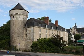
Castle of Tours.
-
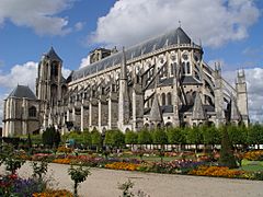
Saint-Etienne cathedral, Bourges.
-
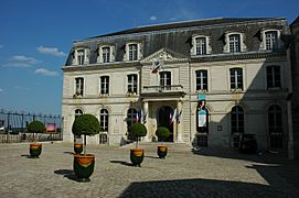
Blois City hall.
-
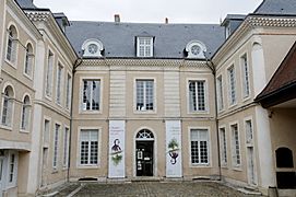
Musée Hôtel Bertrand, Châteauroux.

_16-09-2006.jpg)


Related pages
Images for kids
-
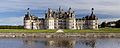
Château de Chambord
-
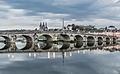
Blois
-
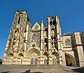
Bourges
-
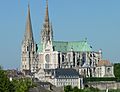
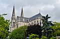
Chartres
-
Châteauroux
-
Orléans
-
Tours


See also
 In Spanish: Centro-Valle del Loira para niños
