
Cher (river) facts for kids
Quick facts for kids Cher |
|
| River | |
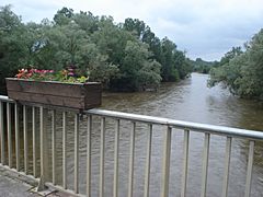
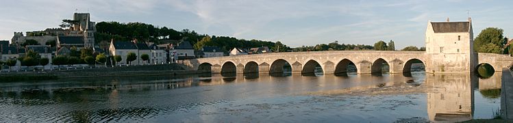
 The Cher river at Saint-Georges-sur-Cher
|
|
| Country | France |
|---|---|
| Regions | Nouvelle-Aquitaine, Auvergne-Rhône-Alpes, Centre-Val de Loire |
| Departments | Creuse, Puy-de-Dôme, Allier, Cher, Loir-et-Cher, Indre, Indre-et-Loire |
| Tributaries | |
| - left | Tardes, Arnon, Fouzon |
| - right | Aumance, Yèvre, Sauldre |
| Cities | Montluçon, Tours |
| Source | |
| - location | Mérinchal, Massif Central, France |
| - elevation | 715 m (2,346 ft) |
| - coordinates | 45°55′17″N 2°28′25″E / 45.92139°N 2.47361°E |
| Mouth | Loire |
| - location | Villandry, Indre-et-Loire, France |
| - elevation | 38 m (125 ft) |
| - coordinates | 47°20′33″N 0°28′50″E / 47.34250°N 0.48056°E |
| Length | 367.8 km (229 mi) |
| Basin | 13,920 km² (5,375 sq mi) |
| Discharge | for Tours |
| - average | 92.60 m³/s (3,270 cu ft/s) |
The Cher is a river in central France. It is a left tributary of the Loire River. This means it flows into the Loire from its left side. The Cher river runs through several regions of France.
The Cher and Loir-et-Cher departments are named after this river.
Contents
The Cher River: A Journey Through France
The Cher river is about 368 kilometers (229 miles) long. Its drainage basin covers a huge area of 13,920 square kilometers (5,375 square miles). A drainage basin is all the land where water flows into a specific river.
The river's average yearly discharge is about 92.60 cubic meters per second. This is the amount of water that flows through the river each second. This measurement was taken near Tours, Indre-et-Loire, between 1966 and 2017.
Where the Cher River Begins
The Cher starts in the Massif Central mountain range. This is in the Mérinchal area, which is part of the Creuse department in the Nouvelle-Aquitaine region. The river begins at a height of about 715 meters (2,346 feet) above sea level.
The Cher's Path
The Cher generally flows towards the northwest. It travels through many different regions and departments in France.
It passes through parts of:
- Nouvelle-Aquitaine region, including the Creuse department.
- Auvergne-Rhône-Alpes region, including the Puy-de-Dôme and Allier departments.
- Centre-Val de Loire region, including the Cher, Loir-et-Cher, Indre, and Indre-et-Loire departments.
Some of the larger cities it flows near include Montluçon and Tours.
Where the Cher River Ends
The Cher river eventually flows into the Loire River. This meeting point is called the bec du Cher, which means "beak of the Cher." It happens in the Regional nature park Loire-Anjou-Touraine, near Villandry. This spot is about 20 kilometers (12 miles) west of the city of Tours. Here, the river is about 38 meters (125 feet) above sea level.
Smaller Rivers Joining the Cher
Many smaller rivers flow into the Cher, adding to its water. These are called tributaries. Here are some of the main ones that are longer than 50 kilometers (31 miles):
- Rivers joining from the left:
- Tardes - 77.3 kilometers (48 miles) long.
- Arnon - 150.5 kilometers (93.5 miles) long.
- Fouzon - 59 kilometers (37 miles) long.
- Rivers joining from the right:
- Aumance - 56.3 kilometers (35 miles) long.
- Yèvre - 80.6 kilometers (50 miles) long.
- Sauldre - 183.1 kilometers (114 miles) long.
Gallery
-
The Cher at Villeneuve-sur-Cher.
-
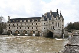
Château de Chenonceau over the Cher river.
-
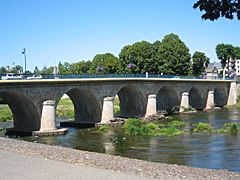
Bridge over the Cher in Saint-Florent-sur-Cher.
-
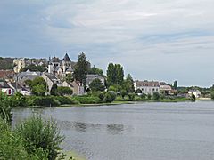
The Cher river at Saint-Aignan.
-
The Cher river at Montrichard.
,_le_Cher.JPG)


.jpg)

Related pages
See also

