
Creuse facts for kids
Quick facts for kids
Creuse
|
|||
|---|---|---|---|

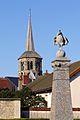
Prefecture building of the Creuse department, in Guéret
|
|||
|
|||

Location of Creuse in France
|
|||
| Country | France | ||
| Region | Nouvelle-Aquitaine | ||
| Département | 4 March 1790 | ||
| Prefecture | Guéret | ||
| Subprefecture | Aubusson | ||
| Area | |||
| • Total | 5,565.4 km2 (2,148.8 sq mi) | ||
| Population
(2014)
|
|||
| • Total | 120,581 | ||
| • Density | 21.66619/km2 (56.1152/sq mi) | ||
| Demonym(s) | Creusois | ||
| Time zone | UTC+1 (CET) | ||
| • Summer (DST) | UTC+2 (CEST) | ||
| ISO 3166 code | FR-23 | ||
| Arrondissements | 2 | ||
| Cantons | 15 | ||
| Communes | 258 | ||
| Website | www.creuse.fr | ||


Creuse (pronounced 'Krooz') is a special area in central France. It's called a 'department' and is part of the Nouvelle-Aquitaine region. The department gets its name from the Creuse River, which flows right through it!
Contents
History of Creuse
Creuse is one of the 83 departments that were created in France during the French Revolution. This happened on March 4, 1790. Most of the land for Creuse came from an old area called the County of La Marche.
At first, the new department had seven smaller areas called districts. These were La Souterraine, Guéret, Boussac, Évaux, Felletin, Bourganeuf, and Aubusson. The main city, or 'capital' (now called a prefecture), was first shared between Guéret and Aubusson. But soon, Guéret became the only capital.
In 1800, France created 'arrondissements' (which are like large districts). The seven original districts of Creuse were changed into four arrondissements: Guéret, Aubusson, Bourganeuf, and Boussac. However, in 1926, the arrondissements of Bourganeuf and Boussac were removed.
Geography of Creuse

Creuse is located in the Nouvelle-Aquitaine region of France. It covers a total area of about 5,565 square kilometers (2,149 square miles).
The department is surrounded by six other departments from three different regions:
- From the Nouvelle-Aquitaine region:
- Corrèze department
- Haute-Vienne department
- From the Centre-Val de Loire region:
- From the Auvergne-Rhône-Alpes region:
- Allier department
- Puy-de-Dôme department
 |
Indre | Cher | |
|
| Haute-Vienne | Allier | |||
| Corrèze | Puy-de-Dôme |
Creuse is in the northwestern part of the Massif Central, which is a large group of mountains and plateaus in central France. A high area called the Millevaches plateau is in the southeastern part of the department.
The highest point in Creuse is in the Forêt de Châteauvert (Châteauvert Forest). It is 932 meters (3,058 feet) high. The lowest point is in the valley of the Creuse River, at 175 meters (574 feet) high.
The most important river in the department is the Creuse River. It flows from the southeast to the northwest and is a tributary of the Vienne River. This river is so important that the department is named after it!
How Creuse is Governed
The department of Creuse is managed by the Departmental Council of the Creuse. This council is located in Guéret, which is the main city. Creuse is part of the larger Nouvelle-Aquitaine region.
Administrative Areas
Creuse is divided into smaller administrative areas to help manage it. There are:
- 2 arrondissements (large districts)
- 15 cantons (smaller administrative areas)
- 258 communes (which are like towns or municipalities)
Here's a quick look at the two main arrondissements:
| Arrondissement | Capital | Population (2014) |
Area (km²) |
Density (Inh./km²) |
Communes |
|---|---|---|---|---|---|
| Aubusson | Aubusson | 37,123 | 2,538.8 | 14.6 | 118 |
| Guéret | Guéret | 83,458 | 3,026.5 | 27.6 | 140 |
The 15 cantons of Creuse were reorganized in March 2015. They include:
- Ahun
- Aubusson
- Auzances
- Bonnat
- Bourganeuf
- Boussac
- Dun-le-Palestel
- Évaux-les-Bains
- Felletin
- Gouzon
- Le Grand-Bourg
- Guéret-1
- Guéret-2
- Saint-Vaury
- La Souterraine
People of Creuse
The people who live in Creuse are called Creusois (for men) and Creusoises (for women) in French.
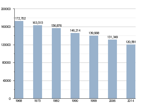
In 2014, Creuse had a population of 120,581 people. This means there were about 21.7 people living in each square kilometer. The arrondissement of Guéret is the largest, with 83,458 people. The Aubusson arrondissement has 37,123 people.
How the population of Creuse has changed over time
Here are some of the main cities in Creuse:
| City | Population (2014) |
Arrondissement |
|---|---|---|
| Guéret | 13,342 | Guéret |
| La Souterraine | 5,295 | Guéret |
| Aubusson | 3,591 | Aubusson |
| Bourganeuf | 2,725 | Guéret |
| Sainte-Feyre | 2,470 | Guéret |
| Saint-Sulpice-le-Guérétois | 1,987 | Guéret |
| Saint-Vaury | 1,791 | Guéret |
| Felletin | 1,700 | Aubusson |
| Gouzon | 1,575 | Guéret |
| Ahun | 1,466 | Guéret |
Gallery

_-_Vue_vers_Ruffec_-_viaduc.jpg)


See also
Images for kids
-
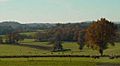
Creuse landscape
-
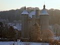
Villemonteix Castle in winter
-
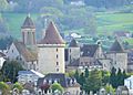
Bourganeuf Castle with infamous Cem Sultan tower
-
View of Evaux-les-Bains
-
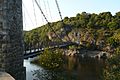
19th-century bridge architecture in Creuse
-
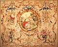
Typical Aubusson tapestry
-
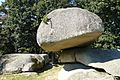
Natural granitic site of Les Pierres-Jaumâtres, in Creuse
-
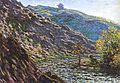
Monet's Petite Creuse, 1889
-
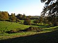
Western Creuse typical landscape
-
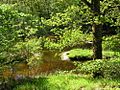
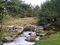
Small river in Creuse
-
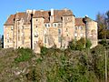
Boussac Castle, Creuse
-
Senoueix Bridge
-
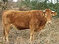
Typical Limousin cattle in Creuse
-
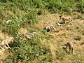
The wolves of Chabrières
-
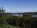
Lake Vassivière in Creuse


.JPG)


More Information
 In Spanish: Creuse (departamento) para niños
