
Creuse (river) facts for kids
Quick facts for kids Creuse |
|
| River | |
_-_Vue_vers_Preuilly-la-Ville.jpg) The Creuse in Fontgombault
|
|
| Country | France |
|---|---|
| Regions | Nouvelle-Aquitaine, Centre-Val de Loire |
| Departments | Creuse, Indre, Indre-et-Loire, Vienne |
| Communes | Aubusson, Argenton-sur-Creuse, Guéret, Le Blanc |
| Tributaries | |
| - left | Sédelle, Gartempe |
| - right | Rozeille, Petite Creuse, Bouzanne, Suin |
| Source | Plateau de Millevaches |
| - location | Massif Central, Nouvelle-Aquitaine, France |
| - elevation | 811 m (2,661 ft) |
| - coordinates | 45°43′43″N 2°10′47″E / 45.72861°N 2.17972°E |
| Confluence | Vienne river |
| - location | Port-de-Piles Ports Nouâtre, Nouvelle-Aquitaine Centre-Val de Loire, France |
| - elevation | 40 m (131 ft) |
| - coordinates | 47°0′22″N 0°34′8″E / 47.00611°N 0.56889°E |
| Length | 236.6 km (147 mi) |
| Basin | 10,279 km² (3,969 sq mi) |
| Discharge | for Leugny |
| - average | 74 m³/s (2,613 cu ft/s) |
The Creuse (which is Cruesa in Occitan) is a river in western France. It flows through two main areas: the Nouvelle-Aquitaine and Centre-Val de Loire regions.
The river starts in the Massif Central mountain range. It then flows into the Vienne river. The Creuse is a "right tributary" of the Vienne, meaning it joins the Vienne from the right side when looking downstream.
Contents
About the Creuse River
The Creuse river is quite long, stretching for about 236.6 kilometers (147 miles). The area of land that drains into the Creuse river is called its drainage basin. This basin covers a large area of about 10,279 square kilometers (3,969 square miles).
How Much Water Flows?
The amount of water flowing in a river is called its discharge. The average amount of water flowing in the Creuse river is about 74 cubic meters per second (2,613 cubic feet per second). This measurement is taken near a town called Leugny.
The river's flow changes throughout the year. It has the most water in February (around 146 cubic meters per second). The lowest flow is usually in August (around 20 cubic meters per second). This is because of rainfall and snowmelt patterns.
Where the Creuse River Flows
The Creuse river begins in a place called the Plateau de Millevaches. This area is part of the Massif Central mountains. The river starts in the town of Le Mas-d'Artige in the Creuse department. Here, it is about 811 meters (2,661 feet) above sea level. From its source, the river generally flows towards the northwest.
The Creuse river eventually joins the Vienne river. This meeting point is known as Bec des Deux Eaux. It's located where three towns meet: Port-de-Piles (in Vienne), Ports, and Nouâtre (both in Indre-et-Loire).
The Creuse river passes through 5 different departments and 80 towns in two regions of France. Some of the important towns it flows through include:
- In the Centre-Val de Loire region:
- Indre: Argenton-sur-Creuse, Le Blanc
- Indre-et-Loire: Yzeures-sur-Creuse, Descartes
- In the Nouvelle-Aquitaine region:
River Branches: Tributaries
A tributary is a smaller stream or river that flows into a larger river. The Creuse river has several important tributaries that add water to it.
|
Rivers joining from the left:
|
Rivers joining from the right:
|
Gallery
-
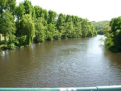
The Creuse in Yzeures sur Creuse
-
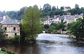
The Creuse in Argenton-sur-Creuse
-
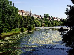
The Creuse in Saint Gaultier
-
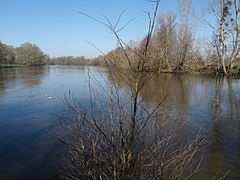
The Confluence (where two rivers meet) of the Gartempe and Creuse rivers

_-_Rivi%C3%A8re.jpg)


More to Explore
- List of rivers of France
- In Spanish: Río Creuse para niños
Images for kids
-
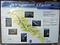
Diagram of the Creuse Dams

