
Gartempe facts for kids
Quick facts for kids Gartempe |
|
| River | |
.jpg) The Gartempe in Saint-Germain
|
|
| Country | France |
|---|---|
| Regions | Nouvelle-Aquitaine, Centre-Val de Loire |
| Departments | Creuse, Haute-Vienne, Vienne, Indre, Indre-et-Loire |
| Communes | Bessines-sur-Gartempe, Montmorillon, La Roche-Posay |
| Tributaries | |
| - left | Ardour, Couze, Vincou |
| - right | Anglin, Brame, Semme |
| City | Montmorillon |
| Source | Massif Central |
| - location | Creuse, Nouvelle-Aquitaine, France |
| - elevation | 640 m (2,100 ft) |
| - coordinates | 46°05′17″N 0°49′48″E / 46.08806°N 0.83000°E |
| Mouth | Creuse |
| - location | La Roche-Posay Yzeures-sur-Creuse, Nouvelle-Aquitaine, France |
| - elevation | 55 m (180 ft) |
| - coordinates | 46°N 47°E / 46°N 47°E |
| Length | 204.6 km (127 mi) |
| Basin | 3,913 km² (1,511 sq mi) |
| Discharge | for La Roche-Posay |
| - average | 38 m³/s (1,342 cu ft/s) |
The Gartempe is a river in France. It flows through two main areas: Nouvelle-Aquitaine and Centre-Val de Loire.
The river starts in the Massif Central mountains. It then flows into another river called the Creuse. The Gartempe is a "left tributary" of the Creuse, meaning it joins the Creuse from the left side when looking downstream.
Contents
About the Gartempe River
The Gartempe river is about 204.6 kilometers (127 miles) long. The area of land that drains water into the Gartempe is roughly 3,913 square kilometers (1,511 square miles). This area is called its drainage basin.
Where the River Starts and Ends
The Gartempe river begins in the western part of the Massif Central mountains. It starts near a small village called Pétillat, which is in the commune of Peyrabout in the Creuse department. The river's starting point is about 640 meters (2,100 feet) above sea level. From there, it mostly flows towards the northwest.
The Gartempe river eventually flows into the Creuse river. This happens near the towns of La Roche-Posay (in the Vienne department) and Yzeures-sur-Creuse (in the Indre-et-Loire department).
Places the Gartempe Flows Through
The Gartempe river passes through 5 different departments and 46 communes (small towns or districts) in 2 regions of France.
- Centre-Val de Loire region:
- Indre: Néons-sur-Creuse
- Indre-et-Loire: Yzeures-sur-Creuse
- Nouvelle-Aquitaine region:
- Creuse: Peyrabout, Le Grand-Bourg
- Haute-Vienne: Châteauponsac, Rancon
- Vienne: Montmorillon, Saint-Savin, La Roche-Posay
Main Rivers Joining the Gartempe
Many smaller rivers and streams flow into the Gartempe. These are called its tributaries. Here are some of the main ones:
- Rivers joining from the left side:
- Ardour - 33.5 km (about 21 miles) long
- Couze - 35.2 km (about 22 miles) long
- Vincou - 50.4 km (about 31 miles) long
- Rivers joining from the right side:
- Anglin - 91.3 km (about 57 miles) long
- Brame - 60.4 km (about 37 miles) long
- Semme - 50.3 km (about 31 miles) long
Gallery
-
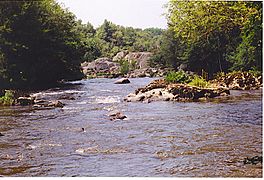
The Gartempe in Portes d'Enfer
-
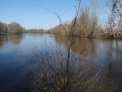
The Gartempe in Montmorillon
-
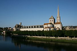
The Saint-Savin-sur-Gartempe abbey
-
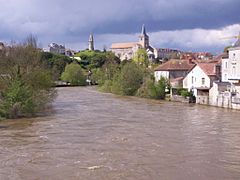
Where the Gartempe meets the Creuse river


.jpg)

Related pages
