
Vienne (river) facts for kids
Quick facts for kids Vienne |
|
| Occitan: Vinhana | |
| River | |
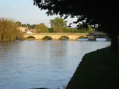
 The Vienne in Limoges
|
|
| Country | France |
|---|---|
| Regions | Centre-Val de Loire, Nouvelle-Aquitaine |
| Departments | Haute-Vienne, Vienne, Creuse, Corrèze, Charente, Indre-et-Loire |
| Communes | Saint-Junien, Confolens, L'Isle-Jourdain, Chauvigny, Chinon |
| Tributaries | |
| - left | Briance, Clain |
| - right | Maulde, Taurion, Creuse |
| Cities | Limoges, Châtellerault |
| Source | Plateau de Millevaches |
| - location | Massif Central, Nouvelle-Aquitaine, France |
| - elevation | 880 m (2,887 ft) |
| - coordinates | 45°39′44″N 2°5′34″E / 45.66222°N 2.09278°E |
| Confluence | Loire river |
| - location | Candes-Saint-Martin, Centre-Val de Loire, France |
| - elevation | 33 m (108 ft) |
| - coordinates | 47°12′24″N 0°5′3″E / 47.20667°N 0.08417°E |
| Length | 363.2 km (226 mi) |
| Basin | 21,161 km² (8,170 sq mi) |
| Discharge | for Candes-Saint-Martin |
| - average | 210 m³/s (7,416 cu ft/s) |
The Vienne (which is Vinhana in the Occitan language) is a very important river in southwestern France. It is a main tributary that flows into the famous Loire river. Many dams have been built on the Vienne to create hydroelectricity, which is a way to make electricity using the power of water.
The Vienne river flows through two large areas of France called Nouvelle-Aquitaine and Centre-Val de Loire. Two French départements (which are like counties) are even named after this river: the Haute-Vienne (number 87) and the Vienne (number 86).
Contents
About the Vienne River
The Vienne river is about 363.2 km (226 mi) long. Its drainage basin (the area of land where all the rain and snow eventually drain into the river) covers about 21,161 km2 (8,170 sq mi).
Where the Vienne River Starts
The Vienne river begins in the Corrèze département. It starts at the bottom of a hill called Mont Audouze. This spot is on the Plateau de Millevaches, near a small town called Millevaches. The river's source is quite high up, at about 880 m (2,887 ft) above sea level.
The River's Journey
From its source, the Vienne river generally flows west. It passes through the city of Limoges. In the past, the water from the Vienne was very important for making the famous Limoges porcelain. After Limoges, the river turns and flows north.
Finally, the Vienne river joins the Loire river. This meeting point is on the left side of the Loire, in the town of Candes-Saint-Martin.
The Vienne river flows through 6 départements and 96 towns (called communes). These are spread across two regions:
- Centre-Val de Loire region:
- Indre-et-Loire: Chinon, Candes-Saint-Martin
- Nouvelle-Aquitaine region:
- Corrèze: Peyrelevade
- Creuse
- Haute-Vienne: Rempnat, Eymoutiers, Saint-Léonard-de-Noblat, Limoges, Aixe-sur-Vienne, Saint-Junien
- Charente: Confolens
- Vienne: Chauvigny, Châtellerault
The Vienne river also flows through three special areas called regional nature parks. These parks help protect nature and include Parc naturel régional de Millevaches en Limousin, Parc naturel régional Périgord Limousin, and Parc naturel régional Loire-Anjou-Touraine.
Main Rivers Joining the Vienne
Many smaller rivers and streams flow into the Vienne river. These are called tributaries. Here are some of the main ones:
|
Rivers Joining from the Left:
|
Rivers Joining from the Right:
|
How Much Water Flows in the Vienne?
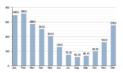
The average amount of water flowing in the Vienne river each year is measured. This is called its discharge. At a place called Nouâtre in the Indre-et-Loire département, the river's average discharge is about 193.0 m3/s (6,820 cu ft/s). This means that much water passes through that spot every second!
The chart below shows how the amount of water in the Vienne river changes throughout the year. As you can see, there's more water in the winter and spring months (January, February) and less in the summer (July, August).
Average monthly discharge (m3/s) at Nouâtre (1958 - 2017)
Vienne River Pictures
-
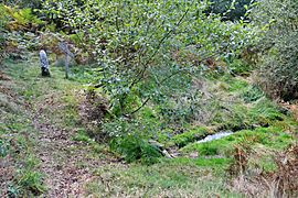
The source of the Vienne river near Saint-Setiers. This is where the river begins its journey.
-
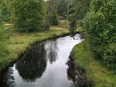
The Vienne river flowing near Peyrelevade.
-
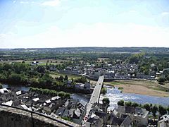
The Vienne river as it passes through the town of Chinon.
-
The Vienne river in Aixe-sur-Vienne (Haute-Vienne).
-
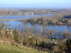
The Confluence of the Vienne river with the Loire river. The Vienne is the river in the foreground.


.JPG)

More to Explore
See also
 In Spanish: Río Vienne para niños
