
Loing facts for kids
The Loing is a river in central France. It's like a long, winding water path that eventually joins a bigger river called the Seine. The Loing flows through three different parts of France: Bourgogne-Franche-Comté, Centre-Val de Loire, and Île-de-France.
Quick facts for kids Loing |
|
| River | |
 The Loing in Moret-sur-Loing
|
|
| Country | France |
|---|---|
| Regions | Bourgogne-Franche-Comté, Centre-Val de Loire, Île-de-France |
| Departments | Yonne, Loiret, Seine-et-Marne |
| Municipalities | Sainte-Colombe-sur-Loing, Amilly, Montargis, Nemours, Saint-Mammès |
| Tributaries | |
| - left | Puiseaux, Solin, Bezonde, Fusain |
| - right | Ouanne, Cléry, Lunain |
| Cities | Amilly, Montargis, Nemours |
| Source | Puisaye |
| - location | Sainte-Colombe-sur-Loing, Yonne, France |
| - elevation | 320 m (1,050 ft) |
| - coordinates | 47°33′12″N 3°13′58″E / 47.55333°N 3.23278°E |
| Confluence | Seine |
| - location | Saint-Mammès, Seine-et-Marne, France |
| - elevation | 45 m (148 ft) |
| - coordinates | 48°23′13″N 2°48′9″E / 48.38694°N 2.80250°E |
| Length | 142.7 km (89 mi) |
| Basin | 4,182 km² (1,615 sq mi) |
| Discharge | for Épisy |
| - average | 18.5 m³/s (653 cu ft/s) |
Contents
River Loing: Facts and Flow
The Loing river is about 142.7 kilometres (88.7 miles) long. That's like driving for almost 143 kilometers! The area of land that drains water into the Loing, called its drainage basin, covers a huge 4,182 square kilometres (1,615 square miles).
Water Flow and Discharge
The average amount of water flowing through the Loing river each second is about 18.50 m3/s (653 cu ft/s). This measurement, called the discharge, is taken near a place called Épisy, which is about 10 km (6.2 mi) from where the Loing joins the Seine river.
The river's water flow changes throughout the year. It's usually highest in February and lowest in September.
Where the Loing River Starts
The Loing river begins in a natural area called Puisaye. This is in a small town named Sainte-Colombe-sur-Loing, located in the southern part of the Yonne department, in the Bourgogne-Franche-Comté region of France. The river starts at a high point, about 320 metres (1,050 feet) above sea level.
The Loing's Journey
As it flows, the Loing generally moves towards the northwest. It passes through many towns and villages in different regions and departments of France:
- In the Bourgogne-Franche-Comté region, it goes through the Yonne department, including towns like Sainte-Colombe-sur-Loing and Saint-Fargeau.
- Next, it enters the Centre-Val de Loire region, flowing through the Loiret department. Here, it passes by towns such as Châtillon-Coligny, Montargis, and Amilly.
- Finally, the Loing reaches the Île-de-France region, specifically the Seine-et-Marne department. Towns like Nemours and Grez-sur-Loing are along its path here.
The Loing river finishes its journey by flowing into the much larger Seine river. This happens in the town of Saint-Mammès, in the Seine-et-Marne department. At this point, the river is about 16 metres (52 feet) above sea level.
Many towns along the river have "Loing" in their names, showing how important the river is to them. Some examples include Sainte-Colombe-sur-Loing, Fontenay-sur-Loing, and Moret-sur-Loing.
Main Rivers Joining the Loing
Smaller rivers that flow into a bigger river are called tributaries. The Loing has several important ones:
|
Rivers joining from the left:
|
Rivers joining from the right:
|
Paintings of the Loing River
The beautiful scenery around the Loing river has inspired many painters over the years. Here are some famous artworks featuring the Loing:
-
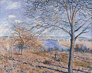
Alfred Sisley : Rives du Loing, effets d'automne (1881) -
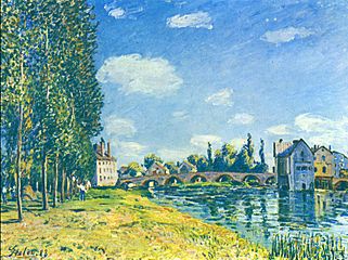
Alfred Sisley : Pont de Moret l'été (1888) -
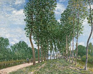
Alfred Sisley : Le long du Loing près de Moret (1892) -
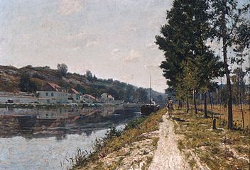
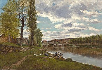
William Lamb Picknell : Rives du Loing (between 1894 and 1897) -
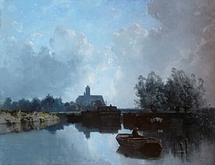
Eugène Cicéri : Au bord du Loing -
Eugène Galien-Laloue : Lavandières au bord du Loing


Images for kids
-
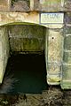
The source of the Loing in Sainte-Colombe-sur-Loing.
-
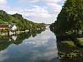
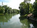
The Loing in Nemours.
-
The Loing in Grez-sur-Loing.
-
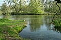
The Loing in Episy.
-
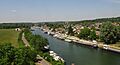
The Loing in Saint-Mammès.


Related pages
See also
 In Spanish: Río Loing para niños
