Dotsero, Colorado facts for kids
Quick facts for kids
Dotsero, Colorado
|
|
|---|---|

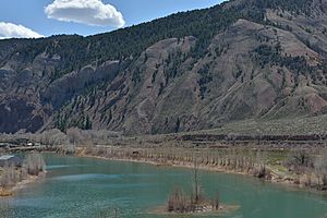
Confluence of the Eagle River and the Colorado River in Dotsero.
|
|

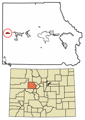
Location of the Dotsero CDP in Eagle County, Colorado.
|
|
| Country | |
| State | |
| County | Eagle County |
| Government | |
| • Type | unincorporated community |
| Area | |
| • Total | 1.551 sq mi (4.017 km2) |
| • Land | 1.356 sq mi (3.511 km2) |
| • Water | 0.195 sq mi (0.506 km2) |
| Elevation | 6,145 ft (1,873 m) |
| Population
(2020)
|
|
| • Total | 1,172 |
| Time zone | UTC-7 (MST) |
| • Summer (DST) | UTC-6 (MDT) |
| ZIP Code |
Gypsum 81637
|
| Area code(s) | 970 |
| GNIS feature | 2583232 |
Dotsero is a small community in Eagle County, Colorado, United States. It's called a "census-designated place" (CDP) because the government counts its population separately. In 2020, about 1,172 people lived there. Dotsero is served by the Gypsum post office. It's known for being where two important rivers meet and for its unique volcanic history.
Contents
History of Dotsero
Railroad Connections
Dotsero was once a very important spot for the Denver and Rio Grande Western Railroad. This railroad had a line that went from Denver to Salt Lake City. At first, the train route from Denver to Salt Lake City was quite long. It went through Dotsero, then south towards Pueblo, Colorado, and then turned north to Denver.
People wanted a more direct way to get from Denver to Salt Lake City. Another railroad, the Denver and Salt Lake Railroad (D&SL), started building a new line. It got close to Dotsero, but it wasn't finished. Later, the Denver and Rio Grande Western Railroad bought the D&SL.
They then built a special connection called the Dotsero Cutoff. This cutoff linked Dotsero to the new D&SL line. It was finished on June 15, 1934. This new route finally gave Denver a direct path to Salt Lake City. Dotsero became the meeting point for the old and new train routes. The older route was still used for a while but has been closed since 1997.
How Dotsero Got Its Name
In 1877, a scientist named Ferdinand Hayden created detailed maps of central and southwest Colorado. He used the location of what is now Dotsero as his "Dot Zero." This was his starting point for all his survey maps. The name "Dotsero" comes from this "Dot Zero" reference point. It became the official station name when the railroad was built in the 1890s.
Geography of Dotsero
Dotsero is located where the Eagle River flows into the Colorado River. You can find it along U.S. Highway 6 and Interstate 70. It's near the beginning of Glenwood Canyon, about 5 miles (8 km) west of Gypsum.
The Dotsero area covers about 1.55 square miles (4.017 square kilometers). A small part of this area, about 0.19 square miles (0.506 square kilometers), is water.
Dotsero Volcano
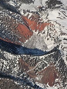
Dotsero sits at the base of a volcano called the Dotsero Volcano. This volcano is special because it's the most recently active volcano in Colorado. The United States Geological Survey says it last erupted about 4,140 years ago. Even though it was a long time ago, the volcano is still considered active today. It's the only active volcano in Colorado.
For many years, the main business in Dotsero was making cinderblocks. These blocks were made from the volcanic rock found around the volcano.
Population Information
The United States Census Bureau first officially counted the population of Dotsero for the United States Census 2010. The population has grown over the years.
| Dotsero CDP, Colorado | ||
|---|---|---|
| Year | Pop. | ±% |
| 2010 | 705 | — |
| 2020 | 1,172 | +66.2% |
| Source: United States Census Bureau | ||
See also
 In Spanish: Dotsero (Colorado) para niños
 | Stephanie Wilson |
 | Charles Bolden |
 | Ronald McNair |
 | Frederick D. Gregory |


