Downtown Portland, Oregon facts for kids
Quick facts for kids
Downtown
|
|
|---|---|
|
Neighborhood
|
|
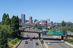
Downtown Portland, viewed from over Interstate 5
|
|
| Country | United States |
| State | Oregon |
| City | Portland |
| Area | |
| • Total | 1.00 sq mi (2.58 km2) |
| Population
(2010)
|
|
| • Total | 12,801 |
| • Density | 12,851/sq mi (4,962/km2) |
| Housing | |
| • No. of households | 8,353 |
| • Occupancy rate | 87% occupied |
| • Owner-occupied | 1,099 households (13%) |
| • Renting | 6,171 households (74%) |
| • Avg. household size | 1.53 persons |
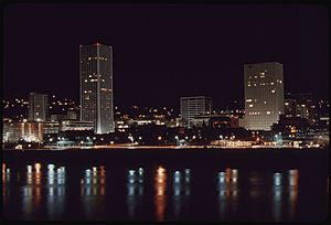
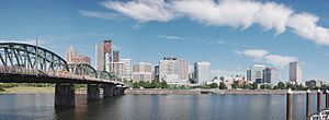
Downtown Portland is the main part of Portland, Oregon, where many businesses and tall buildings are located. It sits on the west side of the Willamette River. This area has most of the city's tallest buildings.
The downtown neighborhood stretches west from the Willamette River to Interstate 405. It goes south from Burnside Street to just past the Portland State University campus. A small part of the northeast section near the river belongs to the Old Town Chinatown neighborhood. Other busy areas close to downtown include the Lloyd District and the South Waterfront.
Portland's downtown is known for its narrow streets, about 64 feet wide. It also has small, square blocks, about 200 feet on each side. This design creates more corner lots, which were thought to be more valuable. The small blocks also make downtown Portland a great place to walk around.
Contents
Downtown Portland's Growth
How Downtown Changed Over Time
By the early 1970s, some parts of downtown Portland were getting old. New shopping malls in nearby towns like Beaverton and Gresham started to attract people and businesses away from downtown.
However, Portland had a different plan for its downtown. Instead of tearing everything down and rebuilding, they focused on improving what was already there. They created a special transit mall in 1977. This area made it easier for public transportation to move around.
They also built a new waterfront park in 1978, which replaced an old freeway. This park was later named Tom McCall Waterfront Park after a governor. In 1984, Pioneer Courthouse Square was opened, becoming a popular public space.
The MAX Light Rail system started in 1986, connecting downtown to other areas. Then, the Pioneer Place mall opened in 1990. All these projects helped bring businesses and shoppers back to downtown Portland. After 1990, downtown became the main area for new buildings and growth in the city.
Recent Changes in Downtown
Downtown Portland used to have many open parking lots. The city is trying to reduce these to build more homes and shops. This helps make downtown feel more lively. For example, some parking lots have been turned into parks with underground parking.
In 2017, a group called Human Access Project worked with Portland Parks & Recreation to open Poet's Beach. This was the city's first official public swimming beach.
In 2020 and 2021, during the COVID-19 pandemic, downtown Portland saw some changes. More people started working from home, so fewer office workers were downtown. The area also experienced challenges, including an increase in graffiti and boarded-up windows.
Portland's Famous Bridges
Portland is often called "Bridgetown" because of the many bridges that cross its rivers. There are nine bridges that lead into or near downtown. They are listed from north to south:
- Fremont Bridge: This bridge carries I-405 traffic.
- Broadway Bridge: It connects the Lloyd District to the Pearl District. The Portland Streetcar also uses this bridge.
- Steel Bridge: This is the only double-deck bridge in the world with independent lifts. It carries MAX Light Rail and Amtrak trains.
- Burnside Bridge: This bridge connects the east side of the city to downtown.
- Morrison Bridge: It leads directly into the main business area from the east side.
- Hawthorne Bridge: This is Portland's oldest highway bridge. It is also the most used bridge for bicycles in Oregon.
- Marquam Bridge: This bridge has two decks and carries I-5 traffic.
- Tilikum Crossing: Portland's newest bridge. Only public transit, bicycles, pedestrians, and emergency vehicles can use it.
- Ross Island Bridge: This bridge connects U.S. Route 26 to the South Waterfront area.
There are three other road bridges in Portland that cross the Willamette River, but they are outside the downtown area. These are the St. Johns Bridge, Sauvie Island Bridge, and Sellwood Bridge.
Getting Around Downtown
Most streets in downtown Portland are one-way. Naito Parkway is the farthest east, and most tall buildings are near I-405 to the west. Interstate 5 runs on the other side of the river. U.S. Route 26 connects downtown to the Oregon Coast and the Cascade Range.
Downtown Portland has great public transportation. TriMet, the local transit agency, runs the MAX light rail system. MAX trains run on different streets in downtown, making it easy to get around.
The Portland Transit Mall is a special area on 5th and 6th avenues. It limits private cars and has many bus lines and MAX light rail stops. This makes it a central hub for public transport.
The Portland Streetcar also serves the southern part of downtown. It connects the South Waterfront area to the Pearl District and Northwest Portland. The streetcar system has two routes. It also connects to the Portland Aerial Tram, which goes up to Oregon Health & Science University (OHSU).
For many years, public transit in downtown was free. This area was called "Fareless Square." However, in 2012, the free zone was stopped because of budget reasons.
Cool Places to Visit
Downtown Portland has many interesting places to see:
- Pioneer Courthouse Square: A popular public square.
- Arlene Schnitzer Concert Hall: A famous concert venue.
- Portland Art Museum: A great place to see art.
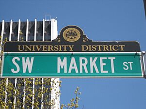
- Portland State University: A large university campus.
- Oregon Historical Society: Learn about Oregon's history.
- Tom McCall Waterfront Park: A beautiful park along the river.
Tall Buildings in Downtown
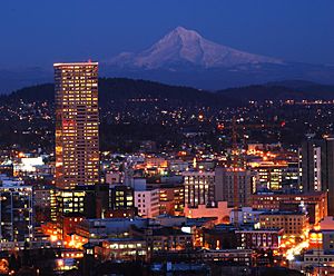
Downtown Portland is home to several impressive high-rise buildings. Here are the five tallest:
- Wells Fargo Center: Built in 1972, it stands 546 feet (166 meters) tall.
- U.S. Bancorp Tower: Built in 1983, it reaches 536 feet (163 meters) high.
- KOIN Center: Built in 1984, this building is 509 feet (155 meters) tall.
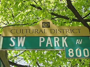
- Park Avenue West Tower: Constructed in 2016, it is 502 feet (153 meters) high.
- PacWest Center: Built in 1984, it rises to 418 feet (127 meters).
Nearby Neighborhoods
Downtown Portland is surrounded by other interesting neighborhoods:
- Old Town Chinatown: To the northeast, known for its historic feel.
- Pearl District: North of downtown, a trendy area with shops and restaurants.
- Goose Hollow: A residential area to the west of Portland State University.
- Southwest Hills: Another residential area west of downtown.
- Marquam Hill: To the south, home to OHSU and the Veteran's Hospital.
- RiverPlace: Located at the southeast corner of downtown.
- South Waterfront: South of downtown, along the river.


