Dowsing Point facts for kids
Quick facts for kids Dowsing PointHobart, Tasmania |
|||||||||||||||
|---|---|---|---|---|---|---|---|---|---|---|---|---|---|---|---|
| Postcode(s) | 7010 | ||||||||||||||
| Location | 2 km (1 mi) NE of Glenorchy | ||||||||||||||
| LGA(s) | City of Glenorchy | ||||||||||||||
| Region | Hobart | ||||||||||||||
| State electorate(s) | Clark | ||||||||||||||
| Federal Division(s) | Clark | ||||||||||||||
|
|||||||||||||||
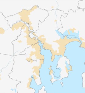
Dowsing Point is a small area where people live, located in Tasmania, Australia. It's part of the Glenorchy area, which is near the city of Hobart. This spot is about 2 kilometers (1.2 miles) north-east of the main town of Glenorchy. In 2016, a survey counted 85 people living in Dowsing Point.
This area is a small part of the bigger Hobart region. It stretches out into the River Derwent. Dowsing Point is also the name of a land feature. This point marks the northern entrance to Prince of Wales Bay.
Dowsing Point is well-known because it's where the Bowen Bridge starts on the western side. This bridge is a major road that connects the Brooker Highway with the East Derwent Highway.
Even though the City of Glenorchy calls it a suburb, not many houses are there. The homes are located between the land used by the army (called Derwent Barracks) and the Elwick Racecourse.
Dowsing Point is home to a special area for science and technology called the Tasmanian Technopark. You can also find a Qantas call center and an army barracks here. In 2007, the local mayor, Adriana Taylor, even suggested that the new Royal Hobart Hospital could be built at Dowsing Point.
History of Dowsing Point
Dowsing Point is officially recognized as a specific place. It has played a role in the area's past.
During the Tasman Bridge disaster, Dowsing Point was very important. It was used as the western end of a temporary bridge. This temporary bridge, called a Bailey bridge, helped people cross the River Derwent after the main bridge was damaged.
Geography of Dowsing Point
The River Derwent surrounds Dowsing Point on its northern, eastern, and most of its southern sides. This means water is a big part of the area's landscape.
Roads in Dowsing Point
A main road, called Route B35 (Goodwood Road), goes right through Dowsing Point. It runs from the west side to the east side of the area.
 | Emma Amos |
 | Edward Mitchell Bannister |
 | Larry D. Alexander |
 | Ernie Barnes |


