Du Tast Lake facts for kids
Quick facts for kids Tast Lake |
|
|---|---|

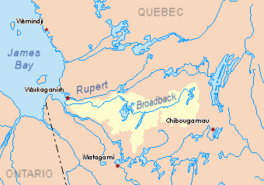
Broadback River basin in yellow
|
|
| Location | Eeyou Istchee James Bay |
| Coordinates | 50°59′19″N 77°23′21″W / 50.98861°N 77.38917°W |
| Type | Natural |
| Primary inflows | Kauskatitineu River |
| Basin countries | Canada |
| Max. length | 12.2 kilometres (7.6 mi) |
| Max. width | 7.4 kilometres (4.6 mi) |
| Surface elevation | 241 metres (791 ft) |
Du Tast Lake is a freshwater lake located in the Eeyou Istchee James Bay area of Quebec, Canada. It is part of the Nord-du-Québec region.
You can reach the lake by a forest road that goes north from Matagami. This road passes about 12.7 kilometres (7.9 mi) west of the lake. The lake's surface is usually frozen from early November until mid-May. However, it's generally safest to be on the ice from mid-November to mid-April.
Contents
Exploring Du Tast Lake's Features
How Big is Du Tast Lake?
Du Tast Lake is about 12.1 kilometres (7.5 mi) long and 7.4 kilometres (4.6 mi) wide at its widest point. It sits at an elevation of 242 metres (794 ft) above sea level.
What Does the Lake Look Like?
The lake has a unique shape, almost like a half doughnut that is open towards the east. This is because a long piece of land, called a peninsula, stretches out from the east bank for about 4.1 kilometres (2.5 mi) into the lake.
There are 13 small islands in Du Tast Lake. The biggest one is called Kauskwepikach Island. A narrow strip of land, about 2.8 kilometres (1.7 mi) wide, separates Du Tast Lake from Dana Lake.
Where Does the Water Come From?
Du Tast Lake gets its water from the Kauskatitineu River, which flows into the southwest side of the lake. It also receives water from several smaller streams coming from the northwest.
You'll find many marshy areas around the lake. The Atikuschekw Marsh is located on the northwestern side of the northern part of Du Tast Lake.
Where Does the Water Go?
The water from Du Tast Lake flows out from a bay on the eastern shore of the northern part of the lake. This outflow travels about 17.0 kilometres (10.6 mi) eastward through marshy areas. It eventually reaches the north shore of Dana Lake. This meeting point is about 2.5 kilometres (1.6 mi) west of where Kaitupscheyau Creek joins Dana Lake.
Nearby Waterways
The mouth of Du Tast Lake is located:
- About 18.2 kilometres (11.3 mi) west of the mouth of Dana Lake.
- About 44.5 kilometres (27.7 mi) southwest of the mouth of Evans Lake.
- About 108.2 kilometres (67.2 mi) east of where the Broadback River meets James Bay.
- About 136.7 kilometres (84.9 mi) north of downtown Matagami.
The main rivers and lakes near Du Tast Lake include:
- North: Broadback River, Rupert River
- East: Dana Lake, Evans Lake, Broadback River
- South: Muskiki River, Chabinoche River, Enistustikweyach River
- West: Colomb Lake, Nottaway River
Naming Du Tast Lake
The name "lac du Tast" (which is French for "Du Tast Lake") was officially recognized on December 5, 1968. This was done by the Commission de toponymie du Québec, which is the organization responsible for naming places in Quebec.
 | Claudette Colvin |
 | Myrlie Evers-Williams |
 | Alberta Odell Jones |


