East Greenmount, Queensland facts for kids
Quick facts for kids East GreenmountQueensland |
|||||||||||||||
|---|---|---|---|---|---|---|---|---|---|---|---|---|---|---|---|

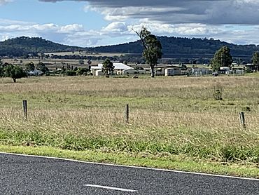
East Greenmount farmland with the Great Dividing Range in the east, 2022
|
|||||||||||||||
| Population | 351 (2021 census) | ||||||||||||||
| • Density | 8.220/km2 (21.29/sq mi) | ||||||||||||||
| Postcode(s) | 4359 | ||||||||||||||
| Area | 42.7 km2 (16.5 sq mi) | ||||||||||||||
| Time zone | AEST (UTC+10:00) | ||||||||||||||
| Location | |||||||||||||||
| LGA(s) | Toowoomba Region | ||||||||||||||
| State electorate(s) | Condamine | ||||||||||||||
| Federal Division(s) | Groom | ||||||||||||||
|
|||||||||||||||
East Greenmount is a small town and area in Queensland, Australia. It's part of the Toowoomba Region. In 2021, about 351 people lived here.
Contents
Exploring East Greenmount's Location
East Greenmount is located in an area called the Darling Downs. As its name suggests, it's just east of another place called Greenmount. The main part of the town is where the New England Highway meets Greenmount Clifton Road.
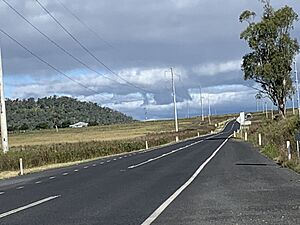
The New England Highway runs through East Greenmount. It comes from the south, near Nobby. It then passes just east of the town. Finally, it heads north-west towards Cambooya.
Mount Sibley: A Local Peak
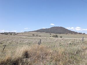
Mount Sibley is a tall, stand-alone mountain. It is located in the south-east part of East Greenmount. This mountain rises to 676 meters (about 2,218 feet) above sea level.
Mount Sibley was named after James Sibley. He was a farmer and a pub owner. He rented the Clifton farming area in the early 1840s.
Emu Creek and Waterways
Emu Creek starts at the northern edge of East Greenmount. It forms where two smaller streams, Elliott Creek and Allan Gully, join together in Ramsay. Emu Creek then flows west into Greenmount.
This creek is part of a larger water system. It flows into Hodgson Creek. Hodgson Creek then flows into the Condamine River. The Condamine River is part of the huge Murray–Darling basin, which is a very important river system in Australia.
A Look at East Greenmount's Past
The name Greenmount comes from a farm. This farm belonged to Donald Mackintosh. He was a politician who represented this area. He was a Member of the Queensland Legislative Assembly from 1899 to 1915.
Emu Creek State School's Beginning
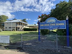
Emu Creek State School first opened its doors on May 31, 1875. The school got its name from the creek that flows through the area. It is not named after the town of Emu Creek, Queensland, which is much further north.
Name Change
Until May 13, 2005, the official name for this area was Greenmount East. It was then changed to East Greenmount.
Learning in East Greenmount
Emu Creek State School is a government primary school. It teaches students from Prep (the first year of school) to Year 6. Boys and girls attend this school. It is located at 14534 New England Highway.
In 2018, the school had 29 students. There were 3 teachers and 5 other staff members working there.
There are no high schools directly in East Greenmount. Students who want to attend secondary school can go to Clifton State High School in Clifton. They can also go to two schools in Toowoomba: Harristown State High School or Centenary Heights State High School.
Local Facilities and Parks
Greenmount Waste Facility
The Greenmount Waste Facility is located at 123 Falknau Road. This facility helps manage waste for the area. It is run by the Toowoomba Regional Council.
Steele Rudd Park
Steele Rudd Park is a special park at 172 Steele Rudd Road. It is named after the family of Steele Rudd, a famous Australian writer. The park has copies of old historical buildings.
 | Selma Burke |
 | Pauline Powell Burns |
 | Frederick J. Brown |
 | Robert Blackburn |


