East Patchogue, New York facts for kids
Quick facts for kids
East Patchogue, New York
|
|
|---|---|

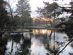
A park in East Patchogue.
|
|

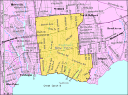
U.S. Census map of East Patchogue.
|
|
| Country | |
| State | |
| County | Suffolk |
| Town | Brookhaven |
| Named for | Its location immediately east of Patchogue |
| Area | |
| • Total | 8.46 sq mi (21.92 km2) |
| • Land | 8.32 sq mi (21.54 km2) |
| • Water | 0.14 sq mi (0.37 km2) |
| Elevation | 23 ft (7 m) |
| Population
(2020)
|
|
| • Total | 21,580 |
| • Density | 2,594.37/sq mi (1,001.66/km2) |
| Time zone | UTC−05:00 (Eastern Time Zone) |
| • Summer (DST) | UTC−04:00 |
| ZIP Code |
11772
|
| Area code(s) | 631, 934 |
| FIPS code | 36-22733 |
| GNIS feature ID | 0949199 |
East Patchogue is a community in Suffolk County, New York. It is located on the South Shore of Long Island. This area is part of the Town of Brookhaven.
East Patchogue is called a "census-designated place" (CDP). This means it's an area that the U.S. Census Bureau defines for gathering statistics. In 2020, about 21,580 people lived here.
Contents
A Look Back: History of East Patchogue
East Patchogue is next to the village of Patchogue. Patchogue has always been a busy place for shopping and business in Suffolk County. The name "Patchogue" can mean a small village or a larger area.
East Patchogue includes the eastern part of this larger Patchogue area. It also covers land east of that, but west of the village of Bellport. This is why a main road, New York State Route 27A, changes its name. It's called "East Main Street" in the western part of East Patchogue. Further east, it becomes "Montauk Highway."
Hagerman: A Lost Hamlet
Long ago, the area around County Road 80 in western East Patchogue was known as Hagerman. A hamlet is a small settlement without its own official government. Over time, as more people moved in, Hagerman became less distinct. The name is not used much anymore, especially since the Hagerman station on the Long Island Rail Road closed. However, there is still a Hagerman fire district.
Where is East Patchogue? Geography
East Patchogue covers about 8.5 square miles (21.9 square kilometers). Most of this area, about 8.3 square miles (21.5 square kilometers), is land. The rest, about 0.2 square miles (0.37 square kilometers), is water.
Who Lives Here? Demographics
| Historical population | |||
|---|---|---|---|
| Census | Pop. | %± | |
| 2020 | 21,580 | — | |
| U.S. Decennial Census | |||
In 2000, there were 20,824 people living in East Patchogue. There were about 7,493 households. The population has grown slightly since then.
The community has a mix of people of all ages. The average age in 2000 was 38 years old.
Important Places: Historic Sites
East Patchogue is home to some historic buildings. The Smith-Rourke House and the Swan River Schoolhouse are listed on the National Register of Historic Places. This means they are important historical sites.
The Avery Homestead, also called the Swan River Nursery, is another historic place. People are working to restore it.
Fun by the Water: Pine Neck Boat Ramp
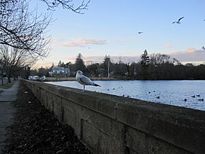
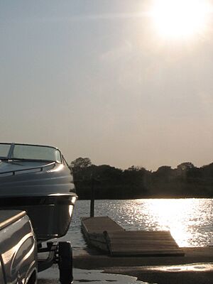
The Pine Neck Avenue boat ramp and fishing pier are popular spots in East Patchogue. They are located on the south shore, along the Swan River. This is a main place for boats to get into the water. From here, boats can reach Patchogue Bay and the Great South Bay.
Pine Neck Park is a undeveloped park in the Town of Brookhaven. It has a natural beach and a fishing pier. There are also two boat ramps for launching boats. Boaters can travel to different parts of the bay from here.
The park is a great place for residents and visitors. It offers beautiful views of Long Island's Great South Bay. You can also see Watch Hill and Davis Park from here. The Fire Island National Seashore is a popular destination for boaters.
Learning in East Patchogue: Education
Students in East Patchogue attend schools in a few different districts. Most students go to schools in the South Country Central School District or the Patchogue-Medford Unified UFSD. Some students in the northeastern parts of East Patchogue attend schools in the Longwood Central School District.
Schools in East Patchogue
- Barton Elementary School
- Brookhaven Annex School
- Patchogue High School (This building is no longer used as a high school)
- Saxton Middle School
- Verne W. Critz Elementary School
- Victory Academy Elementary School
Famous Faces: Notable People
Some well-known people have connections to East Patchogue:
- Tom Baldwin – A racing driver.
- Daniel J. Bernstein – A programmer and professor of mathematics and computer science.
- Giovanni Capitello – A filmmaker and actor. He was raised in East Patchogue.
- Neal Heaton – A baseball pitcher who played for many teams, including the New York Yankees. He lives in East Patchogue.
See also
 In Spanish: East Patchogue para niños
 | Claudette Colvin |
 | Myrlie Evers-Williams |
 | Alberta Odell Jones |


