Eastfield, South Lanarkshire facts for kids
Quick facts for kids Eastfield |
|
|---|---|
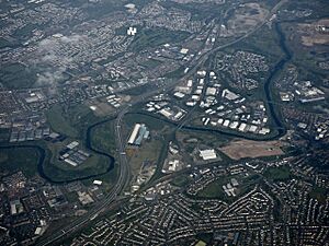 Aerial photograph of the area from the South-west (2017) |
|
| OS grid reference | NS630308 |
| Country | Scotland |
| Sovereign state | United Kingdom |
| Post town | GLASGOW |
| Postcode district | G72 7 / G73 3 |
| Dialling code | 0141 |
| Ambulance | Scottish |
| EU Parliament | Scotland |
| UK Parliament | |
| Scottish Parliament | |
Eastfield is a neighborhood in South Lanarkshire, Scotland. It's mostly a place where people live, found between the towns of Rutherglen and Cambuslang. This area is in the southeast part of the larger Greater Glasgow city area. Eastfield is located south of the River Clyde. It is next to the Stonelaw and Burnside areas of Rutherglen, and the Silverbank area in Cambuslang.
Contents
Eastfield's Past: A Look Back
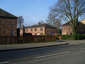
Eastfield was once a large country estate in the late 1800s and early 1900s. A small stream, called a burn, ran through it. There was also a brewery, a brickworks, and a small mining community here. Cottages lined Cambuslang Road, which is now part of the A724. The Eastfield Public School was built in 1898.
Between the 1930s and 1960s, the Eastfield estate was developed with many new homes. These included both council-rented houses and private homes.
For most of the 1900s, a big business in Eastfield was the Richmond Park Laundry. It was one of the largest laundries in the country. It opened around 1907 but closed in 2004. The building was taken down in 2007, and a supermarket was built there instead.
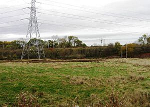
Some parts of Eastfield had soil that was affected by waste from the Whites Chemical Works. One noticeable spot was a large play area built on an old quarry at the end of Dukes Road. This area was empty and fenced off for years until the waste was cleaned up. Now, modern apartments and a new park called Quarryfield are on that site.
In the 2000s, Eastfield has benefited from the M74 motorway being extended nearby. This has brought many businesses closer to the area. To the north, you can find one of Scotland's last steelworks, Clydebridge. It used to employ many people but now operates on a much smaller scale.
Places and Activities in Eastfield
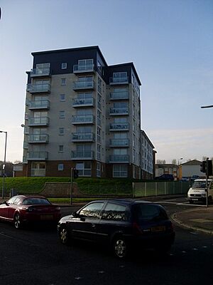
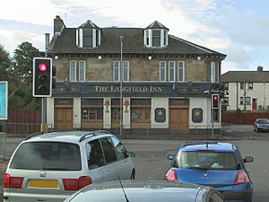
The old sandstone building of the public school was used as an adult education center and a playgroup for young children. However, it was taken down in the early 2000s and replaced by modern apartments. The local pub across the road, The Langfield Inn, was also taken down a few years later.
Two pubs still exist in Eastfield, both located off Dukes Road. These are the Old Oak Inn and the County Inn. The County Inn was built in the 1960s to replace the County Bar in nearby Silverbank, Cambuslang. That older pub was removed when the area was redeveloped with new maisonettes.
Getting Around: Transport Links

The name Richmond Park might be familiar to some bus users. It was the end stop for the First Glasgow 'No 12' bus service. There is another Richmond Park, which is a park in Oatlands, Glasgow, a few miles west. Some buses going to Eastfield, like the frequent '267' service, also pass this other park.
The West Coast Main Line railway tracks run north of Eastfield. The closest train stations are at Cambuslang, about 0.6 miles (1 kilometer) east of Bogleshole Road, and Rutherglen, which is about twice that distance to the west. Burnside railway station, which is on a different train line serving the south side of Glasgow, is 1.2 miles (1.9 kilometers) from the Richmond Park roundabout. However, it is only 0.4 miles (0.6 kilometers) from the shops on Dukes Road at the southern end of Eastfield.
Learning and Fun: Schools and Sports
The wider area around Eastfield has two large, modern high schools. Stonelaw High was built in 1998. Trinity High was built in 1970 and rebuilt in 2009. The path leading to Trinity High from Cambuslang Road used to be the old driveway to the Eastfield mansion.
Trinity High has great sports facilities. These include several astroturf football fields, which were changed in 2021 to be better for 7-a-side games. There is also a modern swimming pool and leisure center called South Lanarkshire Lifestyle Eastfield, which is open to the public. Next to Stonelaw High is Calderwood Primary School, where many local children go, even though it's just outside Eastfield itself.
Pearse Park: A Sports Field

Pearse Park was a playing field on Cambuslang Road in Eastfield. It was the main home for Gaelic games in Scotland. Scotland GAA bought it in 1953 and named it after the Irish revolutionary Patrick Pearse. It was also the home ground for the team Tír Conaill Harps. The park closed in 2005 and was unused for several years, becoming overgrown and having a problem with Japanese knotweed. However, by 2021, there were plans to develop the park again.
How Eastfield is Managed
Some parts of Eastfield, especially east of Dukes Road and including the community center, are officially part of the civil parish of Cambuslang. They also use the G72 postcode zone. The rest of Eastfield is part of Rutherglen's G73 parish and postcode zone.
The entire area is currently managed as part of the Cambuslang West ward by the South Lanarkshire Council. This is also the area covered by local community policing. However, this definition also includes some other streets that have always been considered part of Rutherglen, like Ettrick Crescent.
 | George Robert Carruthers |
 | Patricia Bath |
 | Jan Ernst Matzeliger |
 | Alexander Miles |


