Rutherglen facts for kids
Quick facts for kids Rutherglen
|
|
|---|---|
| Town | |
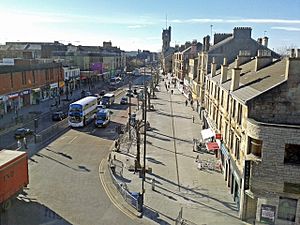 Main Street, the main shopping area of Rutherglen |
|
| Population | 30,950 (2020) |
| OS grid reference | NS614616 |
| Lieutenancy area | |
| Country | Scotland |
| Sovereign state | United Kingdom |
| Post town | GLASGOW |
| Postcode district | G73 |
| Dialling code | 0141 |
| Ambulance | Scottish |
| EU Parliament | Scotland |
| UK Parliament | |
| Scottish Parliament | |
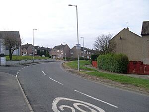
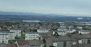
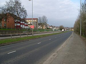
Rutherglen (/ˈrʌðərɡlɪn/) is a town in South Lanarkshire, Scotland. It is located just south-east of the city of Glasgow, about 3 miles (5 km) from Glasgow's city centre. The River Clyde flows directly to the north of Rutherglen.
Rutherglen used to be a separate area with its own local council. In 1975, it became part of the City of Glasgow District. Then, in 1996, Rutherglen became part of the South Lanarkshire council area.
Contents
- History of Rutherglen
- How Rutherglen is Governed
- Getting Around Rutherglen (Transport)
- Local News and Radio (Media)
- Geography of Rutherglen
- Burgh (Main Street) and Clincarthill Areas
- Farme Cross Area
- Shawfield Area
- Wardlawhill, Gallowflat and Stonelaw Areas
- Eastfield Area
- Burnhill, Newfield and Bankhead Areas
- Overtoun Park
- Burnside, High Crosshill and High Burnside Areas
- Spittal Area
- Blairbeth and Fernhill Areas
- Springhall and Cathkin Areas
- Schools in Rutherglen (Education)
- Sports in Rutherglen
- Famous People from Rutherglen
- See also
History of Rutherglen
Rutherglen became a Royal Burgh in 1126. This special status was granted by King David I of Scotland, who ruled from 1124 to 1153. In the 1300s, Walter Stewart, who was the father of King Robert II, was given Farme Castle. This castle was near Farme Cross in the east of Rutherglen and stood until the 1960s.
Rutherglen was once a big centre for heavy industry. It had a long history of coal mining, which ended around 1950. A chemical factory called J&J White's Chemical Works in Shawfield operated from 1820 to 1967. It made over 70% of the UK's chromate products. Today, there are still some effects from the chemical waste in the area. Rutherglen, like many towns around Glasgow, is now mostly a suburb where people live and travel to Glasgow for work or other activities.
What does the name Rutherglen mean?
The name Rutherglen, and its Scots name Ruglen, might come from the Gaelic words An Ruadh-Ghleann, which means "the red valley". Another idea is that the name comes from Welsh or Cumbric, meaning "the valley of Rydderch". Rydderch was a famous king linked to a Welsh-speaking kingdom near Dumbarton.
How Rutherglen is Governed
Rutherglen has its own representatives in both the UK Parliament and the Scottish Parliament.
UK Parliament (Westminster)
Rutherglen used to be a separate area represented in the Parliament of Scotland. From 1708, it was part of larger constituencies in the UK Parliament. In 1918, the Rutherglen constituency was created. In 2005, the town became part of the new Rutherglen and Hamilton West constituency. After another review in 2023, the Rutherglen constituency was brought back.
As of October 2023, Michael Shanks from the Scottish Labour Party is the local Member of Parliament (MP). He won a special election in 2023.
Scottish Parliament (Holyrood)
In 1999, the Scottish Parliamentary constituency of Glasgow Rutherglen was created. In 2011, the area was renamed simply Rutherglen and now includes Cambuslang and Blantyre. Since the 2016 elections, Clare Haughey from the SNP has been the Member of the Scottish Parliament (MSP) for Rutherglen. She won again in the 2021 election.
South Lanarkshire Council
The historic centre of Rutherglen is part of the Rutherglen Central and North ward of South Lanarkshire Council. This area has about 15,000 people. If you include the southern parts of the town, the total population was about 30,000 in 2016. Rutherglen and nearby Cambuslang share many services and facilities for their combined population of about 60,000 residents.
Getting Around Rutherglen (Transport)
Rutherglen has its own Rutherglen railway station which opened in 1849. There are also stations closer to the southern parts of the town, like Croftfoot and Burnside. Many buses connect Rutherglen to Glasgow city centre and other places like Hamilton and East Kilbride. These buses often run along Main Street. From the early 1900s until the late 1950s, Glasgow Corporation Tramways also had tram routes in the area.
The M74 Extension motorway was finished in 2011. This six-lane motorway cuts through the northern part of Rutherglen. It makes it easier to get to places like Glasgow Airport and the English border. However, studies after the motorway was built showed that pollution levels on Rutherglen's Main Street were still high.
Local News and Radio (Media)
The local newspaper for Rutherglen is the Rutherglen Reformer. Its online content is part of the Daily Record. The town also has a local community radio station called CamGlen Radio.
Geography of Rutherglen
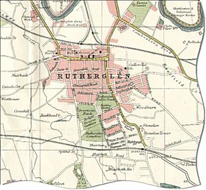
Since it became a Royal Burgh in the 1100s, Rutherglen has grown a lot. Its growth has been limited by the River Clyde to the north, Glasgow to the west, and Cambuslang to the east. However, Rutherglen now covers a much larger area than its original boundaries. Old areas like Bankhead and Burnhill have changed over time. The areas of Farme Cross and Shawfield are mostly used for industry. Villages like Burnside have expanded and are now part of Rutherglen. After World War II, new housing estates were built on former farms and rural lands, changing the town's look.
A book from 1922, Rutherglen Lore, said that the historic Burgh area should be surrounded by homes to the south, and industry to the north. This is still mostly true today. Because of this, and the limited space, new houses have mainly been built on the higher ground to the south, towards the Cathkin Braes. This means the town's historic centre, with most of its shops and people, is further north than the middle of the town's land.
Burgh (Main Street) and Clincarthill Areas
The Burgh area is the old heart of Rutherglen. It is known for its wide, tree-lined Main Street, which has been a protected area since 2008. Here you will find churches, pubs, shops, restaurants, and both old and new public buildings. Most of the homes here are tenements (large apartment buildings). In the 2000s, a webcam showing Main Street became very popular, even though there was no clear reason why.
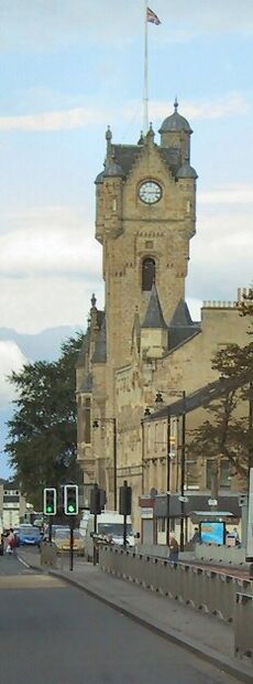
The most striking building on Main Street is the Rutherglen Town Hall. It was built in 1862 and is a very important historical building. After being unused for a while, it was renovated around 2005. Today, it hosts weddings, shows, and exhibitions, and still offers some local services.
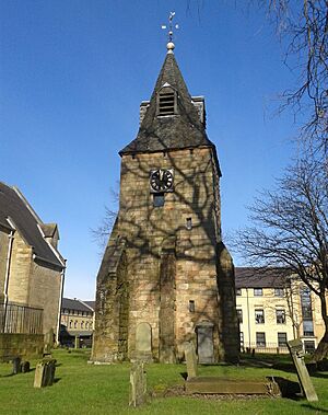
Many other important landmarks are near the Town Hall. To its west is Rutherglen Old Parish Church, which has been on this site since about 600 AD. The current building was built in 1902. Between the church and the Town Hall is an old graveyard (from the 1200s) and the St Mary's bell tower (from the 1500s). It is said that William Wallace signed a peace treaty here in 1297, and John de Menteith later planned to betray Wallace here in 1305. Plaques mark these events.
Outside the church, there is a statue of Dr. James Gorman (1832–1899). He was a respected local surgeon, and the statue was put up in 1901 because of his good deeds, like helping people after mining accidents. Behind the church is a Masonic Hall built in 1897.
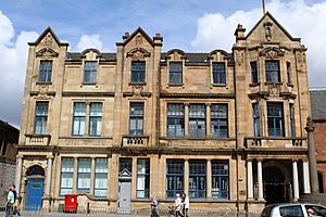
East of the Town Hall is the public library, built in 1907. It was originally a Post Office and Library, but the Post Office moved in 2005. This is a Carnegie library, meaning it was funded by Andrew Carnegie. Its main hall has a stained-glass dome and oak panels. The building was renovated in the 1990s and again in 2010. Outside the library is a copy of the town's old mercat cross (market cross), put there in 1926 to celebrate Rutherglen's 800th birthday.
Behind the library on King Street is the local branch of The Salvation Army. Their brass band often plays at the Old Parish Church. Their hall is roughly where the mediaeval Rutherglen Castle once stood. The local fire brigade used to be nearby but moved to Cambuslang in 1970.
Across from the Town Hall is St Columbkille's Church. The main building was built in 1940, but the church community started in 1851. Behind the church are its older halls, which used to be a school. West of the church is the 1930s Vogue Cinema, now a bingo hall.
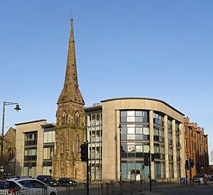
Other important buildings include the tall spire of Rutherglen East Parish Church at Rutherglen Cross. It was built in 1872, closed in 1981, and became the 'Aspire Business Centre' in 2003. Its church halls are now used by local community groups. A cinema called 'The Pavilion' was built nearby in 1914 and closed in 1959.
The Rutherglen police station was built in the mid-1950s on King Street. Before this, the police were based in the Town Hall. The police station is next to the former local Court and museum.
Further west, the Burgh Primary School building (1901) has been kept and turned into a business centre. In 2010, Burgh Primary moved to a new building on Victoria Street. This new site was once the Macdonald School, built in 1865.
The Mitchell Arcade, an indoor shopping centre on Main Street, was built in the early 1970s. It was renovated in 2014 and renamed the Rutherglen Exchange Shopping Centre. It has a rooftop car park. A Boots Chemist has been in the same spot for over a century.
At the western end of Main Street, there are two pubs: the 'Vogue Bar' and 'The Picture House'. This area was changed a lot in the 1970s when a new bypass road was built. This road also caused the destruction of the town's medical clinic and other old buildings. Most of the pubs in Rutherglen are on the north side of Main Street. This is partly because of an old law (the Temperance (Scotland) Act 1913) that made the south side of the street 'dry areas' (no alcohol sales).
Many of Rutherglen's old tenement buildings were repaired by the Rutherglen Housing Action Group, started in 1979. This group later became the Rutherglen and Cambuslang Housing Association.
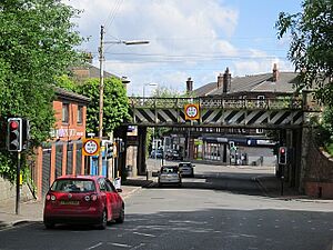
The current Rutherglen railway station opened in 1979. It is the fourth station in the area. The station is now under the M74 motorway and is connected to the streets by a covered walkway. The entrance on Victoria Street was decorated with murals about the town's history in 2018.
Clincarthill Area
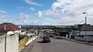
Clincarthill is just south of the Burgh area. It is on a hill and offers great views to the north. This area has many old sandstone tenements, villas, and terraced houses from the late 1800s and early 1900s. Some streets are so steep they can only be reached by footpaths. There are several churches here, including Minhaj-ul-Quran mosque and Rutherglen Baptist Church.
Rutherglen Primary Care Centre, the town's main health facility, is located south of Clincarthill. It was built around 1999. Rutherglen Maternity Hospital was next to it from 1978 to 1998 but was closed and demolished.
Farme Cross Area
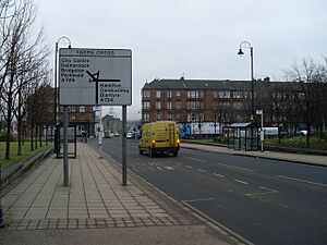
Farme Cross is on the edge of Rutherglen. To the north is the River Clyde, with Glasgow's Dalmarnock district on the other side. Roads and railway bridges from the 1890s connect the two sides. Farme Cross was originally the Farme estate and became known for coal mining in the early 1800s.
There are several historic buildings and pieces of public art here. Four carved standing stones called 'Boundary Stones' were put up in 2001 to remember the Royal Burgh's history. Another monument, 'Slipstream', is by the river and shows metal cog designs related to local industry.

Many businesses used to be at Farme Cross, powered by a large power station across the river. These included the Farme Castle Colliery (coal mine), Caledonian Pottery, and various factories making bolts, dyes, pipes, and wire ropes. By the 1970s, most of these industries had closed, causing job losses. The area was badly flooded in 1994, leading to better flood protection.
A Tesco superstore was built in the early 2000s on former industrial land. This area is now seeing new developments, including small workshops and business parks. The Rutherglen Links business park is an example of this new growth.
Despite its industrial past, Farme Cross has always had homes. The oldest homes are the Terrace cottages, built in the 1880s for local workers. These unique two-storey buildings have doors at both the front and back.
Shawfield Area
Shawfield is the most northern part of Rutherglen. It was once a country estate but became a chemical factory site. It is still industrial, but much of it was abandoned due to the decline of heavy industry and contamination from the old chemical works. The Clyde Gateway projects are working to bring new businesses to this area and make the River Clyde more accessible. Rutherglen's old port, where ships were built, was located here. Currently, Shawfield Stadium hosts greyhound racing.
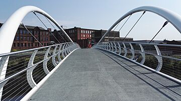
Rutherglen Bridge at Shawfield is the oldest crossing between Rutherglen and Glasgow. A new 'smartbridge' for walkers and cyclists was built to connect Shawfield with Dalmarnock railway station, especially for the 2014 Commonwealth Games.
Wardlawhill, Gallowflat and Stonelaw Areas
Wardlawhill Area
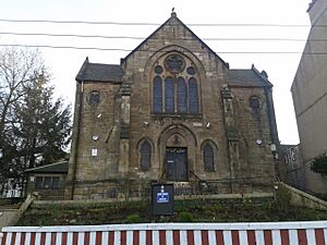
Wardlawhill is east of Clincarthill. It has some older large houses and tenement buildings. Wardlaw Drive, a street on the hill, is one of the steepest in Scotland. At the top of stairs off Hamilton Road is the Sri Sundara Ganapathy Hindu Temple (built 1882), which used to be Wardlawhill Parish Church.
To the south is the old Rutherglen Academy building (built 1886) on Melrose Avenue. It later became Stonelaw High School and was converted into apartments in 2001. Opposite the Academy is a small building, once St Stephen's Episcopal Church, now used as a Masonic Lodge.
Gallowflat Area
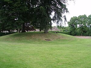
The Gallowflat area, also called East Main Street, has cottage flats and tenement buildings from the 1920s. These were built when Main Street was extended. A notable landmark is an ancient burial mound covered by trees. It was once used as an icehouse for the grand Gallowflat House (built 1760s, demolished 1910s).
Gallowflat Public School (built 1908) was also in this area. Most of its campus has been replaced by housing and a care home.
Stonelaw Area
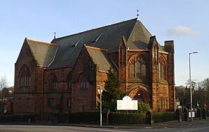
Stonelaw is south of Gallowflat and Wardlawhill. It is home to Rutherglen Bowling Club, which moved here in 1902. The impressive red sandstone building of Stonelaw Parish Church was completed in 1912. A renovation over a century later found a time capsule from when it was built.
There are two other bowling clubs nearby: Overtoun Park Bowling Club and Templeton Bowling Club. The Templeton club was originally for the James Templeton & Co textile company.
This neighbourhood has many features of a garden suburb and is considered one of the more expensive places in Rutherglen. It has many large properties. The new (1998) site of Stonelaw High School is on the edge of the Stonelaw and Burnside areas. Another local school, Calderwood Primary, is also in this area.
Eastfield Area
Eastfield was once a mining community. It was developed for housing in the 1950s. Trinity High School (built 1970, rebuilt 2010) and its sports facilities, including a public swimming pool, are in Eastfield.
To the north of Eastfield is the Clydebridge Steelworks. It now operates at a much lower capacity than in the mid-1900s when it employed over 3,000 workers. In 2020, the company that owns the works announced plans to develop the land, starting with a hotel.
Burnhill, Newfield and Bankhead Areas
Burnhill Area
Burnhill is in the north-west of Rutherglen. It borders the Glasgow district of Toryglen to the west and the M74 motorway to the north. Its eastern side is close to Main Street but separated by a busy bypass road built in the early 1970s.
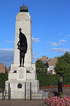
The bypass road caused the destruction of many old buildings in Burnhill. It also separated important landmarks like the Munro United Free Church (built 1850) and Rutherglen's war memorial (erected 1924) from the town centre. The two parts of town are now connected by pedestrian underpasses.
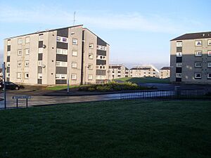
The neighbourhood is known for its 'White Flats' housing scheme, which are 24 blocks of apartments built in the early 1970s and renovated in 2019. Burnhill is home to the local youth club Universal Connections and the Celsius Stadium, home of Rutherglen Glencairn F.C.. This stadium was completed in 2008, replacing their old ground which was taken for the M74 motorway.
Newfield Area
Newfield is just south of Burnhill and borders Bankhead and parts of Glasgow. It has limited facilities, including a pub. Small grassy areas are scattered among the houses.
The burn (small stream) flowing through the area once powered industries on Cathcart Road, such as weaving factories and the Cathkin Laundry. The Cathkin Bakery, which made Nairn's oatcakes, was also here until 1978.
Westhouse, a small housing estate built in the 2000s, is in the Newfield and Bankhead areas. It was built in a former quarry. The 'Old Quarry Bar' on Cathcart Road is located in one of the few tenement buildings that survived redevelopment.
Bankhead and Quigleys Areas
Bankhead is south-west of central Rutherglen. Its houses are of different ages, showing how the town grew over the 1900s. Much of the area has 1930s grey cottage flats. There is a primary school, Bankhead Primary, and a few shops on Wallace Street and Curtis Avenue. The 100 Acres pub is named after 'Hundred Acre Hill', the old name for the high ground nearby.
Mitchell's Farm, dating back to the mid-1800s, is a surviving feature of Bankhead's rural past. Its fields were turned into the Cityford housing development around 1990. The Bankhead coal mine was also nearby. The southern end of Bankhead Road leads to some shops and Croftfoot railway station.
The land between Bankhead and Mill Street became a small housing estate in the early 1970s. The town's old corn mill, which gave Mill Street its name, was near where the Quigleys Community Hall is today. The mill was powered by the Cityford Burn, which flows through this part of Rutherglen.
The King's Park Hotel is south of the neighbourhood. Rutherglen Cemetery's main entrance is a short distance further south.
Overtoun Park
Overtoun Park is Rutherglen's main public park. It is close to the town's geographical centre. The land was given to the Burgh in 1904 by Lord Overtoun. The park used to host the annual Landemer Day fair, which is now held on Main Street.
The Category B listed fountain in the park was originally on Main Street. It was put there in 1897 to celebrate Queen Victoria's Diamond Jubilee and moved to the park in 1911. The bandstand (1914) was moved for the 1988 Glasgow Garden Festival and then re-sited in the park's centre.
The park's children's play area was made bigger in the 2010s. The park's BMX tracks are still used. Environmental groups like Grow73 and Friends of Overtoun Park are active here.
Burnside, High Crosshill and High Burnside Areas
Burnside is a village within Rutherglen that has grown into a leafy suburb. It is surrounded by several mid-20th century housing estates. Unlike affluent Burnside, some parts of these estates face challenges.
Burnside has its own shops, church, railway station, and primary school. It also has a supermarket and a hotel with a popular bar. There is a bowling green and two sets of tennis courts. Many of the traditional homes were built in the early 1900s from sandstone.
The local park, Stonelaw Woods, is at the northern edge of the village. It is named after the demolished Stonelaw Tower, which was once a converted 18th-century coal mine winding engine house.
High Crosshill is a quiet residential area on a steep hill between Burnside and Overtoun Park. It offers some views and includes Rutherglen Cemetery. High Burnside is another residential area on high ground south of Burnside, leading to Cathkin Braes. Some of its oldest properties are very large.
Spittal Area
Spittal is a community built after World War II. It is almost separate from the rest of Rutherglen, bordering Glasgow areas like Croftfoot and Castlemilk. It is close to the Bankhead neighbourhood but separated by railway tracks. The estate was built in an oval pattern of streets, named after places in Ayrshire. Its primary school was built at the highest point in the centre (completed 1955).
A new community centre was built in the early 2000s. There are also local shops and a pub-restaurant called 'The Croft' on the boundary with Croftfoot. Two small burns (streams) run on either side of Spittal's housing.
In 2016, the area's recreation fields were used for new housing. A new AstroTurf football field was added next to the primary school in 2019. Just south of Spittal is Kirkriggs School, a special education facility run by Glasgow City Council.
Blairbeth and Fernhill Areas
Blairbeth Area
Blairbeth is a small housing scheme from the 1950s, with tenements and terraced houses. It was built around a former rural estate. The neighbourhood has some local shops and small parks, as well as a school, St Mark's RC Primary. Its church is located at the edge of the neighbouring Fernhill area.
Many of the hillside streets offer views over Rutherglen and Glasgow. A large flat grass field to the west was used for sports but was reduced in size by a road change in 2016. This change was part of the Cathkin Relief Road works.
Fernhill Area
Fernhill is a housing estate built in the 1960s that has been greatly improved in the 2010s. It is home to an all-girls private school, which uses the historic Fernhill mansion house as its main building. The area borders the Castlemilk housing estate in Glasgow. Fernhill Road runs through the estate, where you can find shops, a community centre, and football fields. The estate also has two churches and a decorative brick entrance wall.
The Cathkin Relief Road was completed in 2017 to extend Mill Street and ease traffic on other local roads. In 2019, Fernbrae Meadows opened south of Fernhill. This area used to be Blairbeth Golf Course and is now a 20-hectare green space.
Springhall and Cathkin Areas
Springhall Area
Springhall is a self-contained housing estate from the 1960s, mostly made up of maisonettes (apartments on two floors). It has a community centre and library that were upgraded between 2019 and 2021. There are also local shops, a Catholic church, and two schools, St Anthony's RC Primary and Loch Primary. Both schools were rebuilt in the 2000s and share a playground. Their playing fields are on the site of a former loch (Boultrie Loch), which was popular for curling and skating in winter.
A 13-storey tower block stands in the centre of the neighbourhood. It is the only building of its height in Rutherglen. It was built on the site of the Springhall mansion house, which was demolished in the 1940s.
Cathkin High School, the secondary school for Loch Primary, is nearby in the Whitlawburn estate, which is part of Cambuslang. A new pre-school facility, Springlaw ELC, opened in 2021, named after both communities.
Cathkin Area
Cathkin is the southernmost and highest part of Rutherglen. It is mostly a post-World War II estate that saw many housing improvements in the early 2000s. The estate borders Cathkin Braes Country Park and farmland near the village of Carmunnock. It offers views over the Greater Glasgow valley. There is a small wooded area near its eastern boundary. Local facilities include a primary school with community facilities, a church, and local shops with a supermarket.
The grounds of the old Cathkin House mansion (built 1799), now converted to apartments, also offer views over Rutherglen and Glasgow. The mansion is surrounded by small residential developments of large villas. Burnside Road, an old route, no longer connects directly with Cathkin Road for vehicles.
Schools in Rutherglen (Education)
Loch Primary and Cathkin Primary schools send their students to Cathkin High School (built 1970, rebuilt 2008). This high school is located just outside Rutherglen in Whitlawburn and mainly serves Cambuslang. However, two schools in Cambuslang (James Aiton and Park View) send their students to Stonelaw High in Rutherglen. Other primary schools that feed into Stonelaw High are Bankhead, Burgh, Burnside, Calderwood, and Spittal Primaries.
Trinity High School is the only Catholic secondary school for both Rutherglen and Cambuslang. It is linked to St Anthony's, St Mark's, and St Columbkille's Primaries. Rutherglen High School is a local school for students with Additional Support Needs. It shares a campus with Cathkin High.
All council-run schools in the South Lanarkshire area were rebuilt between the late 1990s and 2010s.
List of Schools
(Pupil numbers for 2022–23 are in brackets.)
Non-denominational Schools
- Bankhead Primary School, Bankhead Road, Rutherglen, G73 2BQ (310)
- Burgh Primary School, 41 King Street, Rutherglen, G73 1JY (180)
- Burnside Primary School, Glenlui Avenue, Burnside, Rutherglen, G73 4JE (378)
- Calderwood Primary School, Buchanan Drive, Rutherglen G73 3PQ (435)
- Cathkin Primary School, Burnside Road, Rutherglen, G73 4AA (194)
- Loch Primary School, Lochaber Drive, Springhall, Rutherglen, G73 5HX (203)
- Spittal Primary School, Lochlea Road, Spittal, Rutherglen G73 4QJ (151)
- Stonelaw High School, 140 Calderwood Road, Rutherglen, G73 3BP (1248)
Roman Catholic Schools
- St Anthony's Primary School, Lochaber Drive, Springhall, Rutherglen, G73 5HX (161)
- St Columbkille's Primary School, Clincarthill Road, Rutherglen, G73 2LG (279)
- St Mark's Primary School, Kirkriggs Avenue, Blairbeth, Rutherglen, G73 4LY (158)
- Trinity High School, Glenside Drive, Eastfield, Rutherglen, G73 3LW (1186)
Private Schools
- Fernhill School, Fernbrae Avenue, Fernhill, Rutherglen, Glasgow, G73 4SG (230 – for ages 5 to 18)
Sports in Rutherglen
Rutherglen Glencairn F.C. is a football club that plays in the . The club started in 1896 and has won the famous Scottish Junior Cup four times. Glencairn moved into a new stadium called The Celsius Stadium in the Burnhill area in 2009. The Glencairn Venue building on Glasgow Road is owned by the club.
Clyde Football Club played at Shawfield Stadium for 88 years before moving in 1986. The area around Rutherglen is very important for Scottish football. Hampden Park, Scotland's national stadium, is nearby, as is Celtic Park, home of Celtic.
Rutherglen also has women's football clubs. Rutherglen Ladies F.C. was formed in 1921 and played at a high level. More recently, Rutherglen Girls FC was founded in 2012.
Coats Park, home of Cambuslang RFC (rugby union), is near Burnside. The local athletics club, Cambuslang Harriers, is also based there. There are council-run football facilities, a swimming pool, and a gym at South Lanarkshire Lifestyle Eastfield. A GAA field called Pearse Park is also in Eastfield. In Shawfield, there is an indoor trampoline park. Topgolf opened a driving range in Farme Cross in 2022. Traditional golf is played at the Cathkin Braes club on the southern edge of Rutherglen.
Famous People from Rutherglen
Many notable people were born in Rutherglen between 1978 and 1998 because of the Rutherglen Maternity Hospital. However, many of these individuals grew up in Glasgow or other nearby areas.
Artists, Actors, and Media Personalities
- Dave Anderson, actor, musician, and playwright
- Janet Brown, actress and comedian
- Robbie Coltrane, actor and comedian
- Dougie Donnelly, sports TV presenter
- Jack Jester (Lee Greig), professional wrestler
- Jayd Johnson, actor
- Scott Kyle, actor
- George Logan, from the comedy act Hinge and Bracket
- Mamie Baird, journalist; her family home was in Rutherglen
- Matt McGinn, folk singer, lived in Rutherglen for many years
- Edwin Morgan, poet
- Frank Quitely (Vincent Deighan), comic artist
- Richard Rankin, actor and comedian
- Audrey Tait, drummer for Hector Bizerk and Franz Ferdinand
- Dougie Thomson, bass guitarist for Supertramp
- Midge Ure, musician from the band Ultravox
Politicians
- Marie Cassidy, state pathologist for Ireland
- Clare Haughey, SNP MSP for Rutherglen
- Ged Killen, Labour MP for Rutherglen
- John Mason, SNP MSP
- Baron Tommy McAvoy, Labour politician in the House of Lords
Sportspeople
- Steve Archibald, Scotland international footballer
- Alec Bennett, Celtic, Rangers, and Scotland footballer
- Simon Donnelly, international footballer (Celtic)
- Stuart Dougal, football referee
- Scott Forrest, Commonwealth Games rugby international
- Mary Gilchrist, chess player
- Harry Haddock, international footballer (Clyde)
- Archie Jackson, Australian cricketer
- Colin Jackson, Rangers and Scotland defender, lived in Rutherglen
- Collette McCallum, international footballer for Australia
- Amy McDonald, international women's footballer
- Jimmy McMenemy, Celtic and Scotland footballer
- Bobby Murdoch, Celtic midfielder (one of the Lisbon Lions)
- Jack Mowat, football referee, oversaw the 1960 European Cup Final
- Steven Saunders, international footballer (Motherwell)
- Duncan Weir, Scotland international rugby union player
Other Notable People
- William Gemmell Cochran, statistician
- Jonathan Saunders, fashion designer
- James White, lawyer and partner in J & J White Chemicals
See also
 In Spanish: Rutherglen para niños
 | George Robert Carruthers |
 | Patricia Bath |
 | Jan Ernst Matzeliger |
 | Alexander Miles |


