Whitlawburn facts for kids
Quick facts for kids Whitlawburn |
|
|---|---|
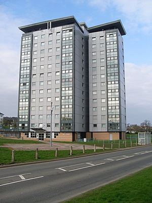
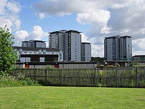 Whitlawburn towers viewed from the south-west |
|
| Population | 3,500 |
| OS grid reference | NS61815941 |
| Country | Scotland |
| Sovereign state | United Kingdom |
| Post town | GLASGOW |
| Postcode district | G72 8 |
| Dialling code | 0141 |
| Ambulance | Scottish |
| EU Parliament | Scotland |
| UK Parliament | |
| Scottish Parliament | |
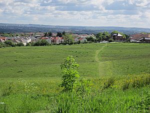
Whitlawburn is a neighborhood in Cambuslang, South Lanarkshire, Scotland. It is located on a hill south of the town center. From here, you can see the wider Greater Glasgow area.
Contents
Exploring Whitlawburn's Homes and Surroundings
Most of the homes in Whitlawburn are part of a large housing project. These homes were built in the late 1960s and early 1970s. They helped solve a housing shortage in the area. Many people moved here from older, crowded buildings in Cambuslang. Before these homes were built, the area was mostly farmland. It even had a farm called Whitlawburn Farm. The name comes from the Whitlaw Burn, a small stream flowing from the Cathkin Braes nearby.
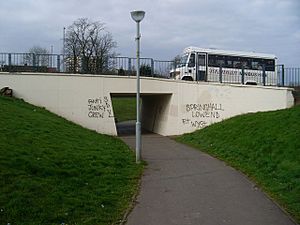
A main road, part of the A749 road, runs through the area. This road connects East Kilbride to Glasgow. It also separates Whitlawburn from nearby areas like Springhall and Cathkin. Even though they are separated, these neighborhoods often share local facilities. There is an underpass that lets people walk safely under the road between Springhall and Whitlawburn. To the east, new housing areas are growing towards Halfway. You can also find an entrance to Cambuslang Public Park here.
The Iconic Tower Blocks and Modern Homes
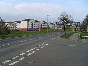
Whitlawburn is easily recognized by its six tall, 13-story apartment buildings. These buildings are named Arran, Ailsa, Benmore, Bute, Kintore, and Roslin. Together, they have 432 apartments. These towers are on the south side of the main road. Around them are modern apartment buildings arranged in a grid. There is also a local shopping area with stores like Nisa and Greggs.
Originally, the buildings were plain grey concrete. But starting in the 1990s, the area got a big makeover. The apartment buildings were painted in bright colors. They also got sloped roofs, which are better for Scotland's rainy weather. The tall towers were covered with new materials and given special lighting. This big project cost £21 million.
In 1989, residents who were unhappy with their homes started the West Whitlawburn Housing Co-operative. This group worked to improve housing conditions. They also set up a system of security cameras and a concierge service for the towers.
More improvements were planned in 2016. Some older flats in the eastern part of Whitlawburn were to be replaced with new houses. This was because some parts of the area were identified as needing more support. By 2019, some old buildings were being taken down. New homes were planned to be finished by 2021.
South of the towers, you'll find the local community centre with a 5-a-side football pitch. There are also two newer housing areas. One is called Lomond View, with larger private homes. The other has 100 homes built by the West Whitlawburn Housing Co-operative. These homes are next to farmland and a golf course (Kirkhill Golf Club). This area is part of the green belt, which means it's protected from too much building. However, in 2016, plans were approved for 240 new houses in a nearby field.
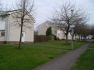
On the north side of the main road, there are rows of terraced houses and cottage flats. You'll also find the local pub and the new buildings of Cathkin High School. More small houses have been built on the old school site. Holmhills Park is also nearby, leading to the Kirkhill area. The home ground of Cambuslang Rugby Club is close by too.
Local Facilities and Schools
Whitlawburn is part of the Cambuslang West area. This is also the zone for local community policing. The closest train stations are Burnside and Kirkhill. Both are about a mile from the western end of Whitlawburn.
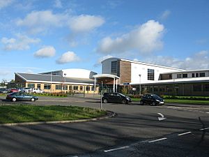
For younger children, the closest primary schools are Loch Primary and St Anthony's RC Primary in Springhall. They are built next to each other and share a playground. West Coats Primary is also an option in Kirkhill. However, children in the newest housing development will go to Cairns Primary in Halfway.
For older students, Cathkin High School is right next to Whitlawburn. This school also has a nursery and a special support facility called Rutherglen High School. Students who attend Catholic schools usually go to Trinity High in Eastfield. A new pre-school, Springlaw ELC, opened in Springhall in 2021. Its name combines "Springhall" and "Whitlawburn" to show unity between the communities.
Famous People from Whitlawburn
- Darren Young: A footballer who played for teams like Aberdeen F.C. and Dunfermline Athletic. He also played for the Scotland under-21 team and later became a manager.
- Derek Young: Also a footballer, he played for Aberdeen, Dunfermline, and Partick Thistle. He was also on the Scotland under-21 team and is Darren's brother.
 | Emma Amos |
 | Edward Mitchell Bannister |
 | Larry D. Alexander |
 | Ernie Barnes |


