Econfina Creek facts for kids
Econfina Creek is a cool, small river found in the middle part of the Florida Panhandle. It flows through areas with hills and even has parts with exciting whitewater rapids! A lot of its water comes from natural springs. The creek eventually flows into Deer Point Lake. This lake is a big reservoir that provides fresh drinking water for Panama City and much of Bay County.
The name "Econfina" comes from the Creek language. Ekana means "earthy," and feno means "bridge" or "footlog." This name refers to a natural bridge that used to cross the river. It was about 15 miles (24 km) upstream from where the river ends. Sadly, this natural bridge collapsed in the 1800s. An old road called the Bellamy Road, built in the 1820s, used to cross this very natural bridge.
Contents
Where Does Econfina Creek Flow?
Econfina Creek starts in the southwest part of Jackson County. It then flows into Bay County, then into Washington County, and finally returns to Bay County. The creek ends its journey in Deer Point Lake. Deer Point Lake is a reservoir that connects directly to North Bay, which is an arm of St. Andrews Bay. Econfina Creek is about 26 miles (42 km) long. The area of land that drains into it, called its watershed, is about 275 square miles (712 sq km).
The creek flows through a hilly landscape made of limestone. This type of land is called karst. Because of this, you can find springs, sinkholes, caves, and rock outcrops along the river. One special cave near the river is the only known home for a type of snail called Dasyscias franzi. This snail eats wood that beavers bring into the cave. The plants growing along the river are also interesting. Some are usually found in the Appalachian mountains but are rare in Florida.
How Do Springs Feed Econfina Creek?
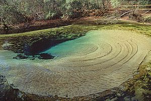
A large amount of the river's water comes from 11 named springs. These springs actually have more than 36 different vents where water flows out! This includes the very large Gainer Springs Group and four other big springs. The springs along Econfina Creek are mostly found in a 4.75-mile (7.64 km) section. This is where the river cuts through the Floridan Aquifer, which is a huge underground water source. More than 80% of the normal water flow of Econfina Creek into Deer Point Lake comes from these springs.
Protected Lands Along the Creek
Most of the land along Econfina Creek is owned by the Northwest Florida Water Management District. They manage about 41,000 acres (166 sq km) in the Econfina Creek Water Management Area. This area is also used as the Econfina Creek Wildlife Management Area. It is managed by the Florida Fish and Wildlife Conservation Commission. This means the land and wildlife are protected for everyone to enjoy.
Paddling Adventures on the Creek
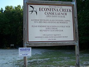
There's a 24-mile (39 km) long paddling trail on Econfina Creek. It goes from the Scott Road Bridge to the State Road 388 Bridge. This trail has the steepest drop in elevation of any canoe trail in Florida. Because of this, it's been called "the most exciting canoe trail in the state." The Florida Department of Environmental Protection suggests that only experienced paddlers use the upper part of the trail. They also warn that the river can be too dangerous for paddling when the water is high after heavy rains.
A Look at Econfina Creek's Past
More than 120 archaeological sites have been found in the Econfina Creek area. Many of these are very old prehistoric sites. For example, Paleo-Indian arrowheads, which are about 7,000 years old, have been discovered here. When the first humans arrived in Florida about 12,000 years ago, the water levels were much lower. Back then, Econfina Creek was more like a series of waterholes instead of a flowing river.
Choctaw and Creek people lived around Econfina Creek at different times before the United States took control of Florida. In the 1830s, these people were forced to leave Florida. This sad event is known as the Trail of Tears.
White settlers began moving to the land along Econfina Creek after the United States bought Florida in 1821. One of the first settlers was William Gainer. He was with Andrew Jackson's army when they passed through the area in 1818. The low-lying land along Econfina Creek was one of the few places in what is now Bay County where large farms, called plantations, were set up. It's said that the first cotton shipped from St. Joseph came from Econfina. To help with this trade, the government declared Econfina Creek a river that ships could use. This was up to the Gainer Bridge, which William Gainer built after the natural bridge fell down.
Deer Point Lake: A Water Source
Deer Point Lake was created in 1961 when a dam was built across North Bay, which is part of St. Andrews Bay. This reservoir covers about 5,000 acres (20 sq km). Its watershed, including Econfina Creek, is about 422 square miles (1,093 sq km). The lake receives an average of 600 million US gallons (2.3 billion L) of water each day from four different sources. It provides fresh water to Panama City and other parts of Bay County. About 60% of the water in the lake comes from Econfina Creek. During very dry times, Econfina Creek can supply up to 80% of the water flowing into the reservoir.
 | Emma Amos |
 | Edward Mitchell Bannister |
 | Larry D. Alexander |
 | Ernie Barnes |


