Edwards, Mississippi facts for kids
Quick facts for kids
Edwards, Mississippi
|
||
|---|---|---|
|
||

Location of Edwards, Mississippi
|
||
| Country | United States | |
| State | Mississippi | |
| County | Hinds | |
| Area | ||
| • Total | 1.66 sq mi (4.30 km2) | |
| • Land | 1.66 sq mi (4.30 km2) | |
| • Water | 0.00 sq mi (0.00 km2) | |
| Elevation | 236 ft (72 m) | |
| Population
(2020)
|
||
| • Total | 995 | |
| • Density | 599.40/sq mi (231.42/km2) | |
| Time zone | UTC-6 (Central (CST)) | |
| • Summer (DST) | UTC-5 (CDT) | |
| ZIP code |
39066
|
|
| Area code(s) | 601 | |
| FIPS code | 28-21580 | |
| GNIS feature ID | 0669683 | |
Edwards is a small town located in Hinds County, Mississippi, in the United States. In 2020, about 995 people lived there. It is part of the larger Jackson metropolitan area.
Contents
Discovering Edwards, Mississippi
A Look Back in Time: Edwards' History
The town of Edwards gets its name from Dick Edwards. He was the owner of a well-known hotel called the Edwards House in Jackson, Mississippi.
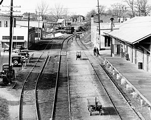
Edwards was first settled in the 1830s and was originally called "Amsterdam." In 1832, a serious sickness, a cholera outbreak, affected the town. Later, in 1839, the Alabama and Vicksburg Railroad was built, but it didn't go directly through Amsterdam. Instead, it made a stop at R. O. Edwards' plantation, which became known as Edwards Depot.
During the Civil War in 1863, the depot was burned down. This was done to stop it from being used by soldiers. The current location of Edwards was chosen in 1866, and the town officially became a town in 1871.
In 1882, an important school called the Southern Christian Institute opened in Edwards. It was started by the Christian Church (Disciples of Christ) to provide education for African Americans. This school later changed its name to Bonner-Campbell College. In 1897, Edwards faced another challenge when a serious disease called yellow fever spread, causing many people in the town to get sick.
Where is Edwards? Its Geography
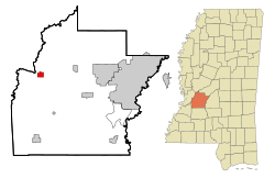
Edwards is located in the western part of Hinds County. It sits on higher ground about 1.5 miles east of the Big Black River. This river forms the border with Warren County.
Interstate 20, a major highway, runs along the northern edge of the town. You can get to Edwards from Exit 19. If you travel east on I-20 for about 26 miles, you'll reach Jackson, the state capital. Going west for about 17 miles will take you to Vicksburg.
The United States Census Bureau reports that the town of Edwards covers a total area of about 4.3 square kilometers (1.66 square miles). All of this area is land.
People of Edwards: Demographics
| Historical population | |||
|---|---|---|---|
| Census | Pop. | %± | |
| 1900 | 586 | — | |
| 1910 | 589 | 0.5% | |
| 1920 | 727 | 23.4% | |
| 1930 | 456 | −37.3% | |
| 1940 | 1,110 | 143.4% | |
| 1950 | 1,002 | −9.7% | |
| 1960 | 1,206 | 20.4% | |
| 1970 | 1,236 | 2.5% | |
| 1980 | 1,515 | 22.6% | |
| 1990 | 1,279 | −15.6% | |
| 2000 | 1,347 | 5.3% | |
| 2010 | 1,034 | −23.2% | |
| 2020 | 995 | −3.8% | |
| U.S. Decennial Census | |||
Edwards' Population in 2020
As of the 2020 United States Census, there were 995 people living in Edwards. These people made up 404 households, with 193 of them being families.
The population of Edwards in 2020 was mostly made up of people identifying as Black or African American, accounting for about 84.72% of residents. White residents made up about 10.95% of the population. Other groups, including Native American, Asian, and those of mixed race or Hispanic/Latino background, made up smaller percentages.
Edwards' Population in 2010
In the 2010 United States Census, there were 1,034 people living in the town. At that time, about 82.4% of the residents were Black, and 15.4% were White. Smaller groups included Native American (0.7%), Asian (0.1%), and people from two or more races (0.6%). About 0.9% of the population identified as Hispanic or Latino.
Learning in Edwards: Education
Students in Edwards attend schools within the Hinds County School District. Younger students go to Bolton/Edwards Elementary-Middle School, which is located in Bolton. Older students attend Raymond High School in Raymond.
The town also has a public library, the Lois A. Flagg Library. It is part of the Jackson/Hinds Library System and is located next to the Edwards Head Start Center.
Famous Faces from Edwards: Notable People
Many interesting people have connections to Edwards, Mississippi. Here are a few:
- Carnella Barnes: A pioneering African American minister in the Christian Church (Disciples of Christ).
- Betty Currie: She was the personal secretary for former President Bill Clinton. She moved away from Edwards as a child.
- George Flaggs Jr.: He is the current mayor of Vicksburg, Mississippi.
- Johnny Fuller: A talented blues and rock 'n' roll musician.
- Otis Harris: An amazing track and field athlete who won gold and silver medals at the 2004 Summer Olympics.
- George W. Lee: A vice-president of the Regional Council of Negro Leadership.
- Fiddlin' Joe Martin: Another notable blues musician.
- Charlie Patton: A very important blues musician who is in the Mississippi Musicians Hall of Fame.
- Melvin Powell: A pitcher who played in the Negro league baseball.
- Aurelius Southall Scott: An educator and newspaper editor.
- Norman Francis Vandivier: A skilled aviator.
See also
 In Spanish: Edwards (Misisipi) para niños


