Elbert, Colorado facts for kids
Quick facts for kids
Elbert, Colorado
|
|
|---|---|

Elbert, Colorado.
|
|

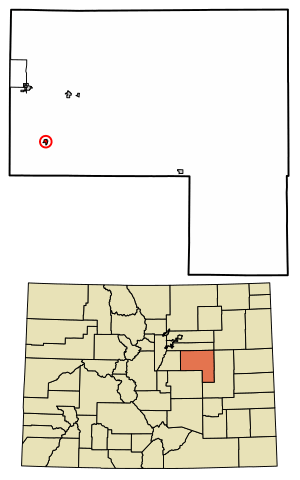
Location of the Elbert CDP in Elbert County, Colorado.
|
|
| Country | |
| State | |
| County | Elbert County |
| Government | |
| • Type | unincorporated community |
| Area | |
| • Total | 0.474 sq mi (1.227 km2) |
| • Land | 0.474 sq mi (1.227 km2) |
| • Water | 0 sq mi (0.000 km2) |
| Elevation | 6,840 ft (2,085 m) |
| Population
(2020)
|
|
| • Total | 188 |
| • Density | 396.8/sq mi (153.2/km2) |
| Time zone | UTC-7 (MST) |
| • Summer (DST) | UTC-6 (MDT) |
| ZIP Code |
80106
|
| Area codes | 303 & 720 |
| GNIS feature | Elbert CDP |
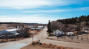
Elbert is a small community in Elbert County, Colorado, United States. It's not an official city or town, but it has a post office and is recognized as a census-designated place (CDP). This means the United States Census Bureau collects information about the people living there. Elbert is part of the larger Denver–Aurora–Lakewood, CO Metropolitan Statistical Area. In 2020, about 188 people lived in Elbert.
Contents
History of Elbert
The Elbert post office first opened its doors in 1875. The community and the county it's in are both named Elbert.
Major Floods in Elbert
Elbert County has experienced several big floods over the years. The most serious one happened in 1935. Flooding from Kiowa Creek destroyed many buildings in Elbert. Water was very deep, between 8 to 15 feet (2.4 to 4.6 m), and left behind 5 feet (1.5 m) of sand. Three-quarters of the town was ruined and never rebuilt.
Meteorite Discovery
On January 11, 1998, people saw a bright fireball in the sky over Elbert County. A few years later, on March 4, 2000, a five-year-old boy named Dustin Riffel found a special stone in a field on his family's property. This stone weighed about 680.5 grams (which is about 1.5 pounds). Scientists later confirmed it was a meteorite! It was officially named "Elbert."
Tornado Event
On June 15, 2009, a large tornado touched down near Elbert. It was an EF2 tornado, meaning it was quite strong. It was about three-quarters of a mile wide! The tornado came within 2 miles (3 km) of the town. It destroyed a barn and damaged an airplane hangar at a nearby farm.
Elbert Today
Today, Elbert is a quiet place with many ranchers and farmers. The local school, the Elbert School, has been rebuilt and serves the community.
Geography and Location
Elbert is located in a valley near Kiowa Creek. Elbert Road is an important road that connects the town to Kiowa, about 10 miles (16 km) to the north. It also goes south about 11 miles (18 km) to Eastonville. If you want to visit Colorado Springs, it's about 37 miles (60 km) southwest of Elbert.
Summer Camps Near Elbert
During the summer, Elbert gets much busier because of two nearby camps:
- Peaceful Valley Scout Ranch: This is a large Boy Scout camp that welcomes about 10,000 visitors every year!
- JCC Ranch Camp: About 2.8 miles (4.5 km) south of Elbert, this is a Jewish camp owned by the Denver Jewish Community Center.
The area of Elbert that is officially counted as a CDP is about 303 acres (1.227 km2), and it's all land.
Population Information
The United States Census Bureau collects information about how many people live in places like Elbert. This helps us understand how communities grow and change.
| Elbert CDP, Colorado | ||
|---|---|---|
| Year | Pop. | ±% |
| 2010 | 230 | — |
| 2020 | 188 | −18.3% |
| Source: United States Census Bureau | ||
Getting Around Elbert
Elbert is located along Elbert Road. This road is a key connection between Kiowa and U.S. Highway 24. The biggest city nearby is Castle Rock, which is about a 45-minute drive away using SH 86. Colorado Springs is about an hour's drive from Elbert via US 24.
See also
 In Spanish: Elbert (Colorado) para niños


