Falls Road, Belfast facts for kids
| Bóthar na bhFál (Irish) | |
| Irish: Bóthar na bhFál Ulster-Scots: Faas Raa | |
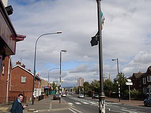
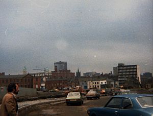
Falls Road looking towards Divis flats and the city centre
|
|
| Maintained by | Belfast City Council |
|---|---|
| Length | 1,600 m (5,200 ft) |
| Location | Belfast, Northern Ireland |
| Postal code | BT12 |
| Coordinates | 54°35′36″N 5°57′30″W / 54.59347°N 5.95823°W |
| Northeast end | Divis Street |
| Southwest end | Andersonstown Road |
| Other | |
| Known for | Numerous murals, Irish republican community |
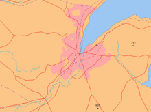
The Falls Road is a famous road in West Belfast, Northern Ireland. It stretches from the city centre all the way to the suburbs of Andersonstown. For over 150 years, this road has been closely connected with the Catholic community in Belfast. In Irish, it's called Bóthar na bhFál, and in Ulster-Scots, it's known as Faas Raa.
Contents
Exploring the Falls Road Area
The Falls Road is part of a main road, the A501, which goes through Belfast. It's about three miles long. The area around the road has many homes, especially in the lower parts. You'll also find lots of small shops, schools, churches, hospitals, and places for fun activities. Long ago, many people worked in big linen mills here, but most of them are now closed. Today, people mostly work in healthcare, education, and other services.
The Falls Road area can be divided into three main parts:
- The Lower Falls starts near the city centre and goes to the Grosvenor Road.
- The Middle Falls is around the Beechmount area.
- The Upper Falls begins near the Donegall Road and continues into Andersonstown.
The very first part of the road, from the city centre to Divis Street, is called Castle Street. It's named after the old Belfast Castle built by the Normans in the 1100s. Near Castle Street, you can find St. Mary's Church, which is the oldest Catholic church in Belfast, built in 1784. There's also Kelly's Cellars, a historic bar from 1720.
A Look at Falls Road History
The name Falls Road comes from the Irish words túath na bhFál, which means "territory of the enclosures." These enclosures were created during the Plantation of Ulster in the 1600s.
The Falls Road was once just a country path. But in the 1800s, many Catholic families moved here. They were escaping poverty in the countryside, made worse by the famine in the 1840s. They came hoping to find work in the new linen mills, especially for women and children. The area where they settled was first called Falls, and that's how the road got its name. Homes were built close together in narrow streets. Today, a big motorway, the Westlink, now runs through this historic area.
Lower Falls: A Busy Community
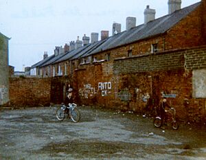
This part of the road goes from Castle Street to the Grosvenor Road. The lower section is called Divis Street, named after Divis mountain. The main Falls Road starts where Northumberland Street and Albert Street meet. This area was once full of small terraced houses built for mill workers in the 1800s.
Homes and Buildings in Lower Falls
Many streets were named after mill owners. For example, Alexander Street West was named after John Alexander, a local mill owner. Other streets got their names from events in the Crimean War (1853–1856), like Raglan Street (after Lord Raglan) and Alma Street (after the Battle of Alma). There were also streets named after places in the Balkans, such as Bosnia Street and Servia Street.
By the 1960s, many old buildings were falling apart. So, Belfast Corporation decided to rebuild much of the area. In the Divis Street area, old houses were replaced by the Divis Flats complex, which included Divis Tower. However, these flats quickly became run down, so most of them were torn down 30 years later and replaced with new terraced houses.
Schools for Young Learners
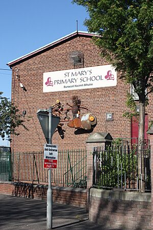
The Millfield campus of Belfast Metropolitan College is at the start of Divis Street. This is a large college for further education. The original St. Mary's Christian Brothers' Grammar School was also here before it moved to the Glen Road. Now, the old school building is home to the Edmund Rice Schools Trust. Across the street is St. Mary's Primary School.
There are other primary schools in Lower Falls, like St. Peter's and St. Joseph's. There's also an Irish language school called Gaelscoil an Lonnáin. Some older schools, like St Finian's and St. Gall's, closed due to fewer students. St Comgall's Public Elementary School, which closed in 1988, is now a community hub called Ionad Eileen Howell.
The Dunlewey Centre is a community education centre. It used to be a home for the Bon Secours Sisters and a girls' primary school.
Places of Worship
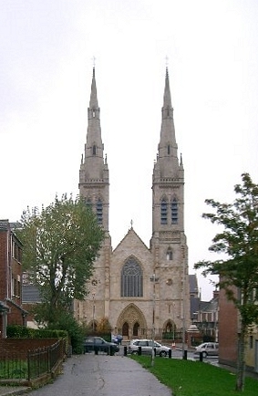
The Lower Falls has three Catholic churches. The oldest is St. Mary's Church, which opened in 1784. St Peter's Cathedral opened in 1866 and became a cathedral in 1986. It has a choir called St Peter's Schola Cantorum. Clonard monastery, home to the Redemptorist religious order, opened in 1911. Father Alec Reid, who helped with the Northern Ireland peace process, lived here.
Many Protestant churches in the area have closed or been changed since the start of the Troubles and the building of peace lines. For example, St. Luke's Church and St Philips Church have closed, with their congregations joining other churches. Some buildings have been repurposed, like the former Presbyterian church in Townsend Street, which is now a rehearsal space for the Ulster Orchestra. A newer church, the New Life City Church, is located on Northumberland Street, near the peace line.
Shops and Businesses
The Lower Falls used to have many linen mills. Now, these have either been torn down or changed for other uses. The Twin Spires Complex, for example, replaced a large mill and now has shops and offices. Conway Mill, another former flax spinning mill, is now a community centre with small businesses, art studios, and the Irish Republican History Museum.
Two large flour mills are still active in Lower Falls: Neill's Flour Mill and Andrews Flour Mill. These mills have a long history in the area. Northumberland Street and Percy Street were named after a Duke of Northumberland. Percy Street was badly damaged during the Belfast Blitz in 1941. In 1969, Percy Street and Dover Street saw major unrest during the 1969 Northern Ireland riots.
Fun and Games
The Falls Leisure Centre offers a swimming pool, gym, and other facilities. It used to be the Falls Public Baths where people could wash and swim. After the Belfast Blitz in 1941, it was used as a temporary morgue.
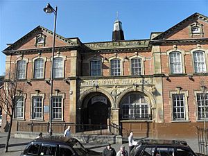
The Falls Road Library, opened in 1908, is one of the few Carnegie libraries in Belfast still working as a library. There used to be several cinemas here, like the Clonard Picture House and the Arcadian Cinema, but they have all closed.
Dunville Park opened in 1893, funded by Robert G Dunville, who owned a whiskey distillery. The park has a football pitch and has been recently updated. Nearby are the clubrooms for Davitt's GAC and Dwyer's GAC.
The Lower Falls has a rich history of storytelling, music, and song, often enjoyed in its many pubs. Most of these old pubs were torn down in the 1970s and 1980s as the area was redeveloped.
Near Divis Street, you'll find the offices of Raidió Fáilte, an Irish language radio station. The Astor Ballroom, a popular dance venue in the 1960s, where bands like Thin Lizzy played, was also nearby.
Murals: Art and Messages
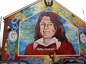
Large murals are painted on some walls along the road. These artworks show local and international political ideas and figures. One famous mural shows Bobby Sands on the side of the Sinn Féin offices. It says: our revenge will be the laughter of our children.
Another series of murals, called the International or Solidarity Wall, shows images of people involved in freedom struggles around the world. These murals are popular with tourists and are often updated. There are also murals on other walls promoting peace and understanding between communities.
Middle Falls: Hospitals and Culture
This section of the road is centered around the Beechmount area. It stretches from the Grosvenor Road to the Whiterock Road. Beechmount is named after Beechmount House, which used to be surrounded by beech trees. It is now an Irish Language school.
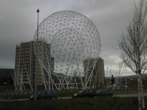
The Whiterock Road leads to the Ballymurphy and Turf Lodge areas, and also to the Black Mountain overlooking Belfast. On the other side of the Falls Road is the Donegall Road. Near the junction with the Westlink, you can see a large sculpture called RISE, also known as the balls on the Falls.
Important Hospitals
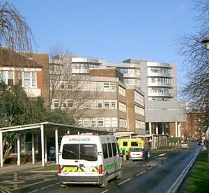
The area has several large hospitals, including the Royal Victoria Hospital, the Royal Jubilee Maternity Service, and the Royal Belfast Hospital for Sick Children (Children's Hospital). These hospitals form Northern Ireland's biggest hospital complex. The Royal Victoria Hospital treats many thousands of people each year. It's also a major training site for medical students. The original hospital opened in 1797 and moved to its current site in 1903. It was even claimed to be the first air-conditioned public building in the world!
More Schools in Middle Falls
There are several schools here. For primary students, there's St. Paul's Primary School and two Irish language primary schools: Gaelscoil na bhFal and Bunscoil an tSléibhe Dhuibh.
For older students, there is St Dominic's Grammar School for Girls. Nearby was St. Rose's High School, which merged with other schools in 2019 to form All Saints College. Several boys' secondary schools in the area have also merged over the years, including St. Thomas's Boys Secondary School and St. Peter's Boys Secondary School. Famous writers like Seamus Heaney and Michael McLaverty taught at St. Thomas's.
Coláiste Feirste is an Irish language secondary school located in the former Riddel family home. St Mary's University College, part of Queen's University Belfast, trains teachers and offers other courses. It hosts many local events, including those organised by Féile an Phobail.
Churches in Middle Falls
St Paul's Church is located opposite the hospitals. It opened in 1887. Broadway Presbyterian Church opened in 1891 but closed in 1982. It has since been turned into an Irish language arts and culture centre.
Fun and Culture
Willowbank Park has playing fields and used to house a British Army barracks. Corrigan Park is a place for Gaelic games. McCrory Park is another sports facility, named after Cardinal Joseph MacRory. The playing fields of Davitt's GAC are in Beechmount. The Whiterock Leisure Centre offers a community garden and playground. The St. James's Community Farm, created by local residents, provides a home for animals and gardening projects.
There's a strong interest in Irish language and culture here. The Cluain Árd centre was set up in 1936 for Irish language fans. In 2002, Belfast City Council approved a Gaeltacht Quarter around the Falls Road. The Cultúrlann McAdam Ó Fiaich, or the Cultúrlann, is an Irish language and arts centre that opened in 1991 in the old Broadway Presbyterian church. It also has an Irish language bookshop. The Féile an Phobail, an annual festival of Irish culture, showcases Irish traditions.
The Áras Uí Chonghaile/James Connolly Visitor Centre is dedicated to James Connolly, a famous figure who lived nearby.
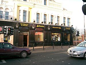
Several large bars are in the middle Falls area, like the Beehive and the Rock Bar. The Rock Bar is said to be the oldest bar on the Falls Road.
The Broadway Cinema was once Belfast's largest suburban cinema, but it closed in 1972 after a bombing. Nearby is the Falls Women's Centre, which helps women in the community.
On the Donegall Road, you can find the former site of Celtic Park. This was once a football stadium and a greyhound racing track. It closed in 1983 and is now a shopping centre.
Upper Falls: Parks and Cemeteries
This section goes from the Whiterock Road to the Andersonstown Road. The Andersonstown Road leads out of the city. The Andersonstown RUC station, which was often attacked, was located here but was closed and torn down in 2005.
Schools in Upper Falls
St. Louise's Comprehensive College is one of Europe's largest girls' schools, though it now also admits boys. St. Kevin's Primary School and St. Maria Goretti Nursery School are also in this area.
Churches in Upper Falls
St. John's RC Church was built in 1928 as the local population grew. St. Matthias's Church on the Glen Road was originally a Church of Ireland church. It closed in 1969 but was taken over by the Catholic parish of St Teresa of Ávila and reopened as a Catholic church in 1970. A new Catholic church opened on the site in 2004.
Fun and Recreation
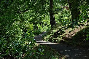
The Falls Park was created in 1873. It has many trees, flower beds, and open grassy areas. The park has playing fields for Gaelic games and soccer, a 3G pitch, and a bowling green. It also has an outdoor gym and a refurbished play park. An outdoor swimming pool, known as The Cooler, was added in 1924 but closed in 1979. The Féile an Phobail festival holds its closing concert here every year.
Opposite Falls Park are the facilities of St. Gall's GAC. Further up the Falls Road is The Felons, a large social club and restaurant.
Cemeteries: Resting Places
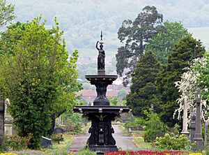
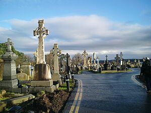
In the late 1800s, as Belfast's population grew, more cemeteries were needed. The Upper Falls was a rural area then, so the city council and the Catholic Church bought land here. Belfast City Cemetery, managed by the Belfast City Council, opened in 1869. Milltown Cemetery, managed by the Catholic Church, opened in the same year.
Near Milltown Cemetery is the Bog Meadows, a large wildlife preserve with wild flowers, birds, and butterflies. It is managed by the Friends of the Bog Meadows and the Ulster Wildlife Trust.
Getting Around: Transport
Long ago, there was a tram service on the Falls Road, which was replaced by trolleybuses in 1938. These trolleybuses were then replaced by diesel buses in the 1960s. During the Troubles, the public bus service stopped, and black taxis filled the gap. After the Troubles ended, the public bus service returned and has grown. Metro now runs the bus service. The Falls Road is a special "quality bus corridor" with many different routes.
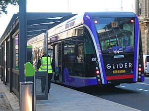
In 2018, the Glider bus service was introduced. It's the first bus service that goes across the city, connecting Poleglass, the Falls Road, the City Centre, and Dundonald.
Street Names: English and Irish
Since 2021, many streets in the area now have signs in both English and Irish. This is a decision by Belfast City Council. For example, Ardmoulin Street is also shown as Sráid Ard an Mhuilinn.
The Troubles: A Difficult Time
In the late 1960s, many Catholics in Northern Ireland began to campaign for civil rights. They wanted fair treatment in housing and jobs, similar to the American Civil Rights Movement. At that time, voting rules in Northern Ireland were different from the rest of the UK, making it harder for some people to vote.
Some Unionists worried that the civil rights campaign was a way to destabilize Northern Ireland. In August 1969, streets around the Falls Road were attacked by armed police reserves and loyalists. Six Catholics were killed, marking the start of 'The Troubles'. The British Government sent the British Army to protect Catholics. At first, the troops were welcomed, but their harsh methods soon made many Catholics and nationalists feel distant from them.
From July 3-5, 1970, the Falls Road was the scene of the Falls Curfew. 3,000 British troops searched the area for hidden weapons. Local young people clashed with the troops, who used tear gas. The Official IRA also fought the British troops. Four Catholic civilians were killed by the Army during this operation. This event is seen as the end of the British Army's good relationship with the nationalist community.
During the Troubles, there were many attacks on Falls Road residents. These attacks increased in 1969 when loyalists from the Shankill Road area destroyed whole streets. To keep people safe, temporary barriers were built. These later became permanent peace walls that still separate the Falls Road from the Shankill Road today.
For 30 years, the British Army had a base on top of Divis Tower. This base was removed in August 2005 after the Provisional Irish Republican Army said they were ending their armed activities. The Falls Road area saw some of the worst violence of the Troubles. The last British soldier killed on the road was Private Nicholas Peacock in 1989.
The Good Friday Agreement was signed in 1998, which led to the end of armed campaigns by groups like the IRA in 2005.
See also
 In Spanish: Falls Road para niños
 | Aurelia Browder |
 | Nannie Helen Burroughs |
 | Michelle Alexander |


