Field Brook facts for kids
Quick facts for kids Field Brook |
|
|---|---|

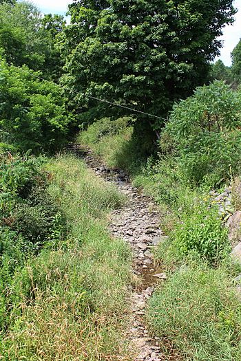
Field Brook looking upstream
|
|
| Other name(s) | Fields Brook |
| Physical characteristics | |
| Main source | pond in Lathrop Township, Susquehanna County, Pennsylvania between 1,320 and 1,340 feet (402 and 408 m) |
| River mouth | Tunkhannock Creek in Nicholson Township, Wyoming County, Pennsylvania 702 ft (214 m) 41°36′52″N 75°48′50″W / 41.61451°N 75.81399°W |
| Length | 5.8 mi (9.3 km) |
| Basin features | |
| Progression | Tunkhannock Creek → Susquehanna River → Chesapeake Bay |
| Basin size | 7.41 sq mi (19.2 km2) |
| Tributaries |
|
Field Brook, also called Fields Brook, is a small stream in Pennsylvania. It flows through Susquehanna County and Wyoming County. This stream is about 5.8 miles (9.3 km) long. It eventually flows into Tunkhannock Creek.
The area of land that drains into Field Brook is about 7.41 square miles (19.2 km2). It has one main branch called East Branch Field Brook. The land around Field Brook has different types of soil and rocks. These include alluvium (river deposits), till (glacial deposits), and bedrock. The stream's watershed is a great place for fish. It is known as a Coldwater Fishery and a Migratory Fishery.
Contents
Where Does Field Brook Flow?
Field Brook starts in a pond in Lathrop Township, Susquehanna County. It flows south and then southwest. The stream then enters a small lake. After the lake, it flows south-southeast for over a mile. It passes by Miller Hill and Mulligan Hill.
The stream then turns south and later southeast. At this point, it leaves Susquehanna County. Field Brook then enters Nicholson Township in Wyoming County. It continues flowing southeast.
After a short distance, it meets its only named branch, East Branch Field Brook. This branch joins Field Brook from the left side. Field Brook then turns south-southeast. Its valley gets wider as it flows. It then turns south-southwest and goes under Pennsylvania Route 92. Finally, the stream turns southeast and then east. It soon reaches Tunkhannock Creek. Field Brook joins Tunkhannock Creek about 13.12 miles (21.1 km) upstream from its mouth.
East Branch Field Brook
Field Brook has one important branch called East Branch Field Brook. This branch flows into Field Brook about 1.48 miles (2.38 km) before Field Brook joins Tunkhannock Creek. The area of land that drains into East Branch Field Brook is about 2.70 square miles (7.0 km2).
Land and Rocks Around the Stream
The land around Field Brook changes along its path. Near where Field Brook joins Tunkhannock Creek, the ground is mostly made of alluvium. This is soil and sand left behind by the river. There is also some till from glaciers, called Wisconsinan Till.
In the middle parts of the stream, the land next to it is also mostly alluvium. The rest of the valley has more Wisconsinan Till. You can also find areas of alluvial fans and alluvial terraces. These are flat areas formed by water. There is also bedrock made of sandstone and shale. In the upper parts of the stream, the land is mostly Wisconsinan Till. But there are also areas of alluvium, wetlands, and a lake.
The mouth of Field Brook is about 702 feet (214 meters) above sea level. The source of the stream is higher up. It is between 1320 and 1340 feet (402 and 408 meters) above sea level.
Field Brook's Watershed
The watershed of Field Brook covers an area of 7.41 square miles (19.2 km2). A watershed is all the land where water drains into a specific stream or river. The mouth of Field Brook is near the town of Nicholson.
In 2015, there was a dam called the McNamara Dam on a small branch of Field Brook. People thought this dam might be unsafe. So, there was a plan to remove it. Removing the dam would allow about 900 feet (270 meters) of the stream to flow freely again.
History of Field Brook
Field Brook was officially added to the Geographic Names Information System on August 2, 1979. Its special ID number is 1174737. The stream is also known by the name "Fields Brook." This name was mentioned in a book from 1883 by Israel C. White. The book was about the geology of the Susquehanna River region.
Two bridges cross Field Brook. A concrete bridge carrying Pennsylvania Route 92 was built in 1927. It is 34.1 feet (10.4 meters) long. Another bridge, made of steel, carries State Route 1015. It was built in 1941 and is also 34.1 feet (10.4 meters) long. Both bridges are in Nicholson Township, Wyoming County.
Wildlife and Environment
The watershed of Field Brook is a special place for fish. It is called a Coldwater Fishery. This means the water is cold enough for certain types of fish to live there. It is also a Migratory Fishery. This means that fish travel through this stream to other places to lay their eggs.
 | Janet Taylor Pickett |
 | Synthia Saint James |
 | Howardena Pindell |
 | Faith Ringgold |


