Flowers Hills facts for kids

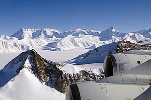
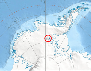
The Flowers Hills (78°24′S 84°10′W / 78.400°S 84.167°W) are a group of hills shaped like a triangle in Antarctica. They are about 34.6 kilometers (21.5 miles) long and 11.5 kilometers (7.1 miles) wide. These hills are part of the Ellsworth Mountains and sit on the eastern side of the Sentinel Range.
The highest points in the Flowers Hills are Gubesh Peak, which is 1,240 meters (4,068 feet) tall, and Dickey Peak, standing at 1,504 meters (4,934 feet). Glaciers and ice streams surround these hills. To the west and north are Hansen Glacier and Dater Glacier. The Rutford Ice Stream is to the east, and Sikera Valley is to the southwest. A place called Kostinbrod Pass separates the Flowers Hills from Doyran Heights. Inside the hills, you'll find ice fields like Lardeya Ice Piedmont and Valoga Glacier.
How the Flowers Hills Got Their Name
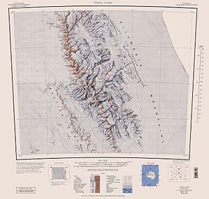
The Flowers Hills were first mapped by the United States Geological Survey. This mapping happened between 1957 and 1959, using surveys and photos taken from U.S. Navy planes.
The Advisory Committee on Antarctic Names officially named these hills. They chose the name to honor Edwin C. Flowers. He was a meteorologist, a scientist who studies weather, at the South Pole Station in 1957.
Cool Places in the Flowers Hills
The Flowers Hills are home to several interesting geographical features. Here are some of them:
- Batil Spur
- Dater Glacier
- Dickey Peak
- Gubesh Peak
- Hansen Glacier
- Kostinbrod Pass
- Lardeya Ice Piedmont
- Monyak Hill
- Rutford Ice Stream
- Sikera Valley
- Strinava Glacier
- Taylor Spur
- Valoga Glacier
 | William M. Jackson |
 | Juan E. Gilbert |
 | Neil deGrasse Tyson |


