Fort Cascades facts for kids
Quick facts for kids |
|
|
North Bonneville Archeological District
|
|

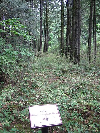
Remnants of the military portage road, 2006
|
|
| Lua error in Module:Location_map at line 420: attempt to index field 'wikibase' (a nil value). | |
| Nearest city | North Bonneville, Washington |
|---|---|
| Area | 69.1 acres (28.0 ha) |
| NRHP reference No. | 87000498 |
| Added to NRHP | February 2, 1987 |
Fort Cascades was a United States Army fort. It was built in 1855. Its main job was to protect a special road. This road helped people get around the "lower cascades" part of the Cascades Rapids. The fort was on the Washington side of the Columbia River. It was located near where North Bonneville and the Bonneville Dam are today. This area is in Skamania County.
Contents
History of Fort Cascades
Building and Leaving the Fort
Fort Cascades first started in 1850. It burned down in 1856. The army finally left the fort in 1861.
The Town of Cascades
A small town called Cascades grew up around the fort. At its busiest, about 130 people lived there. People in the town mostly worked by catching fish from the Columbia River. They also worked on the railroad.
The town of Cascades was once the main government center for Skamania County. This was before 1893. That year, the county records were moved to Stevenson. Reports say the records were moved from the courthouse in an unexpected way at night.
The Great Flood of 1894
In 1894, the Columbia River had its biggest flood ever recorded. The flood covered both the town and the fort. The town was never rebuilt after this huge flood.
Photographs by Carleton Watkins
In 1867, a famous photographer named Carleton Eugene Watkins visited the area. This was many years before the big flood. Watkins was hired by a shipping company. His job was to take pictures of the Columbia River. The "Cascades" area was a very important part of his photo collection.
About 50 of Watkins' special 3D photos of the Cascades still exist. These pictures show river views. They also show the town and the fort's blockhouses. Watkins' photos also show sawmills. He captured trains and riverboats, which were very important for the local economy. Some pictures even show people fishing for salmon before the Bonneville Dam was built. This dam later covered the rapids. Watkins' original photo negatives were lost in the 1906 San Francisco earthquake. But many of his printed photos can be found in museums and private collections today.
Fort Cascades Today
The land where Fort Cascades once stood is about 21-acre (8.5 ha) big. It was added to the National Register of Historic Places in 1987. This means it is a special historic site.
In 1998, the United States Army Corps of Engineers (USACE) started a big project. They built a fish passage through the old fort area. This passage helps young salmon swim around the Bonneville Dam. The project was approved by the state. Some old rail tracks were removed. The spot where the fort's jail was located was also changed.
Today, there is a 1.5-mile (2.4 km) walking trail. It goes through the remains of the fort and town. You can also see a copy of a rock with petroglyphs (ancient rock carvings). The original rock was moved to Stevenson.
Fort Cascades was one of several forts built to protect the portage around the Cascade Rapids. Other forts like it were Fort Raines and Fort Lugenbeel.
 | Jackie Robinson |
 | Jack Johnson |
 | Althea Gibson |
 | Arthur Ashe |
 | Muhammad Ali |

