Fort Davis, Texas facts for kids
Quick facts for kids
Fort Davis, Texas
|
|
|---|---|
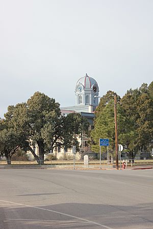
Jeff Davis County Courthouse, located in Fort Davis
|
|
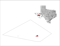
Location of Fort Davis, Texas
|
|
| Country | United States |
| State | Texas |
| County | Jeff Davis |
| Area | |
| • Total | 10.1 sq mi (26.1 km2) |
| • Land | 10.1 sq mi (26.1 km2) |
| • Water | 0 sq mi (0.0 km2) |
| Elevation | 4,961 ft (1,512 m) |
| Population
(2020)
|
|
| • Total | 1,024 |
| • Density | 101.61/sq mi (39.23/km2) |
| Time zone | UTC-6 (Central (CST)) |
| • Summer (DST) | UTC-5 (CDT) |
| ZIP code |
79734
|
| Area code(s) | 432 |
| FIPS code | 48-26688 |
| GNIS feature ID | 2408235 |
Fort Davis is a small community in Jeff Davis County, Texas, in the United States. It is also known as a census-designated place, which means it is a special area studied by the U.S. Census Bureau. In 2020, about 1,024 people lived there. It is also the main town, or county seat, of Jeff Davis County.
Contents
History of Fort Davis
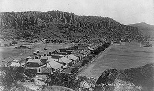
The community of Fort Davis grew around a military fort. This fort was built in 1854. It was located along an important road called the San Antonio–El Paso Road in west Texas.
The fort was named after Jefferson Davis. At that time, he was the Secretary of War for President Franklin Pierce. The fort was used to protect travelers and settlers. It was closed during the American Civil War.
After the Civil War, the fort was reopened in 1867. It continued to be an important place for the U.S. Army. Today, the old fort is a Fort Davis National Historic Site. People can visit it to learn about its history.
Geography and Location
Fort Davis is in the southeastern part of Jeff Davis County. It sits at the base of the Davis Mountains. These mountains are a beautiful natural area.
Two main roads, Texas State Highway 17 and Texas State Highway 118, meet in the center of Fort Davis. These highways connect the town to other places in Texas. For example, Highway 17 goes northeast to Balmorhea and southwest to Marfa. Highway 118 goes northwest through the mountains and southeast to Alpine.
The community covers an area of about 10 square miles (26.1 square kilometers). All of this area is land. Fort Davis is known for being the highest county seat in Texas. It is about 4,961 feet (1,512 meters) above sea level.
Climate in Fort Davis
Fort Davis has a semi-arid climate. This means it is generally dry. Winters are cool and dry. Summers are hot, but they also get more rain.
Because of its high elevation, the temperature can change a lot between day and night. This is called diurnal temperature variation.
Population Information
| Historical population | |||
|---|---|---|---|
| Census | Pop. | %± | |
| 2000 | 1,050 | — | |
| 2010 | 1,201 | 14.4% | |
| 2020 | 1,024 | −14.7% | |
| U.S. Decennial Census 1850–1900 1910 1920 1930 1940 1950 1960 1970 1980 1990 2000 2010 |
|||
According to the 2020 United States census, 1,024 people lived in Fort Davis. There were 415 households and 317 families.
Fun Places to Visit
Fort Davis has several interesting places to explore:
- Chihuahuan Desert Nature Center and Botanical Gardens: This is a great place to learn about the plants and animals of the Chihuahuan Desert. It is part of the Chihuahuan Desert Research Institute.
- Fort Davis National Historic Site: You can visit the old military fort and see how soldiers lived long ago.
- The McDonald Observatory: This famous observatory is run by the University of Texas at Austin. It is a fantastic place to look at stars and planets.
- Very Long Baseline Array: Fort Davis is home to one of the giant radio dishes that make up this special telescope.
- Davis Mountains State Park: This park offers beautiful scenery, hiking trails, and a chance to enjoy nature.
Education in Fort Davis
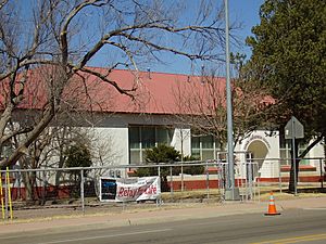
Students in Fort Davis are served by the Fort Davis Independent School District. The schools in the area include:
- Dirks-Anderson Elementary School
- Fort Davis High School
For students who want to continue their education after high school, all of Jeff Davis County is part of the area served by Odessa College.
Gallery
See also
 In Spanish: Fort Davis (Texas) para niños
 | Bayard Rustin |
 | Jeannette Carter |
 | Jeremiah A. Brown |


