Fort Mohave, Arizona facts for kids
Quick facts for kids
Fort Mohave, Arizona
|
|
|---|---|
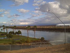
View of Fort Mohave from Avi Resort & Casino
|
|
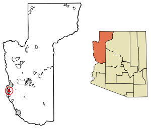
Location in Mohave County, Arizona
|
|
| State | Arizona |
| County | Mohave |
| Founded | 1935 |
| Named for | Fort Mohave |
| Area | |
| • Total | 16.70 sq mi (43.25 km2) |
| • Land | 16.70 sq mi (43.25 km2) |
| • Water | 0.00 sq mi (0.00 km2) |
| Elevation | 545 ft (166 m) |
| Population
(2020)
|
|
| • Total | 16,190 |
| • Density | 969.52/sq mi (374.34/km2) |
| Time zone | MST |
| ZIP codes |
86426
|
| Area code(s) | 928 |
| FIPS code | 04-24895 |
| GNIS feature ID | 2628855 |
Fort Mohave is a community in Mohave County, Arizona, United States. It's called a "census-designated place" because it's a special area used for counting people in the census. The community gets its name from a nearby fort that was important during the Mohave War.
In 2020, about 16,190 people lived in Fort Mohave. This number has grown a lot from 8,919 people in 2000! Fort Mohave is like a neighbor to Bullhead City. Because it has grown so much, it's now the biggest community in Mohave County that isn't officially a city.
The biggest employer in Fort Mohave is Valley View Medical Center. Also, in 2013, a huge solar power plant was built here. It covers more than 200 acres and helps make clean energy from the sun.
Contents
A Look Back at Fort Mohave's History
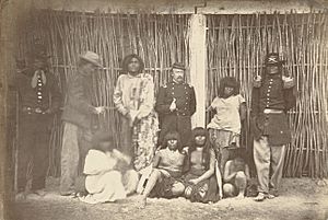
The first European explorer known to visit this area was Melchor Díaz in 1540. He wrote about meeting a large group of native people. They called themselves the Pipa Aha Macav, which means "People by the River". The name "Mojave" comes from "Aha Macav". You might see it spelled "Mohave" for the town and "Mojave" for the tribe.
The fort was built during the Mohave War. It was a base for the U. S. Army to operate against the native Mohave people. These people had lived in the area for hundreds of years.
During the American Civil War, in 1861, the fort was left empty for a while. The soldiers were sent to other places. Later, in 1863, new soldiers came to guard the fort. The U.S. Army stayed there until 1890. After that, the fort was given to the Indian Service. In 1935, it became part of the Fort Mojave Indian Reservation.
Where is Fort Mohave?
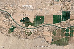
Fort Mohave is in the western part of Mohave County. It's right next to Arizona State Route 95. To the north, you'll find Bullhead City. To the west is the Fort Mojave Indian Reservation. South of Fort Mohave is Mesquite Creek.
Route 95 goes north for about 10 miles to Bullhead City. If you go south on Route 95, you'll reach Needles, California, about 12 miles away, which is across the Colorado River. There's also Aztec Road that goes west from Fort Mohave. It crosses the Colorado River into the southern part of Nevada. From there, it's about 16 miles south of Laughlin.
The area of Fort Mohave is about 16.7 square miles, and it's all land.
Fun Places in Fort Mohave
Many neighborhoods in Fort Mohave are built around man-made lakes and golf courses. You can also find homes on mesas with amazing mountain views. One of the newer golf courses is Los Lagos Golf Club. It was designed by a famous golf course architect named Ted Robinson, Sr.
Fort Mohave is also home to the Mojave Crossing Event Center. This is the biggest stadium for miles around! It can hold 3,000 people for stadium-style events and up to 5,000 people for arena-style events. It's a great place for large indoor gatherings in Mohave County.
Fort Mohave's Population
| Historical population | |||
|---|---|---|---|
| Census | Pop. | %± | |
| 2000 | 8,919 | — | |
| 2010 | 14,364 | 61.0% | |
| 2020 | 16,190 | 12.7% | |
| U.S. Decennial Census | |||
Fort Mohave is located between Bullhead City and Mohave Valley. It's connected to both of these places in terms of its economy and how people live.
Learning in Fort Mohave
Fort Mohave has two public elementary schools: Fort Mojave Elementary School and Camp Mohave Elementary School. Both are part of the Mohave Valley Elementary School District. There are also other schools like Young Scholar's Academy, All Beauty College, the Academy of Building Industries, and Desert Star.
Getting Around and Services
Emergency Services
The Fort Mojave-Mesa Fire Department helps keep everyone in Fort Mohave safe. They respond to emergencies and fires.
Transportation
If you need to travel, Vegas Airporter offers a service. It connects Lake Havasu City, Fort Mohave, and McCarran International Airport in Las Vegas.
See also
 In Spanish: Fort Mohave para niños


