Fort Severn First Nation facts for kids
Quick facts for kids
Fort Severn 89
ᐗᔕᐦᐅ ᐃᓂᓂᐗᐠ
|
|
|---|---|
| Fort Severn Indian Reserve No. 89 | |
| Western Swampy Cree transcription(s) | |
| • Canadian Aboriginal Syllabics | Waśaho Ininiwak |
| Country | |
| Province | |
| District | Kenora |
| First Nation | Fort Severn |
| Government | |
| • Type | Band council |
| Area | |
| • Land | 44.07 km2 (17.02 sq mi) |
| Population
(2016)
|
|
| • Total | 361 |
| • Density | 8.2/km2 (21/sq mi) |
| Website | fortsevern.firstnation.ca |
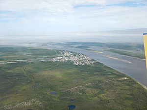
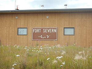
Fort Severn First Nation is a special community in Ontario, Canada. It's home to the Western Swampy Cree people. Their name for themselves is Waśaho Ininiwak (ᐗᔕᐦᐅ ᐃᓂᓂᐗᐠ). The community is located on the Severn River, very close to Hudson Bay.
Fort Severn is the most northern community in all of Ontario. In 2016, about 361 people lived there. The official name for their land is Fort Severn 89.
During winter, the town connects to other places by a special winter or ice road. This road is called the Wapusk Trail. It links Fort Severn to Peawanuck, Ontario, in the east. It also connects to Shamattawa and Gillam, Manitoba, in the west. The community is kept safe by the Nishnawbe-Aski Police Service. This is a police service run by Indigenous people.
Contents
Fort Severn: A Look Back in Time
The land around Fort Severn has been home to different indigenous peoples for thousands of years. When Europeans first arrived, the Swampy Cree people lived here. They spoke a language from the Algonquian family.
Early Days and Fur Trade
In 1689, the Hudson's Bay Company built a trading post here. They first called it Fort James. This was one of the first English fur trading posts in North America. People traded animal furs for goods.
Later, in 1782, the French attacked the outpost. They were allies with the Thirteen Colonies during the American Revolutionary War. They took things from the fort.
Moving the Reserve
In the early 1900s, the Canadian government made a treaty with the First Nations. They set aside land for a native reserve. This land was in the Rocksand area. It was where the Severn and Sachigo Rivers meet. The leaders of the time agreed to this.
In 1973, the reserve moved to a new spot. It moved to the mouth of the Severn River on Hudson Bay. This new location made it easier to get supplies by ship. The reserve officially became a full status reserve on January 11, 1980.
Community Life and Services
Fort Severn has important services for its residents. These services help people stay healthy and learn.
Health and Wellness
There isn't a hospital right in Fort Severn. But medical help is available at the local nursing station. People can also use a special video link called Keewaytinook Okimakanak Telemedicine (KOTM). This link connects them to doctors.
A community doctor visits Fort Severn every month. They do check-ups and help schedule appointments. Specialists like eye doctors, dentists, and hygienists also visit often. They come every two or three months.
Getting Around Town
People in Fort Severn use different ways to travel. They have local roads for cars. In winter, snowmobiles are popular. Four-wheelers are also used. Many people simply walk to get where they need to go.
The Fort Severn Airport is a short drive from the main settlement. An access road leads right to it.
Learning and Education
Wasaho Cree Nation School is the main school in Fort Severn. It provides education for younger students. The school was built in 2016. It helps prepare students for learning in the 21st century.
For older students, there's Keewaytinook Internet High School. It's in a small building. This school offers distance learning. This means students can get their high school education from Fort Severn.
Climate in Fort Severn
Fort Severn has a subarctic climate. This means it's one of the coldest places in Ontario. Summers are usually cool or mild. Sometimes there are short heatwaves.
Winters are very cold and long. They can last from October all the way through May. The weather can be quite extreme.
 | Ernest Everett Just |
 | Mary Jackson |
 | Emmett Chappelle |
 | Marie Maynard Daly |


