Freiston Shore facts for kids
Quick facts for kids Freiston Shore |
|
|---|---|
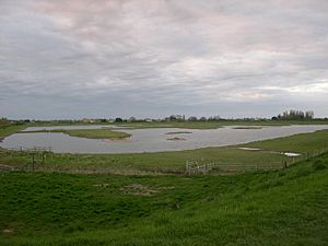
 Artificial lagoon, Freiston Shore |
|
| OS grid reference | TF397425 |
| • London | 100 mi (160 km) S |
| Civil parish |
|
| District |
|
| Shire county | |
| Region | |
| Country | England |
| Sovereign state | United Kingdom |
| Post town | Boston |
| Postcode district | PE22 |
| Police | Lincolnshire |
| Fire | Lincolnshire |
| Ambulance | East Midlands |
| EU Parliament | East Midlands |
| UK Parliament |
|
Freiston Shore is a small place in the Borough of Boston in Lincolnshire, England. It is part of the village area called Freiston. You can find it about 4 kilometers (2.5 miles) east of the town of Boston.
Contents
Freiston Shore's Past
In the late 1700s and early 1800s, Freiston Shore was a popular place for people to visit the seaside. Its sandy beach on The Wash was used as a sea bathing resort. People would come to swim and enjoy the coast. By the mid-1800s, there were even horse races and other fun activities on the beach.
However, the coastline started to change. A natural process called coastal accretion began. This is when sand and mud build up, creating new land. Over time, a salt marsh started to grow where the sandy beach used to be. This meant the hotels and resorts no longer had a beach right outside, and visitors stopped coming.
Since the mid-1900s, even more marshland has been turned into farmland. This was done by building sea banks (large walls or mounds) to keep the sea out.
World War II Defences
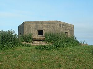
During the Second World War, special defences were built around Freiston Shore. These were part of Britain's plan to stop an invasion. Many pillboxes (small concrete forts), gun positions, and coastal lights were put in place.
You can still see some of these old forts today. One example is a Ruck machine gun post, which was a common type of defence in Lincolnshire during the war.
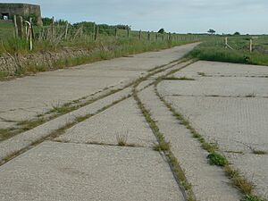
After the war, more land was reclaimed from the sea. This meant Freiston Shore village ended up about half a mile (0.8 km) further inland than it used to be. The old sea bank, with its pillboxes and parts of a light railway that was used there, can still be seen. There is still a path that leads from the village to the marsh on The Wash.
How Sea Defences Changed
In the year 2000, something interesting happened. The process of taking land from the sea was actually reversed! Part of the sea bank was deliberately broken. This allowed the tides to flow back onto the land behind it. This was part of a plan called managed realignment.
The idea was to take pressure off the remaining sea defences, helping them last longer. Also, about 66 hectares (0.66 square kilometers) of new tidal salt marsh was created. This marsh acts like a natural sponge, soaking up wave energy and helping to protect the land from the sea.
Nature at Freiston Shore
The new marsh areas, including one designed to be a brackish marsh (a mix of fresh and salty water) with lagoons, are now part of an RSPB nature reserve. This means it's a special place where wildlife is protected.
Many different birds live or visit Freiston Shore:
- In spring and summer, you might see pied avocets, common redshanks, ringed plovers, northern wheatears, and marsh harriers.
- In autumn and winter, many migrating waders (birds that feed in shallow water) arrive. These include common redshanks, ruddy turnstones, and dunlins.
- You can also spot waterfowl like dark-bellied brent goose and Eurasian wigeon.
 | Audre Lorde |
 | John Berry Meachum |
 | Ferdinand Lee Barnett |


