Fulwell, London facts for kids
Quick facts for kids Fulwell |
|
|---|---|
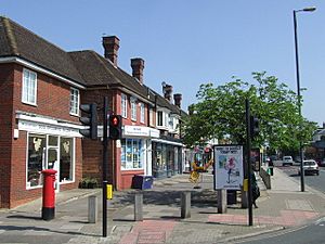
 Hampton Road, Fulwell |
|
| Population | 10,131 (2011 Census. Fulwell and Hampton Hill Ward) |
| OS grid reference | TQ149719 |
| London borough | |
| Ceremonial county | Greater London |
| Region | |
| Country | England |
| Sovereign state | United Kingdom |
| Post town | TWICKENHAM TEDDINGTON HAMPTON |
| Postcode district | TW2 TW11 TW12 |
| Dialling code | 020 |
| Police | Metropolitan |
| Fire | London |
| Ambulance | London |
| EU Parliament | London |
| UK Parliament |
|
| London Assembly |
|
Fulwell is a cool neighbourhood in South West London. It's part of the London Borough of Richmond upon Thames. This area sits right between the towns of Twickenham and Teddington.
The name "Fulwell" first appeared in old documents from the 1400s. It might mean "a well that always has water" or perhaps "a dirty well"! Before 1965, Fulwell was part of an old county called Middlesex. Now, it's part of Greater London.
Even though Fulwell isn't a postal district, many people who live there use the name to say where they are from. You can find the name "Fulwell" in places like the local election area, called Fulwell and Hampton Hill. There's also Fulwell railway station, Fulwell Golf Course, and Fulwell bus garage. You'll also see it in street names like Fulwell Park Avenue and Fulwell Road.
There are two busy spots where roads meet in Fulwell. One is where Hospital Bridge Road and Sixth Cross Road cross Staines Road. The other is where Sixth Cross Road, Hampton Road, South Road, and Wellington Road all meet up. Sixth Cross Road is one of six roads between Staines Road and Hampton Road. There's even a post office called Fulwell Park at the corner of Staines Road and Hospital Bridge Road. In 2009, people wanted to remove Fulwell from the election area name, but it stayed!
Fulwell has an Anglican church called St Michael's. It was closed for 15 years but reopened in 2014. In 2019, it became a full parish church again.
Exploring Fulwell's Past
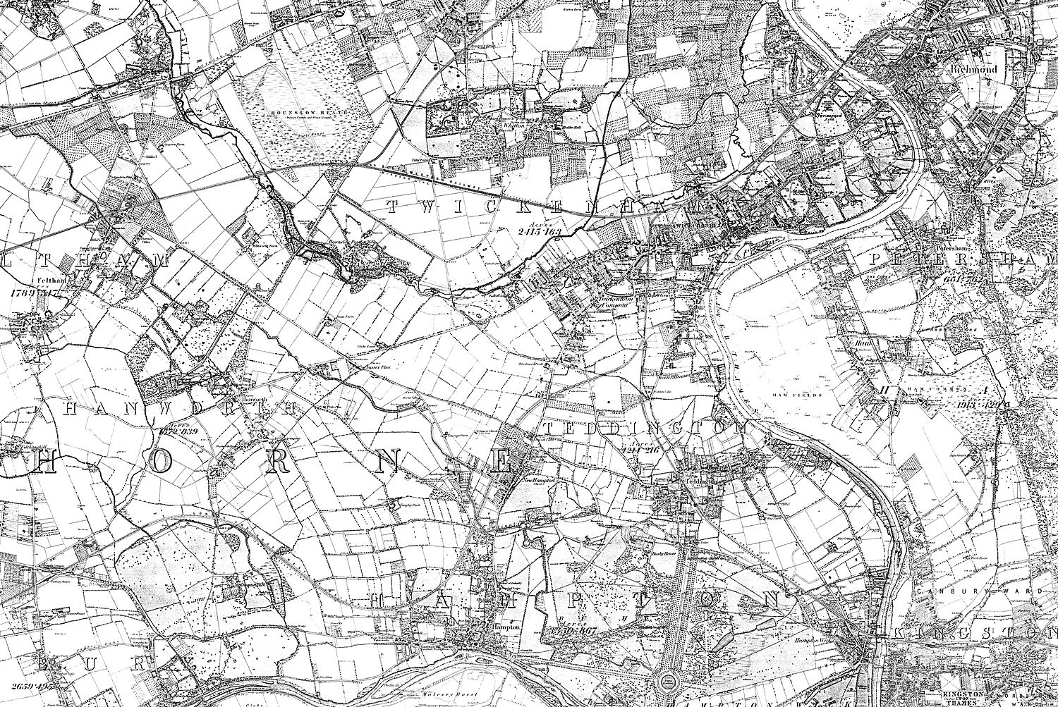
Over time, the area known as Fulwell has changed its size and location. Old maps from the late 1800s show it reaching down to the River Crane. This river is in Whitton. Fulwell was once the southern edge of a large open area called Hounslow Heath.
Some of the earliest mentions of Fulwell are from around the year 1200. These records talk about "assarts," which are pieces of land cleared for farming. Over many years, more and more land in Fulwell was used for farming. Later, during the Victorian era, as London grew bigger, Fulwell started to become more urban.
Even though Fulwell was historically part of Middlesex, things changed in 1965. That's when it became part of the London Borough of Richmond upon Thames. This was part of the new Greater London area.
Fulwell Bus Garage History
The Fulwell bus garage was built a long time ago, in 1902. It was first used for trams, which are like streetcars, and trolley cars. Later, it became a hub for buses. This garage is really good at what it does! In fact, it was named the top London bus garage in 2018.
Grand Homes: Fulwell Lodge and Fulwell Park
Fulwell Lodge was a very grand house. It was built in the early 1600s. This large home was located north of the Staines Road. Near it was Yorke/Fulwell Farm.
In 1871, a famous London property developer named Charles James Freake bought Fulwell Lodge. He also bought its large grounds and the small houses where estate workers lived. His land was huge! It stretched from the A316 Chertsey Road and the River Crane. It even included areas we now know as Twickenham Green and Strawberry Hill. This big estate covered what are now Strawberry Hill Golf Course and Fulwell Golf Course.
Freake named this whole area Fulwell Park. After he passed away in 1884, his wife, Eliza Pudsey, took over the estate. After she died in 1900, a company called Freake Estates managed the land. They leased some of it to start Fulwell Golf Course in 1904.
In 1910, something very interesting happened. The last King of Portugal, Manuel II, bought Fulwell Lodge. He lived there as his home in England until he died in 1932.
After the King's death, a construction company called Wates bought the lodge and its many acres of land. They tore down the old house. The area was then redeveloped and new homes were built, including some low-rise apartments with nice gardens. You can still see hints of this history in the street names today. Roads like Manoel Road, Lisbon Avenue, Augusta Road, and Portugal Gardens remind us of the Portuguese King who once lived there.
 |
Hanworth (part of West Twickenham) | Whitton (part of West Twickenham) | Twickenham |  |
| Hanworth and part of Hampton Hill | Strawberry Hill | |||
| Hampton Hill | Hampton Hill and part of Teddington | Teddington |
 | Laphonza Butler |
 | Daisy Bates |
 | Elizabeth Piper Ensley |


