Furman, South Carolina facts for kids
Quick facts for kids
Furman, South Carolina
|
|
|---|---|

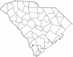
Location of Furman, South Carolina
|
|
| Country | United States |
| State | South Carolina |
| County | Hampton |
| Government | |
| • Type | Council |
| Area | |
| • Total | 3.12 sq mi (8.07 km2) |
| • Land | 3.12 sq mi (8.07 km2) |
| • Water | 0.00 sq mi (0.00 km2) |
| Elevation | 115 ft (35 m) |
| Population
(2020)
|
|
| • Total | 224 |
| • Density | 71.84/sq mi (27.74/km2) |
| Time zone | UTC-5 (Eastern (EST)) |
| • Summer (DST) | UTC-4 (EDT) |
| ZIP code |
29921
|
| Area code(s) | 803 and 839 |
| FIPS code | 45-27835 |
| GNIS feature ID | 1247850 |
Furman is a small town located in Hampton County, South Carolina, in the United States. In 2020, about 224 people lived there. This number was a little lower than the 239 people who lived there in 2010. It's important not to mix up this town with Furman University, which is a different place located in Greenville, South Carolina.
Contents
Where is Furman Located?
Furman is found in the southwestern part of Hampton County. You can find it by looking at these map coordinates: 32.681247 degrees North and -81.187705 degrees West.
Getting Around Furman
U.S. Route 601 (also called Savannah Highway) goes right through the middle of Furman. If you travel north on this road, you'll reach Hampton, which is the main town for the county, about 14 miles away. If you go south, the road ends about 9 miles away at U.S. Route 321. Other nearby towns include Hardeeville, which is 28 miles south, and the city of Savannah, Georgia, about 45 miles to the south.
Furman's Size
The United States Census Bureau says that Furman covers a total area of about 8.1 square kilometers (or 3.12 square miles). All of this area is land, meaning there are no large lakes or rivers within the town's official boundaries.
Who Lives in Furman?
| Historical population | |||
|---|---|---|---|
| Census | Pop. | %± | |
| 1920 | 296 | — | |
| 1930 | 270 | −8.8% | |
| 1940 | 380 | 40.7% | |
| 1950 | 293 | −22.9% | |
| 1960 | 244 | −16.7% | |
| 1970 | 239 | −2.0% | |
| 1980 | 348 | 45.6% | |
| 1990 | 260 | −25.3% | |
| 2000 | 286 | 10.0% | |
| 2010 | 239 | −16.4% | |
| 2020 | 224 | −6.3% | |
| 2021 (est.) | 232 | −2.9% | |
| U.S. Decennial Census | |||
In the year 2000, there were 286 people living in Furman. These people lived in 108 different homes, and 80 of these were families. The town had about 92 people per square mile.
Community Life in Furman
Many homes in Furman had children under 18 living there. About half of the homes were married couples living together. Some homes were led by a single parent, usually a mother. The average number of people living in one home was about 2.65.
The people in Furman were of different ages. About 30% were under 18 years old. The median age, which is the middle age of all the people, was 35 years old. This means half the people were younger than 35 and half were older.
Furman's Railway History
From 1899 until the 1980s, a train line called the Southern Railway ran through Furman. This line was part of a bigger route that connected Columbia to Savannah, Georgia. It also passed through other towns like Allendale and Barnwell.
Why the Railway Was Important
The main reason for this railway was to help people and goods travel between the north and south. It connected with another big train line, the Atlantic Coast Line Railroad, in Hardeeville. This allowed trains to go further south to Florida or north to Charleston. The Southern Railway was built to compete with another train company, the Seaboard Air Line, which had a different route nearby.
Changes to the Railway
Over time, the need for this train line changed. Between 1963 and 1970, the Southern Railway stopped using its tracks between Furman and Hardeeville. This meant Furman became the end of the line from Columbia. Then, in the early 1980s, the Southern Railway stopped using its tracks south of Blackville. This ended all train service to towns like Barnwell, Allendale, and Furman. By the 1970s, it was already very rare to see a train in Furman.
See also
 In Spanish: Furman para niños
 | Aurelia Browder |
 | Nannie Helen Burroughs |
 | Michelle Alexander |

