Geography of Minneapolis facts for kids
Minneapolis is the biggest city in the state of Minnesota in the United States. It is also the main city of Hennepin County.
Contents
About Minneapolis's Land and Water
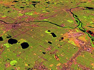
Minneapolis covers about 151.3 square kilometers (58.4 square miles). Most of this area, about 142.2 square kilometers (54.9 square miles), is land. The rest, 9.1 square kilometers (3.5 square miles), is water.
The center of the city is just south of the 45 degrees north latitude line. This line is halfway between the Equator and the North Pole. You can find a special stone marking this spot in the city.
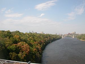
The Mississippi River flows through Minneapolis. It helped the city grow in its early days. Many old streets were built to run along the river. This made sure people could use as much land as possible. Later, streets were built in a north-south and east-west pattern. This created unique intersections, like Seven Corners. Some important streets, like Hennepin Avenue and Nicollet Avenue, have both types of layouts.
Amazing Parks and Lakes
Minneapolis has a huge park system. It covers about 26 square kilometers (ten square miles). Many parks are connected to each other. Theodore Wirth helped create this system. He wanted every child to have a playground nearby. He also helped plant many trees and boulevards.
The Mississippi National River and Recreation Area connects many parks. It also has visitor centers along the river.
Popular Parks to Visit
Theodore Wirth Park is the biggest park in Minneapolis. It is shared with Golden Valley. This park is about 60% the size of Central Park in New York City.
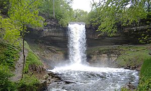
Minnehaha Park is another very famous park. It is home to the beautiful Minnehaha Falls. Many cultural events happen here every year.
Tower Hill Park is in Prospect Park. It has a water tower built in 1913. This spot is one of the highest points in Minneapolis.
The Grand Rounds Scenic Byway
The Grand Rounds Scenic Byway is a special route that circles through the city. It connects many large park areas. This includes land along the Mississippi River, lakes, and other scenic spots.
The route is 50 miles long. It has separate paths for cars, bikes, and walkers. More and more bike and walking paths are being built. They connect Minneapolis with nearby cities.
Minneapolis's Many Lakes
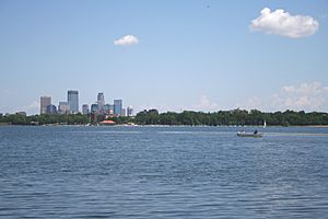
There are 24 small lakes within the city limits. Some of the largest freshwater lakes are to the west. These include Lake Harriet, Bde Maka Ska, Lake of the Isles, and Cedar Lake. Together, they are known as the "Chain of Lakes."
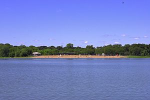
Lake Nokomis and Lake Hiawatha are to the east. All these lakes are connected by paths for biking, running, and walking. People use the lakes for swimming, fishing, picnics, and boating.
How Waterfalls Were Formed
The land where Minneapolis and Saint Paul now stand was once covered by ancient seas. These seas left layers of rock. There was a hard layer of Platteville limestone on top. Below it were softer layers of shale and St. Peter Sandstone.
About 20,000 years ago, huge sheets of ice called glaciers covered this area. As the glaciers melted, they released a lot of water. This powerful water carved deep channels through the rock layers. It also left behind sand and dirt. Sometimes, large chunks of ice were left behind. When they melted, they created hollows in the ground. These hollows became the basins for the Twin Cities' lakes, like Lake Harriet and Bde Maka Ska.
The Story of St. Anthony Falls
Long ago, a giant waterfall called River Warren Falls moved upstream. When it reached the smaller Upper Mississippi River, a new waterfall was created. This new waterfall also started moving upstream on the Mississippi. It carved out the Mississippi River gorge.
This waterfall moved about eight miles over 9,600 years. In 1680, Louis Hennepin saw it and named it St. Anthony Falls. This waterfall was very important because it provided power. This power source helped decide where the city of Minneapolis would be built.
One smaller river, Minnehaha Creek, also created a waterfall. This is Minnehaha Falls. It is a beautiful reminder of how the land was shaped by water. You can clearly see the hard limestone layer over the softer sandstone in its gorge.
 | William Lucy |
 | Charles Hayes |
 | Cleveland Robinson |


