Glendale, Boulder County, Colorado facts for kids
Quick facts for kids
Glendale CDP, Colorado
|
|
|---|---|

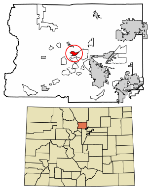
Location of the Glendale CDP in Boulder County, Colorado
|
|
| Country | |
| State | |
| County | Boulder County |
| Government | |
| • Type | unincorporated community |
| Area | |
| • Total | 3.251 km2 (1.255 sq mi) |
| • Land | 3.251 km2 (1.255 sq mi) |
| • Water | 0.000 km2 (0 sq mi) |
| Elevation | 2,243 m (7,359 ft) |
| Population
(2020)
|
|
| • Total | 64 |
| • Density | 19.69/km2 (51.0/sq mi) |
| Time zone | UTC-7 (MST) |
| • Summer (DST) | UTC-6 (MDT) |
| ZIP Code |
Jamestown 80455
|
| Area codes | 303 & 720 |
| GNIS feature ID | 2583240 |
Glendale is a small community located in Boulder County, Colorado, United States. It's known as a census-designated place (CDP), which means it's an area that the United States Census Bureau defines for gathering population data.
Glendale is part of the larger Boulder, CO Metropolitan Statistical Area. In 2020, about 64 people lived in the Glendale CDP. The local post office that serves this area is in Jamestown, and its Zip Code is 80455.
Where is Glendale Located?
Glendale is found in the middle of Boulder County. It sits within the Front Range of the Colorado Rocky Mountains, right in the valley of Left Hand Creek.
You can reach Glendale by taking Lefthand Canyon Drive. This road goes east about 7 miles (11 km) to Altona and U.S. Highway 36. If you head west on the same road, it's about 9 miles (14 km) to Ward and State Highway 72.
The Glendale CDP covers an area of about 3.251 square kilometers (1.255 sq mi), and all of this area is land.
How Many People Live in Glendale?
The United States Census Bureau first officially recognized Glendale as a CDP for the United States Census 2010. This means they started collecting specific population numbers for this area at that time.
Here's a quick look at how the population has changed:
| Glendale CDP, Colorado | ||
|---|---|---|
| Year | Pop. | ±% |
| 2010 | 69 | — |
| 2020 | 64 | −7.2% |
| Source: United States Census Bureau | ||
 | Kyle Baker |
 | Joseph Yoakum |
 | Laura Wheeler Waring |
 | Henry Ossawa Tanner |


