Grapevine Lake facts for kids
Quick facts for kids Grapevine Lake |
|
|---|---|
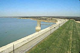
The reservoir's earthen dam
|
|
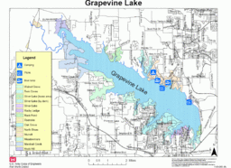
Reservoir and its parks
|
|
| Location | Denton / Tarrant counties, North Texas, United States |
| Coordinates | 32°58′20″N 97°3′24″W / 32.97222°N 97.05667°W |
| Type | Reservoir |
| Primary inflows | Denton Creek |
| Primary outflows | Denton Creek |
| Basin countries | Texas, United States |
| Surface area | 7,280 acres (2,950 ha) |
| Max. depth | 65 ft (20 m) |
| Water volume | 181,100 acre⋅ft (0.2234 km3) |
| Shore length1 | 60 miles (100 km) |
| Surface elevation | 535 ft (163 m) |
| Settlements | Grapevine, Texas |
| 1 Shore length is not a well-defined measure. | |
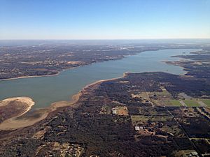
Grapevine Lake is a large reservoir (a man-made lake) in North Texas, USA. It's about 20 mi (32 km) northwest of Dallas and northeast of Fort Worth. The lake was created in 1952 by the US Army Corps of Engineers. They built a dam across Denton Creek, which is a smaller river that flows into the Trinity River.
The main reasons for building Grapevine Lake were to control floods and to store water for nearby cities. It also provides many fun activities and open spaces for people to enjoy. The lake gets its name from the city of Grapevine, Texas, which is right next to it.
Contents
How Grapevine Lake Was Built
Planning the Lake
In 1945, the U.S. Congress approved a plan to build several lakes in Texas. These lakes included Grapevine Lake, Benbrook Lake, Lavon Lake, and Ray Roberts Lake. The goal was to control floods and help with river navigation. These lakes work together as a big system to prevent flooding along the Trinity River.
Building the Dam
The project to build the Grapevine Dam and Reservoir started in January 1948. It was built on Denton Creek, a branch of the Trinity River. The project covers parts of both Tarrant County and Denton County. The Corps of Engineers bought about 15,700 acres (63.5 km²) of land for the new lake. The dam was finished in June 1952, and water began to fill the lake on July 3, 1952.
Lake Facts and Figures
Dam Size
The dam at Grapevine Lake is made of rolled earth-fill. It is about 28 feet (8.5 m) thick and stretches for 12,850 feet (3,920 m) across the land. The top of the dam is 588 feet (179 m) above sea level. The dam is about 137 ft (42 m) tall from the original creek bed.
Water Levels and Capacity
The dam has a spillway at about 560 feet (170 m) above sea level. This spillway helps control the water level during floods. The lake can hold a lot of water, including space for sediment that settles at the bottom. Usually, the lake is kept at its "conservation level," which is about 535 ft (163 m). At this level, the lake holds 181,100 acre-feet (223,400,000 m3) of water. Its surface area is 7,280 acres (29.5 km²).
When the lake is at its normal conservation level, it has about 60 mi (97 km) of shoreline. This is a long way to walk or bike!
Who Uses the Lake's Water?
Three cities have rights to use the water from Grapevine Lake. These are the city of Grapevine, the city of Dallas, and the Dallas County Park Cities (DCPC). The DCPC provides water to many communities in Dallas County. These cities have agreements to take certain amounts of water from the lake for their residents.
Fun Things to Do at Grapevine Lake
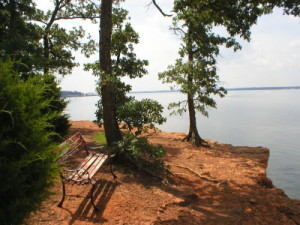
Grapevine Lake is a popular spot for outdoor activities. There are many parks and trails around the lake for everyone to enjoy.
Parks and Trails
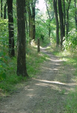
Many parks surround the lake. Some are managed by local cities, while others are still controlled by the Corps of Engineers. The area has about 30 miles (50 km) of natural trails. You can use these trails for walking, biking, or even horseback riding.
Some popular trails include:
- The Northshore trail, which is nine miles (14 km) long.
- The Rocky Point trail, which is three miles (5 km) long.
- The Crosstimbers horse trail, which is five miles (8 km) long.
- The Knob Hill trail, which is four miles (6 km) long.
Camping at the Lake
If you love camping, Grapevine Lake has options for you! You can find basic camping spots, prepared campsites, and even places for trailers or RVs. Murrell Park offers tent and primitive camping. Vineyards Campground, run by the city of Grapevine, has campsites, RV spots, and cabins.
Marinas and Boating
There are three marinas on the lake, which are places where boats are stored and launched. They are all run by a company called Marinas International. On the south side, you'll find Scott's Landing and Silver Lake marinas. On the north side, in Flower Mound, is Twin Coves marina.
These marinas help a lot of people enjoy boating on the lake. Together, they have about 1,400 places for boats to dock in the water. They also have space to store another 575 boats on land. The Grapevine Sailing Club and the United States Coast Guard Auxiliary are based at Scott's Landing.
There are twelve boat ramps around the lake to help people get their boats into the water. Most of these ramps charge a small fee to use them.
Fishing and Hunting
Grapevine Lake is a great place for fishing! You can catch many types of fish here, including largemouth bass, spotted bass, white bass, white crappie, channel catfish, and alligator gar. There are rules about how many fish you can catch and their size. For example, for largemouth bass, there's a size limit of 14 to 18 inches (36 to 46 cm).
If you have a hunting license and a special permit, you can also hunt in certain areas. This is allowed on land controlled by the Corps of Engineers at the northwest end of the lake. You can hunt waterfowl (like ducks) and small game. Bow hunting for feral hogs and deer is also allowed.
In 2010, something very cool was found near the lake! Kris Howe discovered four bones from a 96-million-year-old bird. Scientists from Dallas say this is the oldest bird found in America!
Grapevine Lake and DFW Airport
Grapevine Lake is right next to the Dallas/Fort Worth International Airport (DFW). This makes it a very noticeable landmark for people flying into or out of the airport. If you look out the window during takeoff or landing, you can see many parts of the lake, like its parks, marinas, and the big dam.
 | James Van Der Zee |
 | Alma Thomas |
 | Ellis Wilson |
 | Margaret Taylor-Burroughs |


