Gregory Range facts for kids
Quick facts for kids Gregory |
|
|---|---|
| Highest point | |
| Peak | unnamed peak (in the Blackbraes National Park) |
| Elevation | 1,043 m (3,422 ft) AHD |
| Dimensions | |
| Length | 400 km (250 mi) east–west |
| Naming | |
| Etymology | In honour of Sir Augustus Gregory |
| Geography | |
| Country | Australia |
| Range coordinates | 19°00′S 143°12′E / 19.000°S 143.200°E |
| Parent range | Great Dividing Range |
| Geology | |
| Age of rock | |
| Type of rock | |
The Gregory Range is a mountain range in Far North Queensland, Australia. It is a part of the larger Great Dividing Range.
Contents
Exploring the Gregory Range
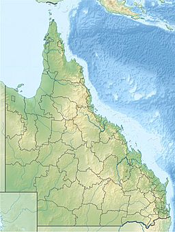
The Gregory Range is located in Queensland, Australia. It lies southeast of Croydon and southwest of Georgetown. This area is known for its unique landscape.
Land and Plants
The range has many temporary waterways. These are streams that only flow after it rains. You will also find rocky sandstone ridges here. These ridges are covered with plants like Eucalyptus miniata, acacia trees, and spinifex grass. Further down the ridges, there are areas with paperbark trees.
The Gregory Range stretches about 400 kilometers (250 miles) from east to west. The southern part of the range is a wavy plateau made of sandstone and basalt. This area has open forests with Bloodwood trees, wattle, other eucalypts, and spear grass.
Ancient Rocks
The rocks in the Gregory Range are very old! The sandstone formed during the Jurassic period, about 180 to 160 million years ago. The basalt and granite rocks are even older. They date back to the Mesoproterozoic age, which was 1.6 to 1.0 billion years ago.
Rivers of the Range
Several important rivers start in the Gregory Range. The Stawall River flows south from the range. It is a branch of the Flinders River.
The Norman River also begins here. Three of its branches, the Carron, Clara, and Yappar Rivers, also start in the range. These rivers flow west towards the Gulf of Carpentaria. The Gilbert and Robertson Rivers also have their beginnings in the range, but they flow north.
Highest Point
The highest point in the Gregory Range is 1,043 meters (3,422 feet) high. This peak is found in the southern part of the range. It is located within the Blackbraes National Park.
History of the Gregory Range
The first European explorer to travel through this area was Augustus Charles Gregory. He explored the region in 1855 or 1856. He was on a big trip from Port Essington to Brisbane.
The range was later named by another explorer, John McKinlay. He named it in 1862. McKinlay was on an expedition from Adelaide. He was searching for the lost Burke and Wills expedition.
 | Madam C. J. Walker |
 | Janet Emerson Bashen |
 | Annie Turnbo Malone |
 | Maggie L. Walker |


