Grisette Mountain facts for kids
Quick facts for kids Grisette Mountain |
|
|---|---|

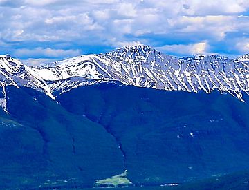
Grisette Mountain seen from The Whistlers
|
|
| Highest point | |
| Elevation | 2,620 m (8,600 ft) |
| Prominence | 240 m (790 ft) |
| Parent peak | Mount Dromore (2700 m) |
| Listing | Mountains of Alberta |
| Geography | |
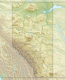
| Location | Jasper National Park Alberta, Canada |
| Parent range | Colin Range Canadian Rockies |
| Topo map | NTS 83C/13 |
| Type of rock | Limestone |
Grisette Mountain is a tall mountain, about 2,620-metre (8,600 ft) (8,596 feet) high. It's found in Jasper National Park in Alberta, Canada. This peak is part of the Colin Range, which is a smaller group of mountains within the huge Canadian Rockies.
The mountain stands about 14 km (8.7 mi) (9 miles) northeast of the town of Jasper. It's a famous sight in the Athabasca Valley, easy to spot from Highway 16 and even from the Canadian train. Its closest taller neighbor is Mount Dromore, which is about 2.4 km (1.5 mi) (1.5 miles) to the east.
Why Grisette Mountain Has Its Name
Grisette Mountain got its name in 1916 from a person named Morrison P. Bridgland. He was a Dominion Land Surveyor, which means he helped map out land. Bridgland named many mountains in Jasper Park and the Canadian Rockies.
He chose "Grisette" because the mountain is made of gray-colored limestone. The French word gris actually means gray. The name was officially accepted in 1947 by the Geographical Names Board of Canada.
What is the Climate Like on Grisette Mountain?
Grisette Mountain is in a subarctic climate zone. This means it has very cold, snowy winters and mild summers. Temperatures can drop below -20 °C (-4 °F), and with the wind chill, it can feel even colder, sometimes below -30 °C (-22 °F).
The best time to visit or climb Grisette Mountain is usually from June through September. During these months, the weather is more pleasant. Rain and melting snow from Grisette Mountain flow into smaller rivers like the Maligne River and Rocky River. These rivers then join the larger Athabasca River.
 | Precious Adams |
 | Lauren Anderson |
 | Janet Collins |


