Gunsight Pass (Sawatch Range, Colorado) facts for kids
Quick facts for kids Gunsight Pass |
|
|---|---|

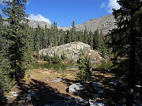
Gunsight Pass viewed from the south.
|
|
| Elevation | 12,185 ft (3,714 m) |
| Traversed by | Forest Trail 428 |
| Location | Gunnison County, Colorado, U.S. |
| Range | Sawatch Range |
| Coordinates | 38°41′00″N 106°35′59″W / 38.6833273°N 106.5997532°W |
| Topo map | Fairview Peak |
Gunsight Pass is a high mountain pass located in the Sawatch Range of the Rocky Mountains in Colorado. It is found in Gunnison County and is part of the Fossil Ridge Wilderness. This wilderness area is looked after by the Gunnison National Forest. The pass sits at an elevation of 12,185 feet (about 3,714 meters). It connects Square Top Mountain to the west and Broncho Mountain to the east. Gunsight Pass also separates the areas where water flows into Brush Creek (to the north) and Lamphier Creek (to the south).
Contents
Exploring Gunsight Pass
Gunsight Pass is a special place high up in the mountains. It is a low point on a sharp ridge that was shaped by ancient glaciers. This area is known for its beautiful views and rugged landscape.
The Trail to Gunsight Pass
You can reach Gunsight Pass by hiking on Forest Trail 428, also known as the South Lottis Creek Trail. This trail is about 10.5 miles (16.9 kilometers) long.
How to Access the Trail
- From the north, you can start at the Lottis Creek Trailhead. This is found on Gunnison County Road 742.
- From the south, the trail begins at the Gold Creek Trailhead. This trailhead is located on Gunnison County Road 771.
Rules for the Wilderness
Since the trail is inside the Fossil Ridge Wilderness, there are some rules to follow. You can only travel on foot or with horses. No special permits are needed to enter this wilderness area.
How Glaciers Shaped the Pass
The land around Gunsight Pass shows many signs of ancient glaciers. These huge sheets of ice covered the area during the Pleistocene Ice Age.
Glacial Features
- Arête: The pass is the lowest point on an arête. An arête is a sharp, knife-like ridge that forms between two glacial valleys.
- Cirques: On either side of the arête, there are two glacial cirques. A cirque is a bowl-shaped hollow carved out by a glacier.
- Moraines: In the valleys below the pass, you can find moraines. These are piles of rocks and dirt left behind by melting glaciers.
- Glacial Cobble: The ground in some spots along Forest Trail 428 can be difficult to walk on because of "glacial cobble." This means there are many rounded rocks and stones that were carried and smoothed by the glaciers.
The Rocks of the Pass
The ridge itself is made of very old rocks. These are called Proterozoic metasedimentary and metavolcanic rocks. This means they were once regular sediments or volcanic rocks that changed over millions of years due to heat and pressure deep inside the Earth.
The Story Behind the Name
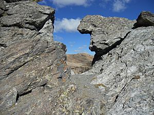
Around the year 1900, a local resident named John Gardiner did something amazing. He used explosives to blast a hole through the ridge at the pass. He did this to make it easier for his pack trains to get through. Pack trains were groups of animals, like mules, that carried supplies. The opening he created looked like the "sight" on a gun, which is how Gunsight Pass got its name.
 | Roy Wilkins |
 | John Lewis |
 | Linda Carol Brown |


