Hand County, South Dakota facts for kids
Quick facts for kids
Hand County
|
|
|---|---|

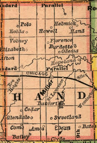
Hand County and its towns and villages in 1892
|
|

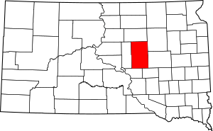
Location within the U.S. state of South Dakota
|
|
 South Dakota's location within the U.S. |
|
| Country | |
| State | |
| Founded | 1873 (created) 1882 (redrawn) 1882 (organized) |
| Named for | George A. Hand |
| Seat | Miller |
| Largest city | Miller |
| Area | |
| • Total | 1,440 sq mi (3,700 km2) |
| • Land | 1,437 sq mi (3,720 km2) |
| • Water | 3.6 sq mi (9 km2) 0.2% |
| Population
(2020)
|
|
| • Total | 3,145 |
| • Estimate
(2023)
|
3,107 |
| • Density | 2.184/sq mi (0.8433/km2) |
| Time zone | UTC−6 (Central) |
| • Summer (DST) | UTC−5 (CDT) |
| Congressional district | At-large |
Hand County is a county located in the state of South Dakota in the United States. As of the 2020 census, about 3,145 people lived there. The main town and county seat of Hand County is Miller.
Contents
History of Hand County
Hand County was named after George A. Hand. He was the secretary for the Dakota Territory at the time. The county was first created in 1873 by the government of the Dakota Territory. Its exact borders were set in 1882, which is also when the county officially started to operate.
Geography and Nature
The land in Hand County has gentle, rolling hills. You can find small ponds and lakes scattered around. Most of the land is used for farming. The county's highest point is about 2,080 feet (634 meters) above sea level. This is located on the western edge of the county.
Hand County covers a total area of about 1,440 square miles (3,730 square kilometers). Most of this area, about 1,437 square miles (3,722 square kilometers), is land. Only a small part, about 3.6 square miles (9.3 square kilometers), is water.
Main Roads in Hand County
Neighboring Counties
- Faulk County - to the north
- Spink County - to the northeast
- Beadle County - to the east
- Jerauld County - to the southeast
- Buffalo County - to the southwest
- Hyde County - to the west
Protected Natural Areas
Hand County has several areas set aside to protect wildlife and nature. These are called State Game Production Areas or State Recreation Areas. They are great places for outdoor activities.
- Collins State Game Production Area
- Dakota State Game Production Area
- East Pearl State Game Production Area
- Hawkins State Game Production Area
- Lake Jones State Game Production Area
- Lake Louise State Game Production Area
- Lake Louise State Recreation Area
- Lechtenberg State Game Production Area
- Reinhardt State Game Production Area
- Rosehill State Game Production Area
- Spring Lake State Game Production Area
- West Pearl State Game Production Area
Lakes in Hand County
- Costigan Slough Lake
- Jones Lake
- Lake Louise
- Matter Lake
- Spring Lake
- Wall Lake
Population and People
| Historical population | |||
|---|---|---|---|
| Census | Pop. | %± | |
| 1880 | 153 | — | |
| 1890 | 6,346 | 4,047.7% | |
| 1900 | 4,525 | −28.7% | |
| 1910 | 7,870 | 73.9% | |
| 1920 | 8,778 | 11.5% | |
| 1930 | 9,485 | 8.1% | |
| 1940 | 7,166 | −24.4% | |
| 1950 | 7,149 | −0.2% | |
| 1960 | 6,712 | −6.1% | |
| 1970 | 5,883 | −12.4% | |
| 1980 | 4,948 | −15.9% | |
| 1990 | 4,272 | −13.7% | |
| 2000 | 3,741 | −12.4% | |
| 2010 | 3,431 | −8.3% | |
| 2020 | 3,145 | −8.3% | |
| 2023 (est.) | 3,107 | −9.4% | |
| U.S. Decennial Census 1790-1960 1900-1990 1990-2000 2010-2020 |
|||
2020 Census Information
According to the 2020 census, Hand County had 3,145 people. There were 1,348 households, which are groups of people living together. There were also 891 families. The population density was about 2.2 people per square mile.
2010 Census Information
In the 2010 census, there were 3,431 people living in Hand County. Most people in the county were white (98.4%). A small number were Asian, American Indian, or Black. About 0.6% of the population identified as Hispanic or Latino.
Many people in Hand County have German (57.3%) or Irish (15.3%) backgrounds. Other common ancestries include Norwegian, English, and Dutch. The average age of people in the county was about 48.2 years old.
Towns and Communities
Hand County has several towns and communities where people live.
Cities in Hand County
- Miller (This is the main town and county seat)
- Wessington (Only part of this city is in Hand County)
Towns in Hand County
Special Communities
- Millerdale Colony (This is a census-designated place, meaning it's a community identified by the census bureau)
Other Communities (Unincorporated)
These are smaller communities that are not officially organized as cities or towns.
- Polo
- Vayland
Townships in Hand County
Townships are smaller local government areas within the county.
- Alden
- Alpha
- Bates
- Burdette
- Campbell
- Carlton
- Cedar
- Como
- Florence
- Gilbert
- Glendale
- Grand
- Greenleaf
- Hiland
- Holden
- Hulbert
- Linn
- Logan
- Midland
- Miller
- Mondamin
- Ohio
- Ontario
- Park
- Pearl
- Plato
- Pleasant Valley
- Ree Heights
- Riverside
- Rockdale
- Rose Hill
- St. Lawrence
- Spring Hill
- Spring Lake
- Wheaton
- York
Unorganized Territory
One part of Hand County is called "Northwest Hand." This area does not have its own local government like a township.
See also
 In Spanish: Condado de Hand para niños
 | James B. Knighten |
 | Azellia White |
 | Willa Brown |

