Harvey, Illinois facts for kids
Quick facts for kids
Harvey, Illinois
|
|||
|---|---|---|---|
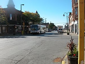
Central Business District
|
|||
|
|||
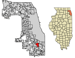
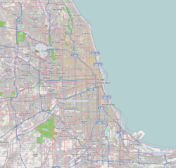
Location of Harvey in Cook County, Illinois.
|
|||
| Country | United States | ||
| State | Illinois | ||
| County | Cook | ||
| Township | Thornton, Bremen | ||
| Founded | May 1891 | ||
| Village | May 1891 | ||
| Area | |||
| • Total | 6.21 sq mi (16.07 km2) | ||
| • Land | 6.21 sq mi (16.07 km2) | ||
| • Water | 0.00 sq mi (0.00 km2) | ||
| Elevation | 604 ft (184 m) | ||
| Population
(2020)
|
|||
| • Total | 20,324 | ||
| • Density | 3,274.90/sq mi (1,264.41/km2) | ||
| Time zone | UTC-6 (CST) | ||
| • Summer (DST) | UTC-5 (CDT) | ||
| ZIP Code(s) |
60426–60428
|
||
| Area code(s) | 708 | ||
| FIPS code | 17-33383 | ||
| Wikimedia Commons | Harvey, Illinois | ||
Harvey is a city located in Cook County, Illinois, United States. It is part of the larger Chicago metropolitan area. In 2020, about 20,324 people lived in Harvey.
The city of Harvey shares its borders with several other towns. To the north, you'll find Dixmoor and Riverdale. To the east are Dolton, Phoenix, and South Holland. East Hazel Crest is to the south. Finally, to the west are Hazel Crest, Markham, and Posen.
Contents
A Look at Harvey's Past
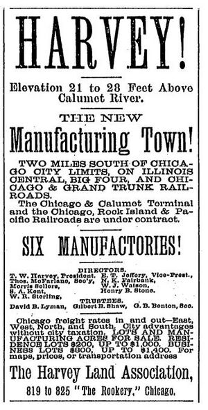
Harvey was started in 1891 by Turlington W. Harvey. He was a friend of Dwight Moody, who founded the Moody Bible Institute in Chicago. Harvey was planned to be a special town based on Christian values. It was also one of the "Temperance Towns," meaning alcohol was not allowed. The town was designed much like Pullman, another famous company town in Illinois.
Harvey grew a lot after World War II. Many people found jobs there, especially at the Buda Engine Co. This company later became part of Allis-Chalmers in 1953. Harvey's population was largest in 1980. After that, the city began to lose jobs and people. This happened as steel and other big industries changed. A large shopping center, the Dixie Square Mall, closed in 1978.
In recent years, leaders in Harvey have tried to help the city's economy. For example, they offered money to developers to fix up the old Dixie Square Mall. However, many shopping malls across the country have faced challenges. The city also gave money for a hotel project, but it was not finished. In 2018, Harvey faced financial difficulties. The state had to take some of the city's money to help pay for pensions. This led to some city workers losing their jobs.
Where is Harvey?
Harvey covers an area of about 6.21 square miles (16.07 square kilometers). All of this area is land.
Neighboring Towns
Harvey is surrounded by many other communities.
- To the north: Dixmoor and Riverdale
- To the east: Riverdale, Dolton, Phoenix, and South Holland
- To the south: South Holland and East Hazel Crest
- To the west: Posen, Markham, and Hazel Crest
People of Harvey
| Historical population | |||
|---|---|---|---|
| Census | Pop. | %± | |
| 1900 | 5,395 | — | |
| 1910 | 7,227 | 34.0% | |
| 1920 | 9,216 | 27.5% | |
| 1930 | 16,374 | 77.7% | |
| 1940 | 17,878 | 9.2% | |
| 1950 | 20,683 | 15.7% | |
| 1960 | 29,071 | 40.6% | |
| 1970 | 34,636 | 19.1% | |
| 1980 | 35,810 | 3.4% | |
| 1990 | 29,771 | −16.9% | |
| 2000 | 30,031 | 0.9% | |
| 2010 | 25,301 | −15.8% | |
| 2020 | 20,324 | −19.7% | |
| U.S. Decennial Census 2010 2020 |
|||
In 2020, Harvey had 20,324 residents. There were 8,657 households, which are groups of people living together. The city's population density was about 3,275 people per square mile.
The people living in Harvey come from many different backgrounds. About 63.33% of residents were African American. About 5.87% were White. Around 2.50% were Asian. A small number were Native American or Pacific Islander. About 20.55% were from other races. About 6.89% were from two or more races. People of Hispanic or Latino background made up 29.72% of the population.
Many households in Harvey have children. About 34.1% of households had children under 18. The average household had about 3.62 people. The average family had about 2.77 people.
The median age in Harvey was 34.5 years. This means half the people were younger than 34.5, and half were older. About 25.8% of the population was under 18. About 13.5% of residents were 65 years or older.
Learning and Getting Around
Education in Harvey
Several school districts serve the students of Harvey. Most elementary school students attend schools in Harvey Public School District 152. Some parts of Harvey are in the Posen-Robbins School District 143½ or the Dolton - Riverdale School District 148.
For high school, students usually go to schools operated by Thornton Township High Schools District 205. If a student lives in the Posen-Robbins School District 143½ area, they would attend a high school in the Bremen High School District 228. Harvey is also part of Illinois Community College District 510, which offers higher education.
Getting Around Harvey
Harvey has good public transportation options. Two train stations serve the city on the Metra Electric University Park line. These stations connect Harvey to Chicago. One is at 147th Street (also known as Sibley Boulevard) and Clinton Street. The other is at Park Avenue and 154th Street.
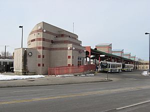
Many Pace bus routes also serve Harvey. The Pace Harvey Transportation Center is a hub for these bus routes.
Three main streets that run north and south in Chicago also go through Harvey. These are Halsted Street (Illinois Route 1), Dixie Highway (which is Western Avenue in Chicago), and Wood Street (which is Ashland Avenue in Chicago). Harvey's own Ashland Avenue divides the city for house numbering.
Notable people
See also
 In Spanish: Harvey (Illinois) para niños
 | Janet Taylor Pickett |
 | Synthia Saint James |
 | Howardena Pindell |
 | Faith Ringgold |


