Williamsburg, Massachusetts facts for kids
Quick facts for kids
Williamsburg, Massachusetts
|
|||
|---|---|---|---|
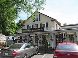
Williamsburg General Store
|
|||
|
|||
| Nickname(s):
Burgy
|
|||
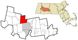
Location in Hampshire County in Massachusetts
|
|||
| Country | United States | ||
| State | Massachusetts | ||
| County | Hampshire | ||
| Settled | 1735 | ||
| Incorporated | 1771 | ||
| Government | |||
| • Type | Open town meeting | ||
| Area | |||
| • Total | 25.7 sq mi (66.6 km2) | ||
| • Land | 25.6 sq mi (66.2 km2) | ||
| • Water | 0.2 sq mi (0.4 km2) | ||
| Elevation | 530 ft (162 m) | ||
| Population
(2020)
|
|||
| • Total | 2,504 | ||
| • Density | 97.38/sq mi (37.60/km2) | ||
| Time zone | UTC-5 (Eastern) | ||
| • Summer (DST) | UTC-4 (Eastern) | ||
| ZIP Codes |
01039, 01096
|
||
| Area code(s) | 413 | ||
| FIPS code | 25-79915 | ||
| GNIS feature ID | 0618211 | ||
Williamsburg is a small town located in Hampshire County, Massachusetts, in the United States. It's a classic New England community. In 2020, about 2,504 people lived here. Williamsburg is also part of the larger Springfield area.
Contents
Exploring Williamsburg's Past
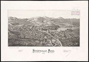
Williamsburg was first settled by people in 1735. It became an official town in 1771. Besides the main village of Williamsburg, the town also includes two other villages: Haydenville and Searsville. Haydenville is now known for its Haydenville Historic District, which protects its old buildings and history.
The Mill River flows through Williamsburg. It starts where the East and West branches of the river meet. Then it flows through Haydenville and into Northampton, eventually reaching the Connecticut River.
The Village of Searsville
Searsville is another small village in Williamsburg. It's located about a mile above the center of Williamsburg village. In 1795, a blacksmith named Rufus Hyde moved his shop here. This area soon became a place for small industries.
Early in the 1800s, a few small shops in Williamsburg and Searsville started to finish woolen goods. They would clean, dye, and prepare the wool. It wasn't until 1813 that spinning and weaving moved from homes into factories. In 1819, Nathaniel Sears built a shop for finishing woolen cloth. This is how the community got its name, Searsville.
Major Roads and Travel
Massachusetts Route 9 is the main highway that goes through Williamsburg. It leads southeast about 7 miles to the center of Northampton. If you go west, it leads about 33 miles to Pittsfield. Another road, Massachusetts Route 143, goes west from Williamsburg village to Chesterfield and Worthington.
The Great Mill River Flood of 1874
On May 16, 1874, a terrible flood happened along Williamsburg's Mill River. This disaster took 139 lives and left almost 800 people without homes. The flood happened when the Williamsburg Reservoir Dam suddenly broke. A huge wall of water, about twenty feet high, rushed into the valley below.
Every town and village along the river was badly damaged by the fast-moving water. The flood's power lessened when it reached Northampton. This was where the Mill River meets the Connecticut River. Northampton was the last town to be hit by the flood. Four more people were swept away there.
Williamsburg's Geography
Williamsburg covers a total area of about 66.6 square kilometers (about 25.7 square miles). Most of this area, 66.2 square kilometers (25.6 square miles), is land. Only a small part, about 0.4 square kilometers (0.15 square miles), is water. This means that 0.53% of the town's area is covered by water.
People Living in Williamsburg
| Historical population | ||
|---|---|---|
| Year | Pop. | ±% |
| 1850 | 1,537 | — |
| 1860 | 2,095 | +36.3% |
| 1870 | 2,159 | +3.1% |
| 1880 | 2,234 | +3.5% |
| 1890 | 2,057 | −7.9% |
| 1900 | 1,926 | −6.4% |
| 1910 | 2,132 | +10.7% |
| 1920 | 1,866 | −12.5% |
| 1930 | 1,801 | −3.5% |
| 1940 | 1,684 | −6.5% |
| 1950 | 2,056 | +22.1% |
| 1960 | 2,186 | +6.3% |
| 1970 | 2,342 | +7.1% |
| 1980 | 2,237 | −4.5% |
| 1990 | 2,515 | +12.4% |
| 2000 | 2,427 | −3.5% |
| 2010 | 2,482 | +2.3% |
| 2020 | 2,504 | +0.9% |
| 2022* | 2,469 | −1.4% |
| * = population estimate. Source: United States Census records and Population Estimates Program data. |
||
In the year 2000, there were 2,427 people living in Williamsburg. These people lived in 1,027 households, and 658 of these were families. The average household had about 2.36 people, and the average family had about 2.88 people.
About 21.3% of the people in town were under 18 years old. About 12.9% were 65 years old or older. The average age of people in Williamsburg was 42 years old.
Williamsburg is known for its charming town center. Here you can find the Williamsburg General Store, the Williamsburg Market, the Meekins Library, and the town Post Office.
Famous People from Williamsburg
Many interesting people have connections to Williamsburg:
- Chris Collingwood is the lead singer of the pop-punk band Fountains of Wayne.
- Alice Hall Farnsworth was an astronomer who studied stars and planets.
- Ruth V. Hemenway was a Christian medical missionary.
- Fay Jones was a well-known American artist.
- Tracy Kidder is an author who won a Pulitzer Prize for his writing.
- Frederick A. Lyon was a soldier in the Union Army during the American Civil War. He received the Medal of Honor for his bravery.
- Patricia MacLachlan is an author famous for books like Sarah, Plain and Tall.
- Argalus Starks was a state legislator in Wisconsin.
- Sarah Thomas is a Vice President for Libraries at Harvard University.
- Edward Thorndike was an important educational psychologist.
- Bob Toski is a golfer and teaching professional who won 11 professional golf tournaments.
See also
 In Spanish: Williamsburg (Massachusetts) para niños


