Hindmarsh Island facts for kids
| Geography | |
|---|---|
| Location | South Australia |
| Coordinates | 35°31′S 138°52′E / 35.517°S 138.867°E |
| Area | 45.5 km2 (17.6 sq mi) |
| Length | 14.7 km (9.13 mi) |
| Width | 6.5 km (4.04 mi) |
| Coastline | 43.7 km (27.15 mi) |
| Highest elevation | 25 m (82 ft) |
| Administration | |
|
Australia
|
|
| Demographics | |
| Population | 1233~ |
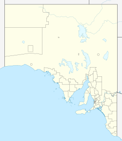
Hindmarsh Island (called Ngarrindjeri: Kumerangk by the local Indigenous people) is a special river island in South Australia. It's found in the lower part of the Murray River, close to the town of Goolwa.
This island is a popular place for tourists to visit. It became even more popular after the Hindmarsh Island bridge opened in 2001. Hindmarsh Island is about 100.1 kilometres (62.2 miles) south-east of the Adelaide city centre. It takes about 1 hour and 15 minutes to drive there.
Contents
- Island History: A Timeline
- The Hindmarsh Island Bridge
- Island Geography
- Island Climate
- Places to Visit on Hindmarsh Island
- Hindmarsh Island Caravan Park
- Hindmarsh Island Monument
- Hindmarsh Island Airstrip
- Hindmarsh Island Lookout
- Lonely Island
- Hindmarsh Island Weather Receiver
- Hindmarsh Island River Murray Mouth Lookout
- Lake Cloud
- Narnu Farm
- Karinga Park Homestead
- Telstra Telephone Tower
- Hindmarsh Island Mangroves
- Hindmarsh Island Boat Ramps
- Hindmarsh Island Cemetery
- Ukrainian Youth Association Camp Ground
- Hindmarsh Island Forests
- Animals of Hindmarsh Island
- Protected Areas
- See also
Island History: A Timeline
Before Europeans arrived, the Ngarrindjeri people lived on the island. They knew it as Kumarangk.
- 1830: Captain Charles Sturt was the first European to visit Hindmarsh Island. He used the island as a lookout point and from there, he saw the Murray Mouth, where the river meets the ocean.
- 1831: Captain Collet Barker explored the Murray Mouth. Sadly, he was killed by Indigenous Australians after swimming across the mouth.
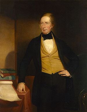
- 1837: The island was named by Captain John William Dundas Blenkinsop. He named it after South Australia's first Governor, Sir John Hindmarsh.
- 1849: Dr. John Rankine became the island's first farmer, raising animals.
- 1856: A flour mill was built on the island.
- 1858: A public ferry started carrying people between Goolwa and the island. In the same year, the first telegraph line connecting Adelaide and Melbourne passed through the island.
- 1861: The island's cemetery was planned out.
- 1880s: The Alberto and Selberto Forests were planted.
- 1914: A trial barrier (barrage) was built to connect Hindmarsh Island with Mundoo Island.
- 1935: Permanent barrages were built. These helped keep the water level steady around Goolwa and stopped salt water from getting into the river. This was good for farming.
- 1965: The island got mains electricity, bringing power to homes and businesses.
- 1970: Little penguins used to live on Hindmarsh Island. Sadly, this group of penguins is now extinct.
- 1985: A large area, including the island, was named a "wetland of international importance" under the Ramsar convention. This means it's a very important natural area.
- 2001: About a third of the island became part of the Coorong National Park. The Hindmarsh Island Bridge, connecting the island to the mainland, was also opened.
- 2005: Coorong Quays Hindmarsh Island became the largest freshwater marina in the Southern Hemisphere.
- Today: Hindmarsh Island now has fresh water on its northern side and salt water on its southern side. These waters are kept separate by the barrages.
The Hindmarsh Island Bridge
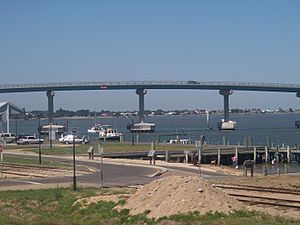
The Hindmarsh Island Bridge connects the island to Goolwa. It officially opened on 4 March 2001.
- Length: 319 metres (1,047 feet)
- Height: 19 metres (62 feet)
- Width: 11 metres (36 feet)
- Clearance Height: 14 metres (46 feet)
- Construction Started: October 1999
- Construction Finished: March 2001
The building of the bridge caused a lot of discussion. Some local Indigenous people (the Ngarrindjeri) and landowners were against its construction. They said the island had important cultural meaning for them. A Federal Court Judge later looked at the evidence. In 2001, Justice John von Doussa found that the Ngarrindjeri women who spoke about their beliefs were "credible witnesses." He was satisfied that their knowledge was a genuine part of their Aboriginal tradition.
Island Geography
Hindmarsh Island is a diverse place with different types of land.
- Area: 45.5 square kilometres (17.6 square miles)
- Coastline: 43.7 kilometres (27.2 miles) (not including the marina)
- Highest Point: 25 metres (82 feet) above sea level
- Salt Lakes: 49
- Land Types: Grasslands, wooded forests, salt lakes, and mangroves.
Nearby Islands
Hindmarsh Island is surrounded by several smaller islands.
- Mundoo Island: This is a medium-sized island off the east coast. It's a private cattle farm. A road here also acts as a barrier to stop river water from flowing into the ocean.
- Rat Island/Grindstone Island: A small private island off the easternmost point of Hindmarsh Island.
- Varcoe Island: An extremely small island with no people living on it.
- Bird Island/Gull Island: A small island with no people, located off the southernmost point of Hindmarsh Island.
- Goose Island: A small private island off the north-western area. It has two people living on it.
- Goat Island: A small private island off the north-eastern area. It has one person living on it and more plants than Goose Island.
- Limestone Island/Goose Island: A small island in a Game Reserve. It's named for its limestone rock formations and can sometimes flood in winter.
Island Climate
Hindmarsh Island has a Mediterranean climate, just like Adelaide. This means it has hot, dry summers and mild, cool winters.
| Climate data for Hindmarsh Island | |||||||||||||
|---|---|---|---|---|---|---|---|---|---|---|---|---|---|
| Month | Jan | Feb | Mar | Apr | May | Jun | Jul | Aug | Sep | Oct | Nov | Dec | Year |
| Record high °C (°F) | 46.8 (116.2) |
44.1 (111.4) |
41.8 (107.2) |
37.6 (99.7) |
30.4 (86.7) |
27.0 (80.6) |
23.5 (74.3) |
29.9 (85.8) |
32.0 (89.6) |
38.4 (101.1) |
41.8 (107.2) |
45.2 (113.4) |
46.8 (116.2) |
| Mean daily maximum °C (°F) | 25.7 (78.3) |
24.6 (76.3) |
24.0 (75.2) |
21.8 (71.2) |
18.5 (65.3) |
15.9 (60.6) |
15.4 (59.7) |
16.4 (61.5) |
18.7 (65.7) |
21.3 (70.3) |
23.3 (73.9) |
24.9 (76.8) |
20.9 (69.6) |
| Mean daily minimum °C (°F) | 15.4 (59.7) |
15.5 (59.9) |
13.9 (57.0) |
11.8 (53.2) |
9.7 (49.5) |
8.4 (47.1) |
7.7 (45.9) |
7.7 (45.9) |
9.0 (48.2) |
10.7 (51.3) |
12.4 (54.3) |
13.9 (57.0) |
11.3 (52.3) |
| Record low °C (°F) | 7.8 (46.0) |
9.1 (48.4) |
7.4 (45.3) |
5.0 (41.0) |
1.2 (34.2) |
−0.6 (30.9) |
2.0 (35.6) |
1.0 (33.8) |
3.4 (38.1) |
4.3 (39.7) |
5.8 (42.4) |
7.0 (44.6) |
−0.6 (30.9) |
| Average rainfall mm (inches) | 12.8 (0.50) |
14.4 (0.57) |
18.6 (0.73) |
27.7 (1.09) |
41.0 (1.61) |
59.8 (2.35) |
60.5 (2.38) |
53.0 (2.09) |
50.6 (1.99) |
40.6 (1.60) |
27.8 (1.09) |
30.4 (1.20) |
437.2 (17.2) |
| Average rainy days | 5.2 | 4.5 | 7.4 | 10.0 | 15.8 | 18.1 | 19.9 | 17.8 | 14.9 | 12.7 | 9.9 | 8.1 | 144.3 |
| Source: Bureau of Meteorology | |||||||||||||
Places to Visit on Hindmarsh Island
Hindmarsh Island Caravan Park
This caravan park is located on the northern side of Hindmarsh Island. It has camping areas, forests, and grasslands. It opened in the early 1980s.
- Area: 22.2 acres (9.0 hectares)
Hindmarsh Island Monument
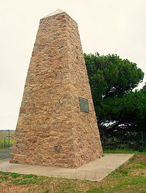
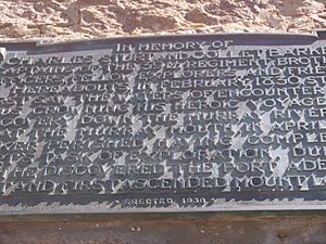
This monument honors Sturt and Barker and was put up in 1930.
- Height: 3.4 metres (11 feet)
Hindmarsh Island Airstrip
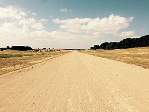
The airstrip was built in 2008 for emergency planes like the Flying Doctor Service, and for private planes. It has a hardened dirt runway.
- Length: 500 metres (1,600 feet)
- Width: 12 metres (39 feet)
Hindmarsh Island Lookout
This lookout was built in the late 1990s. It offers great views of Goolwa. It's also used as a downhill track for mountain biking.
- Height: 10 metres (33 feet) above sea level
Lonely Island
Lonely Island is unique because it's an island within an island (Hindmarsh Island) within an island (Australia)! It's in the middle of a dried-up salt lake that fills with water in winter.
- Area: 1.21 acres (0.49 hectares)
Hindmarsh Island Weather Receiver
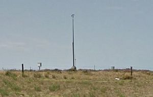
This weather receiver is next to the Hindmarsh Island Marina. It collects weather information for the Bureau of Meteorology. It was built in 2006.
- Height: 7 metres (23 feet)
Hindmarsh Island River Murray Mouth Lookout
This lookout is on the south-west side of the island. From here, you can see the Murray Mouth, where the river meets the ocean.
Lake Cloud
Lake Cloud is the biggest salt lake on the island. It's located on the eastern side.
- Area: 19 acres (7.7 hectares)
- Lowest Point: 2 metres (6.6 feet) below sea level
Narnu Farm
Narnu Farm is a fun holiday spot for families. It's a farm with animals and offers places to stay.
Karinga Park Homestead
This homestead offers accommodation and a getaway experience. It covers 20 acres (8.1 hectares) of land, much of which is part of Alberto Forest.
Telstra Telephone Tower
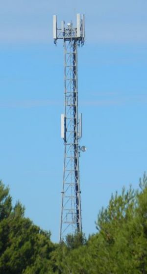
This tower provides phone service for Hindmarsh Island. It's located in Alberto Forest on the island's tallest hill, which is why it was built there.
- Built: 2006
- Height: 42 metres (138 feet)
Hindmarsh Island Mangroves
This is the only mangrove area on Hindmarsh Island. It's located on the southern part of the island.
- Area: 7.5 hectares (19 acres)
Hindmarsh Island Boat Ramps
There are several boat ramps around the island for easy access to the water:
- Captain Sturt Parade Boat Ramp
- Valmai Tce Boat Ramp
- Randell Road Boat Ramp
- Monument Road Boat Ramp
- Marina Boat Ramp
- Sugars Ave Boat Ramp
- Mundoo Channel Drive Boat Ramp
Hindmarsh Island Cemetery
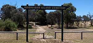
This old cemetery is in the center of the island. It was planned in 1861. Today, it's a popular place to visit, with graves dating back to the late 1700s.
Ukrainian Youth Association Camp Ground
This campground was bought in the early 1970s and is used by many groups today. It has buildings with kitchens and meeting rooms.
Hindmarsh Island Forests
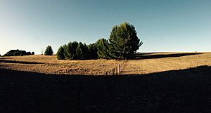
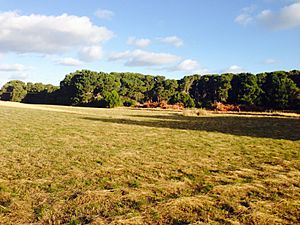
Forests cover about 11% of Hindmarsh Island. They are spread across different parts of the island. The West Forest (Alberto Forest) is on the west side, and the East Forest (Selberto Forest) is on the east side. These forests were planted after 1949.
Alberto Forest
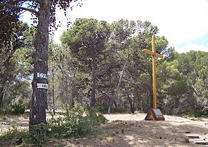
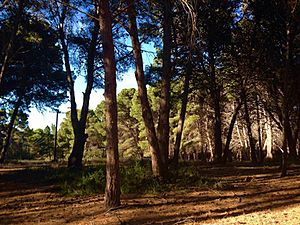
Alberto Forest is on the west side of the island. Parts of it include the Hindmarsh Island Caravan Park and Karinga Park Homestead. This forest mainly has Aleppo pine trees, which are 15 to 25 metres (49 to 82 feet) tall. Its main job was to stop sand dunes from wearing away.
- Area: 1.48 square kilometres (0.57 square miles)
Selberto Forest
Selberto Forest is on the east side of the island. Its trees are also Aleppo pines, ranging from 15 to 30 metres (49 to 98 feet) tall.
- Area: 5.2 square kilometres (2.0 square miles)
Animals of Hindmarsh Island
Hindmarsh Island is home to many different animals.
Native Species
These animals are naturally found on the island.
- Kangaroo: You can mostly find these marsupials in the forests and open grasslands. They are shy and usually avoid people.
- Blue Tongue Lizards: These lizards eat insects, snails, flowers, fruits, and berries. They often hide under pine needles or between rocks.
- Australian White Ibis: This bird is common along the coastline and in the forest. They often look for shade.
- Purple Swamphen: This bird is often found along the coast near reeds and ponds.
- Red Bellied Black Snake: This black snake with a red belly is found all over the island. Its bite can cause a lot of pain. It hibernates in winter and is seen in forests and grasslands only in summer.
- Australian Magpies: These black and white birds are found everywhere on the island, making them the most common bird.
- Barn Owl: This owl lives around the coastline and in the forests. You can often hear its special sound at night from high in a tree.
- Cape Barren Geese: A large group of over 50 of these geese lives on the island for most of the year. They are considered an endangered species.
- Little Penguins: These are the smallest penguins. They used to live along the south coast until the 1970s. As more people moved to the island, the penguins struggled and eventually died out.
Introduced Species
These animals were brought to the island by people.
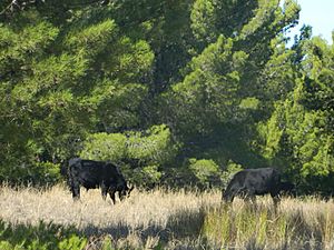
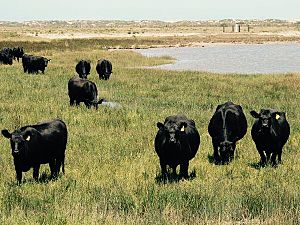
- Cattle: Bulls were brought to Hindmarsh Island in the 1960s. You might see them in the forests or farm areas, often sitting in the shade or eating grass. It's best not to bother them, as they can be aggressive.
- European Rabbits: These rabbits were brought to the island in the 1950s. They can be gray, white, or black and are often found in the forest. They are very shy and will run away if you get close.
- Red Fox: Red foxes have been on the island since the 1850s, brought from Europe. They are considered pests. They are mostly found on the southern coast and are very shy animals.
Protected Areas
Hindmarsh Island has areas that are protected to keep its nature safe.
- The Lawari Conservation Park was created in 2017. It's on the eastern end of the island and looks over the Goolwa Channel and Mundoo Channel.
- The entire island and its nearby waters are part of the Ramsar site called the Coorong and Lakes Alexandrina and Albert Wetland. This means it's a very important wetland recognized around the world.
See also
 In Spanish: Isla de Hindmarsh para niños
 | Bessie Coleman |
 | Spann Watson |
 | Jill E. Brown |
 | Sherman W. White |


