Hogan River facts for kids
Quick facts for kids Hogan |
|
|---|---|

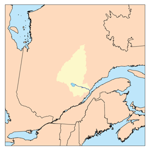
Watershed of Saguenay River
|
|
| Country | Canada |
| Province | Quebec |
| Region | Saguenay-Lac-Saint-Jean |
| Physical characteristics | |
| Main source | Hogan lake Lac-Ashuapmushuan, Quebec, Le Domaine-du-Roy (RCM), Saguenay-Lac-Saint-Jean, Quebec 453 m (1,486 ft) 49°54′36″N 73°46′58″W / 49.91000°N 73.78278°W |
| River mouth | Aiglon Lake Lac-Ashuapmushuan, Quebec, Le Domaine-du-Roy (RCM), Saguenay-Lac-Saint-Jean, Quebec 408 m (1,339 ft) 49°49′37″N 73°52′57″W / 49.82694°N 73.88250°W |
| Length | 18.0 km (11.2 mi) |
| Basin features | |
| Tributaries |
|
The Hogan River is a river in Quebec, Canada. It flows into the Boisvert River, which is part of the larger Normandin River system. The Hogan River is located in an area called Lac-Ashuapmushuan, Quebec, which is an unorganized territory. This means it doesn't have a local government like a town.
The river is in the Regional County Municipality (RCM) of Le Domaine-du-Roy. This RCM is part of the Saguenay-Lac-Saint-Jean region. The Hogan River flows through two areas called Sarrasin and Rinfret.
The main activity in this river valley is forestry, which means cutting down trees for wood. Recreational tourism, like fishing or hiking, is also popular here. Forest roads, like R1004 and R0210, help people access the river valley.
The Hogan River usually freezes over in early November. It stays frozen until mid-May. However, it's generally safe to walk on the ice from mid-November to mid-April.
River Journey
The Hogan River starts at Hogan Lake. This lake is about 1.5 kilometers (0.9 miles) long and sits at an elevation of 453 meters (1,486 feet). It's located near the edge of the Sarrasin area.
From Hogan Lake, the river flows for about 18 kilometers (11.2 miles). Here's how its journey goes:
- It flows southwest for 2.8 kilometers (1.7 miles) through the Sarrasin area. It passes through Consol Lake, which is 1.1 kilometers (0.7 miles) long.
- Then, it continues southwest for 2.4 kilometers (1.5 miles) into the Rinfret area. Here, it crosses Sylvain Lake, which is 2.1 kilometers (1.3 miles) long.
- Next, it flows southwest for 6.5 kilometers (4 miles). It widens into another part of Sylvain Lake, which is 2.6 kilometers (1.6 miles) long.
- Finally, it flows west for 6.3 kilometers (3.9 miles), making a big "S" shape before reaching its mouth.
The Hogan River ends by flowing into a bay on the southeastern shore of Lake Aiglon. Lake Aiglon is 3.3 kilometers (2.1 miles) long and is 408 meters (1,339 feet) above sea level. The Boisvert River also flows through Lake Aiglon.
From Lake Aiglon, the water from the Hogan River continues its journey:
- It flows down the Boisvert River.
- It enters the Ashuapmushuan Wildlife Reserve.
- It reaches the north shore of Charron Lake.
- Then, it flows through Lac la Blanche for 7.4 kilometers (4.6 miles).
- It continues through Lake Jordan for 9.8 kilometers (6.1 miles).
- Finally, it flows through Nicabau Lake for 9.7 kilometers (6 miles) to a dam.
- From Nicabau Lake, the water flows southeast along the Normandin River for 38.7 kilometers (24 miles) to Ashuapmushuan Lake.
- After that, the water flows through the Ashuapmushuan River all the way to Saint-Félicien, Quebec, on the west shore of Lac Saint-Jean.
Surrounding Rivers and Lakes
The Hogan River is surrounded by many other rivers and lakes. Here are some of the nearby waterways:
- North side: Chonard River, Nepton River North, Waconichi Lake, Mistassini Lake.
- East side: Chonard River, Chief's River, L’Épervier River, Petite Meule River.
- South side: Boisvert Lake (Normandin River), Épervier River, Vimont Lake, Normandin River, Dobleau River.
- West side: Armitage River, Énard River, Chibougamau Lake.
Name Origin
The name "Hogan" comes from a family name of English origin.
The official name "Hogan River" was made formal on March 28, 1972. This happened when the Commission de toponymie du Québec (Quebec's Place Names Commission) was created.
 | Georgia Louise Harris Brown |
 | Julian Abele |
 | Norma Merrick Sklarek |
 | William Sidney Pittman |

