Holly River facts for kids
Quick facts for kids Holly River |
|
|---|---|

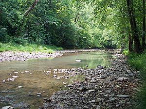
Right Fork Holly River in the Elk River Wildlife Management Area in 2007
|
|
|
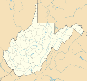
Location of the mouth of the Holly River in Braxton County, West Virginia
|
|
| Country | United States |
| State | West Virginia |
| Counties | Webster, Braxton |
| Physical characteristics | |
| Main source | Left Fork Holly River northeastern Webster County 2,920 ft (890 m) 38°37′44″N 80°15′34″W / 38.6289961°N 80.2595219°W |
| 2nd source | Right Fork Holly River north-central Webster County 2,338 ft (713 m) 38°32′59″N 80°20′27″W / 38.5498299°N 80.3409131°W |
| River mouth | Sutton Lake on the Elk River eastern Braxton County 915 ft (279 m) 38°39′12″N 80°35′28″W / 38.6534349°N 80.5912026°W |
| Length | 3.9 mi (6.3 km) |
| Basin features | |
| Basin size | 148 sq mi (380 km2) |
The Holly River is a small river in central West Virginia, United States. It flows into the Elk River. The Elk River then joins the Kanawha River, which flows into the Ohio River. Finally, the Ohio River joins the mighty Mississippi River. This means the Holly River is part of the huge watershed (or drainage area) of the Mississippi River.
The river gets its name from the many holly bushes that grow along its banks. It drains an area of about 148 square miles (380 km2) in the Allegheny Mountains. The main part of the Holly River is about 3.9 miles (6.3 km) long. But if you include its longest branch, the Left Fork, it stretches for about 28 miles (45 km).
Contents
Where Does the Holly River Begin?
The Holly River actually starts when two smaller rivers, called "forks," come together. These are the Left Fork Holly River and the Right Fork Holly River.
The Left Fork Holly River
- This fork is about 24.1 miles (38.8 km) long.
- It begins in the northeastern part of Webster County. This is about 4 miles (6.4 km) southwest of a town called Pickens.
- The Left Fork flows generally west.
- It passes through the southern part of Holly River State Park.
- It also flows by the community of Hacker Valley.
- Finally, it enters the eastern part of Braxton County.
The Right Fork Holly River
- This fork is almost as long, at about 23.9 miles (38.5 km).
- It starts in the north-central part of Webster County. This is about 7 miles (11 km) northeast of Webster Springs.
- The Right Fork flows generally northwest.
- It passes through the communities of Diana and Big Run.
- Like the Left Fork, it also enters the eastern part of Braxton County.
The River's Journey to Sutton Lake
Once the Left and Right Forks meet, they form the main Holly River. From this meeting point, the Holly River flows west for about 3.9 miles (6.3 km). It then becomes an arm of Sutton Lake. This lake was created by a dam on the Elk River. The Holly River's mouth (where it ends) is about 9 miles (14 km) east of the town of Sutton.
The main part of the Holly River, along with the lower sections of its Left and Right Forks, are all part of the Elk River Wildlife Management Area. This area helps protect the natural environment and wildlife.
What's Around the Holly River?
Most of the land around the Holly River is covered in trees. About 97% of the area is forest, mostly with deciduous trees. These are trees that lose their leaves in the fall. The other small part, about 2%, is used for farms and pastures where animals graze.
 | Misty Copeland |
 | Raven Wilkinson |
 | Debra Austin |
 | Aesha Ash |


