Hooker County, Nebraska facts for kids
Quick facts for kids
Hooker County
|
|
|---|---|

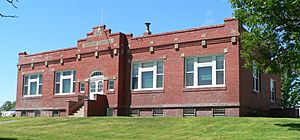
Hooker County Courthouse in Mullen
|
|

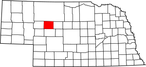
Location within the U.S. state of Nebraska
|
|
 Nebraska's location within the U.S. |
|
| Country | |
| State | |
| Founded | 1889 |
| Named for | Joseph Hooker |
| Seat | Mullen |
| Largest village | Mullen |
| Area | |
| • Total | 721 sq mi (1,870 km2) |
| • Land | 721 sq mi (1,870 km2) |
| • Water | 0.3 sq mi (0.8 km2) 0.05%% |
| Population
(2020)
|
|
| • Total | 711 |
| • Density | 0.9861/sq mi (0.3807/km2) |
| Time zone | UTC−7 (Mountain) |
| • Summer (DST) | UTC−6 (MDT) |
| Congressional district | 3rd |
Hooker County is a small county in the state of Nebraska, USA. It's known for its wide-open spaces and quiet living. As of 2020, about 711 people live there. The main town and county seat is Mullen. This is the only community of a good size in the county.
When Nebraska created its license plate system in 1922, Hooker County was given the number 93. This is because it had the fewest registered vehicles out of all 93 counties in the state.
Contents
History of Hooker County
Hooker County was officially created in 1889. This happened when a new railroad line, built by the Chicago, Burlington and Quincy Railroad, came through the area. The county was named after Joseph Hooker. He was a famous general during the American Civil War.
Geography and Landscape
Hooker County has a landscape of low, rolling hills. These hills generally run from east to west. The Middle Loup River flows through the northern part of the county, also moving eastward.
The total area of Hooker County is about 721 square miles. Almost all of this area is land. Only a tiny bit, about 0.3 square miles, is water.
Most of Nebraska uses the Central Time Zone. However, the western counties use the Mountain Time Zone. Hooker County is the easternmost county in Nebraska that observes Mountain Time.
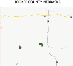
Main Roads in Hooker County
Neighboring Counties
Hooker County shares its borders with several other counties:
- Cherry County to the north
- Thomas County to the east (this is where the time zone changes!)
- McPherson County to the south
- Arthur County to the southwest
- Grant County to the west
Lakes in the County
You can find a couple of lakes in Hooker County:
- Carr Lake
- Jefford Lake
Population Changes Over Time
| Historical population | |||
|---|---|---|---|
| Census | Pop. | %± | |
| 1890 | 426 | — | |
| 1900 | 432 | 1.4% | |
| 1910 | 981 | 127.1% | |
| 1920 | 1,378 | 40.5% | |
| 1930 | 1,180 | −14.4% | |
| 1940 | 1,253 | 6.2% | |
| 1950 | 1,061 | −15.3% | |
| 1960 | 1,130 | 6.5% | |
| 1970 | 939 | −16.9% | |
| 1980 | 990 | 5.4% | |
| 1990 | 793 | −19.9% | |
| 2000 | 783 | −1.3% | |
| 2010 | 736 | −6.0% | |
| 2020 | 711 | −3.4% | |
| 2022 (est.) | 686 | −6.8% | |
| US Decennial Census 1790-1960 1900-1990 1990-2000 2010 2020 2022 |
|||
The population of Hooker County has changed quite a bit over the years. In 1890, there were only 426 people living there. The population grew steadily, reaching its highest point in 1920 with 1,378 residents. Since then, the number of people living in Hooker County has slowly decreased. In 2020, the population was 711.
Towns and Villages
Hooker County has one main village that serves as its county seat. It also has a former community.
Village
- Mullen (This is the county seat, meaning it's the center for county government.)
Former Community
See also
 In Spanish: Condado de Hooker para niños
 | James B. Knighten |
 | Azellia White |
 | Willa Brown |


