Huntley, Montana facts for kids
Quick facts for kids
Huntley, Montana
|
|
|---|---|

Location of Huntley, Montana
|
|
| Country | United States |
| State | Montana |
| County | Yellowstone |
| Area | |
| • Total | 1.60 sq mi (4.15 km2) |
| • Land | 1.52 sq mi (3.94 km2) |
| • Water | 0.08 sq mi (0.21 km2) |
| Elevation | 3,019 ft (920 m) |
| Population
(2020)
|
|
| • Total | 442 |
| • Density | 290.79/sq mi (112.30/km2) |
| Time zone | UTC-7 (Mountain (MST)) |
| • Summer (DST) | UTC-6 (MDT) |
| ZIP code |
59037
|
| Area code(s) | 406 |
| FIPS code | 30-38200 |
| GNIS feature ID | 2408411 |
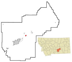
Huntley is a small community in Yellowstone County, Montana, United States. It is known as a census-designated place (CDP). This means it's a place the government counts for population, but it's not officially a city or town. In 2020, about 442 people lived there.
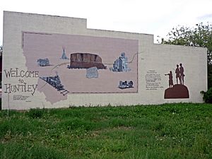
Huntley gave its name to the Huntley Project. This was a big government plan to bring water to dry farmland. The project started giving water to the area in 1907. Today, Huntley is a community located east of Billings. It sits between the towns of Shepherd and Worden.
Contents
History of Huntley
This area was once part of the dry Crow Indian Reservation. The community was named after S.O. Huntley. He was a partner in a company that ran stagecoaches. Stagecoaches were like old-fashioned buses pulled by horses.
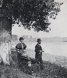
Huntley was located where boats could travel furthest up the Yellowstone River. This spot is called the "head of navigation." The first steamboat, named Josephine, arrived there on June 6, 1875. But boats didn't come very often. A U.S. post office opened in March 1878. In 1880, only 37 people lived in Huntley.
In 1872, people were surveying the land for a railroad. This led to a fight called the "Baker Battle" between Sioux Indians and Army engineers. The Northern Pacific Railroad finally arrived in 1882. This connected Huntley to the new city of Billings.
Just three years later, the town, then called "Huntley Station," had two stores, a hotel, and a blacksmith shop. Many German immigrants moved to the area. They built Lutheran and German Methodist churches.
In 1905, the United States Bureau of Reclamation started an irrigation project. This project was called the Huntley Project. Irrigation means bringing water to dry land to help crops grow. The land used for this project had been part of the Crow Indian Reservation until 1904. Huntley became part of this project. New railroad towns like Ballantine, Worden, and Pompey's Pillar were also founded in 1907 as part of the project.
In 1937, the Yellowstone River flooded. Huntley was one of the communities most damaged by this flood. Much of the original town was destroyed. The river even took over some of the land where the town stood. The flood also washed away a bridge that crossed the river. After the flood, the town was moved to a higher spot on the south side of the river.
Geography
Huntley is located at 45°53′59″N 108°18′16″W / 45.89972°N 108.30444°W.
The United States Census Bureau says that Huntley covers about 1.3 square miles (3.4 square kilometers). All of this area is land.
Climate
Huntley has a cold semi-arid climate. This means it's usually dry and can have cold winters. It's often called "BSk" on climate maps.
| Climate data for Huntley Experimental Station, Montana, 1991–2020 normals, extremes 1911–present | |||||||||||||
|---|---|---|---|---|---|---|---|---|---|---|---|---|---|
| Month | Jan | Feb | Mar | Apr | May | Jun | Jul | Aug | Sep | Oct | Nov | Dec | Year |
| Record high °F (°C) | 69 (21) |
74 (23) |
82 (28) |
92 (33) |
99 (37) |
107 (42) |
109 (43) |
106 (41) |
102 (39) |
94 (34) |
81 (27) |
76 (24) |
109 (43) |
| Mean maximum °F (°C) | 56.7 (13.7) |
61.9 (16.6) |
72.1 (22.3) |
81.8 (27.7) |
87.3 (30.7) |
94.6 (34.8) |
100.1 (37.8) |
99.2 (37.3) |
95.2 (35.1) |
84.1 (28.9) |
70.2 (21.2) |
58.1 (14.5) |
100.8 (38.2) |
| Mean daily maximum °F (°C) | 34.9 (1.6) |
39.2 (4.0) |
49.8 (9.9) |
58.5 (14.7) |
67.5 (19.7) |
77.1 (25.1) |
87.1 (30.6) |
86.1 (30.1) |
75.3 (24.1) |
60.3 (15.7) |
46.7 (8.2) |
36.4 (2.4) |
59.9 (15.5) |
| Daily mean °F (°C) | 23.4 (−4.8) |
26.7 (−2.9) |
35.9 (2.2) |
45.2 (7.3) |
54.5 (12.5) |
63.3 (17.4) |
71.0 (21.7) |
69.3 (20.7) |
59.2 (15.1) |
45.7 (7.6) |
33.9 (1.1) |
24.6 (−4.1) |
46.1 (7.8) |
| Mean daily minimum °F (°C) | 11.8 (−11.2) |
14.3 (−9.8) |
22.1 (−5.5) |
31.9 (−0.1) |
41.1 (5.1) |
49.5 (9.7) |
54.9 (12.7) |
52.5 (11.4) |
43.2 (6.2) |
31.1 (−0.5) |
21.0 (−6.1) |
12.9 (−10.6) |
32.2 (0.1) |
| Mean minimum °F (°C) | −15.7 (−26.5) |
−9.6 (−23.1) |
−0.8 (−18.2) |
17.8 (−7.9) |
26.7 (−2.9) |
36.5 (2.5) |
44.7 (7.1) |
41.5 (5.3) |
29.6 (−1.3) |
14.0 (−10.0) |
−2.2 (−19.0) |
−10.9 (−23.8) |
−24.1 (−31.2) |
| Record low °F (°C) | −52 (−47) |
−53 (−47) |
−37 (−38) |
−7 (−22) |
9 (−13) |
27 (−3) |
36 (2) |
29 (−2) |
16 (−9) |
−15 (−26) |
−33 (−36) |
−47 (−44) |
−53 (−47) |
| Average precipitation inches (mm) | 0.45 (11) |
0.50 (13) |
0.80 (20) |
1.70 (43) |
2.61 (66) |
2.26 (57) |
1.53 (39) |
0.85 (22) |
1.35 (34) |
1.35 (34) |
0.58 (15) |
0.46 (12) |
14.44 (366) |
| Average snowfall inches (cm) | 6.7 (17) |
7.1 (18) |
4.7 (12) |
1.8 (4.6) |
0.2 (0.51) |
0.0 (0.0) |
0.0 (0.0) |
0.0 (0.0) |
0.2 (0.51) |
2.7 (6.9) |
4.4 (11) |
6.6 (17) |
34.4 (87.52) |
| Average precipitation days (≥ 0.01 in) | 5.0 | 5.3 | 6.0 | 9.0 | 11.7 | 11.2 | 7.4 | 5.9 | 6.7 | 7.0 | 5.1 | 5.1 | 85.4 |
| Average snowy days (≥ 0.1 in) | 4.5 | 5.0 | 3.4 | 1.3 | 0.2 | 0.0 | 0.0 | 0.0 | 0.1 | 1.2 | 2.8 | 4.4 | 22.9 |
| Source 1: NOAA | |||||||||||||
| Source 2: National Weather Service | |||||||||||||
People in Huntley
| Historical population | |||
|---|---|---|---|
| Census | Pop. | %± | |
| 2020 | 442 | — | |
| U.S. Decennial Census | |||
In 2000, there were 411 people living in Huntley. They lived in 160 households, and 108 of these were families. The population density was about 319 people per square mile. Most people (97.32%) were White. A small number were Native American or Asian. About 3.16% of the people were Hispanic or Latino.
Many households (39.4%) had children under 18 living with them. More than half (53.8%) were married couples. About 11.3% of households had someone 65 years or older living alone. The average household had 2.57 people.
The population had a mix of ages. About 32.1% were under 18. About 29.4% were between 25 and 44 years old. The average age in Huntley was 38 years. For every 100 females, there were about 99.5 males.
The average yearly income for a household was $36,125. For families, it was $36,750. About 11.5% of the people in Huntley lived with very little money. This included 15.4% of those under 18.
Economy
The main way people in Huntley make a living is through agriculture. This means farming. Farmers in Huntley grow crops like yams, sugar beets, corn, wheat, and barley.
Media
Huntley is part of the Billings media area. This means people in Huntley get their TV and radio from Billings.
The Yellowstone County News is a weekly newspaper. It is based in Huntley and shares news for the larger Billings area.
Education
The schools in Huntley are part of the Huntley Project K-12 Schools district. This district includes schools for all grades, from kindergarten to 12th grade.
Notable people
- Richard R. "Dick" Jones (1910–2008): He was a business leader in trucking. He was also a politician for the Republican Party in Wyoming.
- Monica Lindeen: She used to be a member of the Montana House of Representatives. This is where laws are made for the state of Montana.
See also
 In Spanish: Huntley (Montana) para niños
 | Janet Taylor Pickett |
 | Synthia Saint James |
 | Howardena Pindell |
 | Faith Ringgold |


