Hurricane Arthur facts for kids
| Category 2 hurricane (SSHWS/NWS) | |

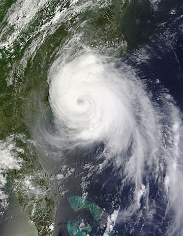
Hurricane Arthur south of North Carolina on July 3
|
|
| Formed | July 1, 2014 |
|---|---|
| Dissipated | July 9, 2014 |
| (Extratropical after July 5) | |
| Highest winds | 1-minute sustained: 100 mph (155 km/h) |
| Lowest pressure | 973 mbar (hPa); 28.73 inHg |
| Fatalities | 1 indirect |
| Damage | At least $22.7 million (2014 USD) |
| Areas affected | |
| Part of the 2014 Atlantic hurricane season | |
Hurricane Arthur was a powerful storm that happened in 2014. It began to form on July 1, 2014, not far from the eastern coast of Florida. Arthur quickly grew stronger and became a hurricane early on July 3.
This storm was expected to either just miss or directly hit the Cape Hatteras and Outer Banks area of North Carolina. Warnings for hurricanes or tropical storms were put in place for areas stretching from northeastern South Carolina all the way up to Nova Scotia in southeast Canada.
Contents
Arthur's Journey and Impact
Where Did Arthur Go?
Hurricane Arthur started near Florida and then moved north along the East Coast of the United States. It was a big concern for places like North Carolina because it was heading right for them. People in coastal areas had to prepare for strong winds and heavy rain.
How Did Arthur Affect People?
When Hurricane Arthur passed by, it caused some problems. There were high waves along the coast, especially in places like Assateague Island. These waves could be dangerous for swimmers and boats.
The storm also brought a lot of rain, which led to flooding in some areas. For example, Rodanthe Pier on Hatteras Island saw flooding after Arthur moved through. Strong winds from the hurricane were powerful enough to overturn mobile homes in North Carolina, showing how destructive these storms can be.
Arthur's Path to Canada
After affecting the United States, Arthur continued its journey north. It eventually reached The Maritimes in Canada, where it was no longer a tropical hurricane but a "post-tropical cyclone." Even after changing, it still caused damage. In Fredericton, New Brunswick, many trees were lost, with officials estimating about 10,000 trees were damaged or destroyed. Yarmouth also saw damage from the storm's remnants.
Images for kids
-
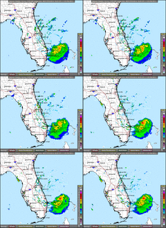
This image shows Hurricane Arthur forming north of the Bahamas on July 1.
-
Big waves hitting Assateague Island because of Hurricane Arthur on July 4.
-
Flooding at Rodanthe Pier on Hatteras Island after Hurricane Arthur passed.
-
A video loop showing Arthur as it hit land in the Outer Banks on July 4.
-
Mobile homes in North Carolina that were flipped over by Arthur's strong winds.
-
Post-tropical Cyclone Arthur over The Maritimes in Canada on July 5.
-
Damage from Arthur's leftover storm at the Forest Hill Cemetery in Fredericton, New Brunswick.
-
Damage caused by Arthur at Frost Park in Yarmouth.
-
Rainfall amounts from Hurricane Arthur across eastern Canada and Maine (text is in French).
See also
 In Spanish: Huracán Arthur para niños
 | Dorothy Vaughan |
 | Charles Henry Turner |
 | Hildrus Poindexter |
 | Henry Cecil McBay |


