Ijevan facts for kids
Quick facts for kids
Ijevan
Իջևան
|
||
|---|---|---|
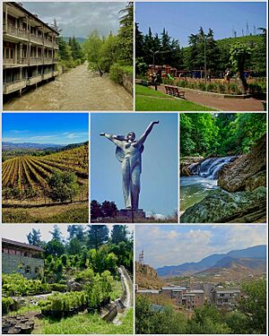
From top left:
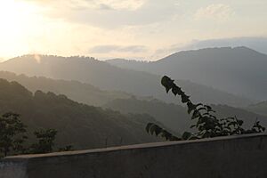
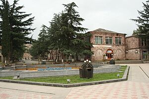
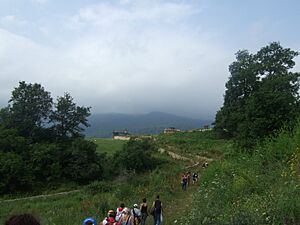
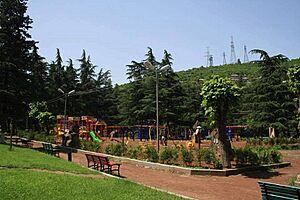
Aghstev River • Ijevan central park
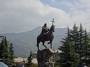
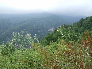
Ijevan Vineyards • Mother Armenia Ijevan Wildlife Sanctuary • Ijevan Dendropark Ijevan skyline and Gugark mountains |
||
|
||
| Country | ||
| Province | Tavush | |
| Municipality | Ijevan | |
| Founded | 1780s | |
| City status | 1961 | |
| Area | ||
| • Total | 4.6 km2 (1.8 sq mi) | |
| Elevation | 755 m (2,477 ft) | |
| Population | ||
| • Total | 21,081 | |
| • Density | 4,580/km2 (11,870/sq mi) | |
| Time zone | UTC+4 (AMT) | |
| Postal code |
4001, 4002
|
|
| Area code(s) | (+375) 263 | |
| Vehicle registration | 57 | |
| Ijevan at GEOnet Names Server | ||
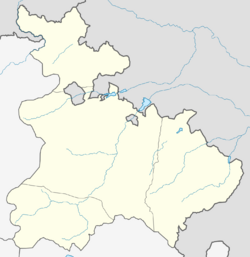
Ijevan (Armenian: Իջևան) is a town and community in the Tavush Province of Armenia. It is the main city of the province. Ijevan is located in the middle of the region, at the base of the Ijevan ridge of the Gugark Mountains. It sits by the Aghstev River.
Ijevan is about 137 kilometers (85 miles) northeast of Yerevan, the capital city. The main highway connecting Yerevan and Tbilisi passes through Ijevan. In 2011, the town had 21,081 people, making it the most populated town in Tavush. Ijevan is also known for its beautiful mountains.
Contents
- What's in a Name? The Meaning of Ijevan
- A Look Back: The History of Ijevan
- Nature's Beauty: Geography and Climate
- People and Population: Demographics
- Art and Traditions: Culture
- Getting Around: Transportation
- Work and Play: Economy and Tourism
- Learning and Growth: Education
- Staying Active: Sport
- Friends Around the World: Twin Towns and Partnerships
- Well-Known People from Ijevan
- See also
What's in a Name? The Meaning of Ijevan
The town's current name, Ijevan, means "inn" in Armenian. Its older name, Karavansara, used until 1919, also meant "inn" but in Persian. Long ago, this area had many roadside inns called caravanserais. These inns offered a place to rest for travelers going between historic Syria and the North Caucasus. The name Ijevan became official in 1961 when the settlement became a town.
A Look Back: The History of Ijevan
People have lived in the Ijevan area for a very long time. Old tombs and a cemetery from the late Bronze Age have been found here. This shows that people settled here early on.
Ancient Times and Trade Routes
Historically, the area of Ijevan was part of ancient lands called Utik and Gugark. These were provinces of Greater Armenia. The Aghstev River divided Ijevan. One side was part of Utik, and the other was part of Gugark.
Ijevan was on an important trade route between the Levant (Eastern Mediterranean) and the Northern Caucasus. During the Middle Ages, many rest-houses and caravanserais were built here. They served as resting spots for merchants and their caravans. These travelers were mainly on the road from Tbilisi to Dvin. You can still see the remains of a medieval caravanserai by the Aghstev River.
Under Russian Rule
The village of Karavansara was founded in the 1780s under Persian rule. In the early 1800s, this area, along with Georgia, became part of the Russian Empire. This was made official by the Treaty of Gulistan in 1813.
Around 1840, the area became part of a new Russian administrative division. Later, in 1868, it became part of the Kazakh uezd. Under Russian rule, about 6,000 Armenian families from Karabakh moved to the Aghstev river valley. They settled in the Tavush region, including Karavansara. The village grew a lot in the 1860s and 1870s. This happened because a new road opened between Kazakh and Erivan (Yerevan) that passed through Karavansara.
Modern Ijevan
After Armenia became independent in 1918, Karavansara's name was changed to Ijevan in 1919. In 1920, Ijevan was one of the first Armenian settlements where Soviet rule was established. In 1930, it became the center of the new Ijevan region.
The first big plan for the town was made in 1948. In 1951, the Ijevan Wine-Brandy Factory opened. A rug and carpet factory opened between 1959 and 1965. As industries grew, Ijevan became a town in 1961. In 1970, it was made a city of special importance within the Armenian Soviet Socialist Republic.
After Armenia gained independence in 1991, Ijevan became the main city of the new Tavush Province. This happened because of administrative changes in 1995.
Nature's Beauty: Geography and Climate
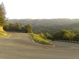
Ijevan is surrounded by the Gugark Mountains. It is located in the valley of the Aghstev River. The town is about 755 meters (2,477 feet) above sea level. The mountains around Ijevan are covered with thick forests. In some areas, these forests turn into beautiful alpine meadows.
Ijevan is next to the village of Getahovit to the north and Gandzakar to the south. There is a small lake at the southern entrance of the town called Spitak Jur.
The climate in Ijevan is classified as humid subtropical. This means it has warm, wet summers and mild winters. The average yearly temperature is 12.4 °C (54.3 °F). In January, the average is 0.5 °C (32.9 °F), and in July, it is 23.9 °C (75.0 °F). The highest temperature ever recorded was +39 °C (102.2 °F). The lowest was -16.1 °C (3.0 °F). The town gets about 575.2 mm (22.65 inches) of rain each year.
| Climate data for Ijevan (1991-2020), extremes 1981-2020 | |||||||||||||
|---|---|---|---|---|---|---|---|---|---|---|---|---|---|
| Month | Jan | Feb | Mar | Apr | May | Jun | Jul | Aug | Sep | Oct | Nov | Dec | Year |
| Record high °C (°F) | 21.0 (69.8) |
22.5 (72.5) |
29.0 (84.2) |
34.5 (94.1) |
31.0 (87.8) |
36.0 (96.8) |
38.0 (100.4) |
39.0 (102.2) |
34.7 (94.5) |
31.5 (88.7) |
28.0 (82.4) |
26.0 (78.8) |
39.0 (102.2) |
| Daily mean °C (°F) | 0.5 (32.9) |
1.6 (34.9) |
6.1 (43.0) |
12.0 (53.6) |
17.0 (62.6) |
20.7 (69.3) |
23.9 (75.0) |
23.5 (74.3) |
19.3 (66.7) |
13.4 (56.1) |
7.6 (45.7) |
2.6 (36.7) |
12.4 (54.2) |
| Record low °C (°F) | −16.1 (3.0) |
−15.3 (4.5) |
−10.8 (12.6) |
−8.0 (17.6) |
1.2 (34.2) |
5.6 (42.1) |
8.8 (47.8) |
9.9 (49.8) |
4.2 (39.6) |
−2.0 (28.4) |
−10.2 (13.6) |
−14.5 (5.9) |
−16.1 (3.0) |
| Average precipitation mm (inches) | 19.7 (0.78) |
27.6 (1.09) |
47.8 (1.88) |
70.5 (2.78) |
95.1 (3.74) |
81.6 (3.21) |
58.6 (2.31) |
35.5 (1.40) |
40.2 (1.58) |
45.5 (1.79) |
33.5 (1.32) |
19.6 (0.77) |
575.2 (22.65) |
| Average precipitation days (≥ 1.0 mm) | 3.9 | 5.5 | 7.9 | 10.8 | 14.5 | 10.7 | 7.3 | 5.5 | 5.8 | 7.6 | 5.7 | 4.3 | 89.5 |
| Average relative humidity (%) | 69.4 | 69 | 70 | 73.5 | 75.6 | 71.9 | 69.5 | 67.2 | 73.1 | 77.9 | 75.1 | 71.4 | 72.0 |
| Mean monthly sunshine hours | 118.4 | 120 | 136.3 | 138.7 | 172.4 | 210.6 | 205.2 | 198.7 | 175.3 | 137.2 | 119.9 | 110.7 | 1,843.4 |
| Source: NOAA | |||||||||||||
People and Population: Demographics
Ijevan is the largest urban community in Tavush. Most of the people living here are Armenians. They belong to the Armenian Apostolic Church. The main church body for the area is the Diocese of Tavush.
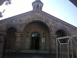
The Surp Nerses Cathedral in Ijevan is the main church for the Diocese of Tavush. It opened in 1997 after an old cultural center was rebuilt. Another church in town, the Holy Saviour's, was blessed in 2012. It was built on the foundations of a 19th-century church that was ruined long ago.
In 2011, Ijevan had 21,081 people. This made it the most populated town in the province. By 2016, the population was estimated to be around 20,700.
| Historical population | ||
|---|---|---|
| Year | Pop. | ±% p.a. |
| 1831 | 440 | — |
| 1873 | 1,016 | +2.01% |
| 1897 | 1,790 | +2.39% |
| 1926 | 2,261 | +0.81% |
| 1939 | 4,426 | +5.30% |
| 1959 | 7,639 | +2.77% |
| 1976 | 15,006 | +4.05% |
| 1989 | 18,681 | +1.70% |
| 2001 | 20,223 | +0.66% |
Art and Traditions: Culture
Local stories say that King Artavasdes I built a city where Ijevan is now, back in the 2nd century BC. He supposedly brought together attractive young people from all over Armenia to settle there. This way, the people of Ijevan today are said to be descendants of those handsome generations from 2,000 years ago!
Historical Monuments and Sites
Ijevan and its nearby areas have many old buildings and sites that show Armenian Architecture. These include:
- Surp Hovhannes Church: This church is from the 13th century and is west of the town.
- Makaravank monastery: This 10th-century monastery is about 15 km (9 miles) north of Ijevan. It's a popular place for tourists.
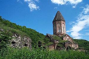
- Arakelots Monastery of Kirants: This monastery dates back to the 13th century and is a few kilometers north of Ijevan.
- Kirants Monastery: This monastery is from the 8th century and is 10 km (6 miles) north of Ijevan.
- The monastery of Gandzakar village: This is located a few kilometers south of Ijevan.
- King Ashot Yerkat fortress: The remains of this 10th-century fortress are 7 km (4 miles) southwest of Ijevan.
- Aghjkaberd fortress: The remains of this 13th-century fortress are 10 km (6 miles) southwest of Ijevan.
Sculptures and Arts
From 1985 to 1990, Ijevan hosted a yearly sculpture event. Artists from all over the world came to create art. Because of this, people started calling Ijevan "the city of 100 sculptures." Today, there are 116 sculptures in the Ijevan sculptures garden in the town center.
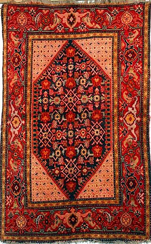
The ethnographic museum of Ijevan reopened in 1999. The art gallery was renovated in 2003. The town also has a house of culture, a music school, an arts school, and an art gallery. Ijevan is well-known for its traditional Armenian handmade rugs and carpets.
The town has its own local TV station called "Ijevan TV."
Getting Around: Transportation
Ijevan is connected to the capital city, Yerevan, and other parts of Armenia by the M-4 highway. This highway goes towards the Armenia-Azerbaijan border, which is 16 km (10 miles) northeast of the town.
Within the region, Ijevan is connected to nearby towns and villages in Tavush Province by a network of local roads.
In the late 1980s, Ijevan had a railway station on the line between Yerevan and Ganja, Azerbaijan. After the dissolution of the Soviet Union, the station closed. There are no train services there now, but people are thinking about reopening the line.
Work and Play: Economy and Tourism
Industry and Jobs
Ijevan is the main economic center of Tavush. During the Soviet era, the town made great progress in industry. This was especially true for carpet making and wood processing. Today, only one of the old Soviet-era factories is still working: the Ijevan Wine-Brandy Factory. It opened in 1951 and is famous for its pomegranate wine. The Ijevan carpet weaving mill used to be the largest in the Caucasus region. It was the third largest in the entire Soviet Union.
After Armenia became independent, many smaller factories opened. One example is the "Karart" stone processing plant, which started in 2003. In 2014, a software development company called "Vector" opened in Ijevan. However, many people in Ijevan and the surrounding area still struggle to find jobs.
Fun and Exploration: Tourism
Tavush is one of the most beautiful regions in Armenia. Ijevan is like a forest resort, nestled in the valley of the Aghstev River, surrounded by forests and tall mountains. The town used to have a large hotel built in 1969, but it is now in ruins.
The Ijevan Sanctuary is a protected wildlife area west of the town. It covers about 59 square kilometers (23 square miles).
The Yenokavan canyon, near the village of Yenokavan just north of Ijevan, is a very popular place to visit. It has many cliffs, caves, forests, rivers, and waterfalls. The "Anapat cave" has ancient carvings that look like Mayan and Aztec art. There are small guesthouses and a modern resort in the Yenokavan canyon for visitors.
Learning and Growth: Education
Ijevan has 6 public schools and 3 kindergartens for young children.
The Ijevan campus of the Yerevan State University has been operating in the town since 1994. In the 2016–17 school year, it had over 700 students. The Ijevan campus has 4 main study areas:
- Natural Sciences
- Humanities
- Economics
- Applied Arts
Staying Active: Sport
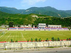
Ijevan is home to the Arnar Stadium. This stadium was built in 2007. In 2008, it hosted the Armenian Independence Cup final match. This was the first and only time this final was played outside the capital, Yerevan.
FC Bentonit Ijevan was the town's only professional football club. It closed in 2007 due to money problems. Now, the town has an under-19 football club called FC Nikarm, which started in 2000.
The town also has a sports school for children and young people, run by the local government. Ijevan is also where the yearly MultiForce off-road racing international competition takes place. This event brings participants from Armenia and nearby countries.
Friends Around the World: Twin Towns and Partnerships
Ijevan is connected with other cities around the world as "twin towns" or "sister cities." This means they have special friendly relationships.
Ijevan is twinned with:
 Kostroma, Russia (since 2014)
 Valence, France (since 1996)
Ijevan also works together with:
Well-Known People from Ijevan
- Grigor Jaghetyan, a politician who was the Minister of Finance for the First Republic of Armenia.
- Garnik Avalyan, a former member of the Armenia national football team.
- Nikol Pashinyan, a politician who is the current Prime Minister of Armenia.
See also
 In Spanish: Ijeván para niños
 | Bessie Coleman |
 | Spann Watson |
 | Jill E. Brown |
 | Sherman W. White |


