
Valence, Drôme facts for kids
Quick facts for kids
Valence
Valença (Occitan)
|
|||
|---|---|---|---|
|
Prefecture and commune
|
|||
-002.jpg)
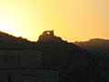
View of the city of Valence
|
|||
|
|||

Valence
Location in France

Valence
Location in Auvergne-Rhône-Alpes
|
|||
| Country | France | ||
| Region | Auvergne-Rhône-Alpes | ||
| Department | Drôme | ||
| Arrondissement | Valence | ||
| Canton | Valence-1, 2, 3 and 4 | ||
| Intercommunality | CA Valence Romans Agglo | ||
| Area
1
|
36.69 km2 (14.17 sq mi) | ||
| Population
(2022)
|
64,288 | ||
| • Density | 1,752.19/km2 (4,538.2/sq mi) | ||
| Demonym(s) | Valentinois | ||
| Time zone | UTC+01:00 (CET) | ||
| • Summer (DST) | UTC+02:00 (CEST) | ||
| INSEE/Postal code |
26362 /26000
|
||
| Elevation | 106–191 m (348–627 ft) (avg. 123 m or 404 ft) |
||
| 1 French Land Register data, which excludes lakes, ponds, glaciers > 1 km2 (0.386 sq mi or 247 acres) and river estuaries. | |||

.svg)
Valence is a city in southeastern France. It's the main city of the Drôme area and is part of the Auvergne-Rhône-Alpes region. Valence is located on the left bank of the Rhône River. It is about 100 kilometers (62 miles) south of Lyon. The city is also on the main railway line that connects Paris to Marseille.
Valence is the eighth-largest city in its region by population. In 2018, it had 64,726 registered inhabitants. The larger urban area had 132,556 people. The city is divided into four main areas called cantons.
Valence is in the heart of the Rhône Valley. It is often called "the door to the South of France." A local saying, à Valence le Midi commence, means "at Valence the South begins." This shows how the city has a southern French culture. Located between the Vercors Massif and Provence, Valence attracts many tourists. Important transport routes include the A7 autoroute and A49 autoroute highways. It also has the RN7 road and the Paris/Marseille TGV high-speed train line. The Rhône River is also a key transport route.
The Valence area has a large marina called Port de l'Épervière. It also has a trading port, two train stations (Valence-Ville and Valence-TGV), and an airport. The city's main businesses are in agriculture, metallurgy, engineering, and electronics.
The city was founded in 121 BC by the Romans. It quickly became an important crossroads after Lyon. As it grew, Valence became a Roman colony. Over the centuries, the town continued to expand. Today, you can see many old buildings from the Middle Ages, Renaissance, and later centuries in the city center. Valence is historically linked to the Dauphiné region. It is the second-largest city there after Grenoble. Today, it is part of the network of French Towns and Lands of Art and History.
Important buildings in Valence include the Maison des Têtes. This house was built between 1528 and 1532. The Saint-Apollinaire Cathedral was built between 1063 and 1099. Another famous landmark is the monumental fountain, designed by Eugène Poitoux. The city has many historical monuments. Most of these are in the Old Valence area. Valence is known for its beautiful flowers and green spaces. It has been awarded the "four flowers" label, which is the highest level, by the Concours des villes et villages fleuris competition.
Contents
- Valence Through Time: A Brief History
- Valence's Location and Landscape
- Getting Around Valence
- City Layout and Neighborhoods
- City Government and Services
- Population and Community Life
- Health and Safety
- Education in Valence
- Sports in Valence
- Valence's Economy
- Culture and Landmarks
- Sister Cities
- Famous People from Valence
- Images for kids
- See also
Valence Through Time: A Brief History
The people from Valence are called Valentinois. This name also refers to a geographical area and an old French province. Valence was the capital of this province, which was part of the Dauphiné.

The name Valence comes from the Latin word valentia. This means "strength" or "capacity." In Roman times, it was known as Valentia Julia. It was the capital of the Segovellauni people. It also had a famous school before the Romans took control. Valence became a Roman colony under Augustus. It was an important town in the Viennensis Prima region under Valentinian I. It may have been the seat of a bishop (a church leader) as early as the 4th century.
In the 5th century, different groups like the Alans and Goths took control of Valence from the Romans. In 440, the Romans gave deserted lands in Valence to the Alans. A few years later, Aetius settled the Burgundians in the region. Valence became part of the Kingdom of the Burgundians. Later, the city fell under the power of the Franks, then Arabs from Spain, and other rulers. Its own bishops also fought to keep control of the city. These bishops often disagreed with the citizens and the counts of Valentinois. To make them stronger, the Pope joined their bishopric with that of Die in 1275.
The citizens asked the dauphin for protection. In 1456, Louis XI confirmed their rights and privileges. Valence became a center for Protestantism in the province in 1563. King Francis I fortified the town. A famous university was founded in Valence in the mid-15th century. However, when the Edict of Nantes was canceled in 1685, it greatly harmed the city's businesses and population.
City Names and Symbols
The Roman conquest of Gaul made the Rhône Valley a key route. Many settlements were founded, including Valentia. This Latin name means "valiant, strong." It was in the land of the Segovellauni people.
The city is called Valença in the Occitan language. Its official symbol, or blazon, shows a red shield with a silver cross. On the cross is a blue tower. The city's motto is Unguibus et Rostro, which means "With claws and beak."
Ancient Times: Roman Beginnings

The city of Massalia asked Rome for help against the Salyes people. The Romans helped them starting in 125 BC. In 121 BC, the Roman army defeated the Allobroges tribe near the Rhône and Isère rivers.
Some historians believe that Gaius Marius set up his camp near these rivers. This was when he was sent by Rome to stop the Cimbri and Teutons. Digs on the Lautagne plateau, south of Valence, found old defensive structures from the 1st century BC. This suggests that Valence might have started as a Roman military camp.
Choosing the City's Location
The city of Valentia was built on a raised area on the left bank of the Rhône River. It was about 5 kilometers (3 miles) south of where the Isère River joins the Rhône. This location was chosen because it was a crossing point for many transport routes.
Valentia was important for trade going north and south along the Rhône. It was also on the Via Agrippa road. The city was part of east-west routes as well. Different paths from the Isère and Drôme valleys met at Valence. People crossed the Rhône at Valence using a ferry, a shallow crossing, or a bridge.
Life in the Ancient City
The city of Valence, like many Roman cities, had a grid plan for its streets. The main east-west street, called the decumanus, was found near the city hall. The main north-south street, the cardo, was the Via Agrippa. It went straight through the city from south to north.
A forum was likely located along the Via Agrippa. This was a public square, probably surrounded by important buildings like a civil basilica and a temple. The exact location of these buildings is not known.
South of the forum, ruins of thermae (Roman baths) were found. Valence got its water from many nearby springs. The city still has many streams and canals today. These come from water that flows out of springs at the foot of the terraces.
Fragments of architecture found near the current cathedral suggest there was a large temple there. The city also had places for entertainment. These included a circus, an amphitheatre, and a theater. An odeon was also found during the construction of the new museum.
The city was surrounded by ramparts (defensive walls) from the early Roman Empire. These were built between 15 BC and 15 AD. In 1869, digs found a large gate in the south of the old town. It had two towers and was decorated with military symbols. Houses were built around the city, outside the walls.
Valence in Later Roman Times
In the first centuries AD, Valence became a key road junction. Even during the later Roman Empire, it kept its important position.
However, from the 4th century, Valentia faced many attacks. But the city inside its walls remained grand. Some historians even compared it to Arles and Vienne.
By the 5th century, the city was protected by its ramparts. The Visigoths took Valence in 413 AD. The Burgundians controlled the Rhône basin by the end of the 5th century. Valence then became part of the Frankish Kingdom in 533 AD. These invasions removed most signs of Roman life.
During this difficult time, the city made its old walls stronger. Roman gates were blocked up, changing the city's main roads. People from the countryside moved to small hills, creating many villages around Valence.
The Middle Ages: Growth and Conflict

Around 800 AD, a new Cathedral of Saint-Estève (St. Stephen) was built. It was located where the baptistery used to be. This church held many holy items. The bishop's area also had homes for church officials. In 890, the widow of King Boso of Provence had her son, Louis III, crowned King of Provence in Valence.
In 1029, the Archbishop of Vienne gave the County of Viennois to Guigues III the Old. This area belonged to the Counts of Albon for decades. The region still suffered attacks from the Saracens in the late 9th and 10th centuries.
The Rhône River was sometimes seen as the border between France and the Holy Roman Empire. Valence was part of the Empire until the 15th century. But the river was also a link between different areas. The Diocese of Valence and the County of Valentinois stretched across both sides of the river. It was also an important trade route, especially for salt. This helped the city grow. Valence was a key stop for boats being pulled up the Rhône. This was because the wind changed direction there, making it hard to sail. Many people in Valence specialized in helping haulers.

The city was safe from floods and protected by its walls. It was a stop for people on pilgrimages to Compostela. Religious life was strong. The Saint-Apollinaire Cathedral was built, as was the Abbey of Saint-Ruf. Two powerful figures fought for control of the city: the Bishop and the Count of Valentinois.
The economy grew, and towns developed, especially along the Rhône. New areas formed around the Abbey of Saint-Pierre. This abbey led to the current town of Bourg-lès-Valence. Other settlements grew outside the city walls, often near religious buildings.
After the County of Valentinois became part of the Dauphiné, the dauphin Louis II gained control. When Louis II died, his heirs sold the Valentinois to Charles, the dauphin and future King of France, in 1419. The County of Valentinois became part of the Crown of France in 1424.

The late 15th and early 16th centuries were a golden age for Valence. This period saw the building of the Maison des Têtes and the Pendentif. The University of Valence was founded on July 26, 1452, by the dauphin Louis, who later became Louis XI. It quickly became famous. Well-known professors taught law, theology, medicine, and arts there. Louis XI continued to support the university.
Louis XI often stayed in Valence. He gave a gate to the city, the Saunière gate, and some nearby houses. He also allowed a market in Valence in 1476. This era ended suddenly in 1562. Protestant troops occupied the city, and many religious buildings were destroyed.
Early Modern Era: Changes and Conflicts

François Rabelais studied in Valence in 1532. Valence was a military town from its beginning. In the 1700s, it had 7,100 people who had to house soldiers. To ease this burden, a barracks was built in 1714.
Charles IX visited Valence during his royal tour of France (1564–1566). He was with his court and many nobles.
The story of Louis Mandrin ended in Valence in May 1755. He was a smuggler who challenged the tax system. After being held in the city prison, Mandrin was sentenced to death. He was executed on the Place des Clercs. His body was displayed for three days, and many people came to pay tribute to him. Mandrin's death marked the end of his actions but the start of a legend.
Napoleon Bonaparte was stationed in Valence from 1785 to 1786. He was part of the La Fère artillery regiment. He visited Valence many times later. He crossed the city on October 12, 1799, returning from his expedition to Egypt.
The French Revolution and Beyond

After the Estates-General met, people became restless. News of the storming of the Bastille reached the region around July 20. This brought hope but also fears of a plot by aristocrats. The Great Fear spread quickly, causing villages to prepare for defense. Local groups formed to help each other. Valence invited nearby communities on January 31, bringing together 16,000 guards from 293 towns.
The university closed in 1792. It was later re-established and is now part of the Community Grenoble Alpes University.
Pope Pius VI died in Valence on August 29, 1799. He was in exile from the Vatican. After more than two years, his body finally left Valence on December 24, 1801, to return to the Vatican.
20th Century: Community and Conflict

After the Armenian genocide of 1915, many Armenians found safety in France. In the 1920s, Valence employers recruited 150 Armenians from Marseille. By 1926, 827 Armenians lived in Valence, and by 1931, there were 1,670. They came from places like Bursa, Malatya, and Harput. Armenians were popular with employers but faced some distrust from local people. Many were young adults, children, and elderly who had suffered greatly. They mostly worked as laborers or started small businesses. An "Armenian quarter" quickly grew in the city.
By 1956, there were 2,500 Armenians in Valence, making up 6% of the population. It was the fourth-largest Armenian community in France. The community had a strong identity with newspapers, cinemas, and sports clubs. They integrated quickly; by 1946, half of Valence's 2,000 Armenians chose French citizenship.
In 1947, 200 Armenians from Valence tried to return to Soviet countries, but this was not successful. The community welcomed new refugees from political unrest in Syria (1950s-1960s) and Lebanon (1970s-1980s). As of 1997, 7,500 people in Valence were part of this community. The Armenian National Union is based in Valence.
This strong presence is seen in street names. The Rue d'Arménie and Place Missak Manouchian are examples. The community's cultural life is very active, with 28 associations.
World War II: Bombings and Resistance
During World War II, Valence was bombed by Allied planes. These attacks aimed to destroy the bridge over the Rhône. On August 15, 1944, bombs destroyed parts of the city, including the hospital. 280 people died. Only the gate of the prefecture building remained. Four days later, on August 19, 1944, a German train carrying nitroglycerin exploded. This destroyed much of the La Palla area and caused 335 casualties. On August 2, 1944, bombings south of Valence destroyed 51 locomotives.
The northern part of Valence was almost completely destroyed. It was rebuilt and now has many government buildings. The Drôme department was a center for the Resistance. In 1943, the Resistance grew stronger. Many young men refused to work in Germany and joined the Maquis (Resistance groups). The people of Drôme supported the Resistance.
Valence's Location and Landscape
Where is Valence Located?

Valence is a key crossing point between Paris and the Mediterranean Sea. It is in the center of the Rhône Valley. The city is at the mouth of the Isère Valley, which leads to the Alps. It is west of the historic province of Dauphiné. Valence is also on the border of the Ardèche department, separated by the Rhône. The city is surrounded by mountains. To the west are the Massif Central and the Ardèche hills. To the east is the Vercors Massif.
Valence is 561 kilometers (349 miles) southeast of Paris. It is about 100 kilometers (62 miles) south of Lyon and southwest of Grenoble. It is 120 kilometers (75 miles) north of Avignon and 220 kilometers (137 miles) north of Marseille. Valence is a few kilometers south of the 45th parallel. This is why it is often called the "gateway to Southern France."

The city is built on four levels of land, called alluvial terraces, on the left bank of the Rhône.
- The lowest terrace is closest to the river. This is where fishermen and sailors lived.
- The intermediate terrace was safe from floods. This is where the historic city grew, first inside its walls, then expanding outside.
- The third terrace became highly urbanized in the second half of the 20th century.
- The highest terrace, called the Lautagne plateau, has developed into a center for technology since the late 20th century.
Valence is in the south of the Auvergne-Rhône-Alpes region. It is the main city (prefecture) of the northern part of the Drôme department. Valence is the capital of four cantons: Valence-1, Valence-2, Valence-3, and Valence-4. The city is the most populated part of the Communauté d'agglomération Valence Romans Agglo. This group includes 56 towns since January 1, 2017.
Nearby Towns
 |
|
|||
Land and Geology

The city covers an area of 36.69 square kilometers (14.17 square miles). Its altitude ranges from 106 to 191 meters (348 to 627 feet).
The land around Valence was formed by ancient rivers and glaciers. The Rhône River cut through granite rock. Over time, thick layers of sediment were deposited in the Valence area. During the Miocene epoch, a type of rock called molasse formed from eroded material from the Alps and the Massif Central. Later, during the Pliocene epoch, the area became a lake, leaving behind lake deposits. In the Quaternary period, glaciers and meltwater shaped the land, creating the four terraces seen in Valence today.
The Drôme des Collines region, which includes Valence, formed at the end of the Miocene. The confluence of the Isère and Rhône rivers, along with river erosion, created the four terraces in Valence.
Rivers and Waterways
Valence is on the left bank of the Rhône River. One of its smaller rivers, the Épervière, also flows through the city. This 2.6-kilometer (1.6-mile) long river is formed by many of the city's channels.
The Plain of Valence

The city gives its name to a specific area called the Valentinois. Most of this region is the plain of Valence. This plain was shaped by the Rhône River, which left behind fertile soil. This plain is bordered by the Rhône Valleys to the west, the Isère to the north, and the Drome to the south. It looks like a cheerful orchard with peach, apricot, and cherry trees. These are mixed with fields of grain and vegetables. Large farms are scattered across this agricultural area.
To the east, the Monts du Matin are a long line of hills. They are dominated by the limestone cliffs of the Vercors. To the south, beyond the Drôme Valley, the plain ends at the large forest of Marsanne.
The view from the ruins of the Château de Crussol shows the plain of Valence as a large flat area. It is bordered by two clear mountain ranges. The plain is very large because it is made of many terraces. Only the buildings and crops change the look of these terraces.
Today, the plain of Valence is centered around the city's infrastructure. The city's growth is slowly spreading across the whole area. However, some towns still keep their village feel and rural character. These were old farming villages, often located on higher ground for defense. Their names, like Montélier and Montvendre, suggest their high positions.
The plain of Valence and the Valentinois region do not include the western part of the city. This part is in the neighboring Ardèche department.
Climate and Weather

Valence has a humid subtropical climate. A key feature is an almost constant wind that blows through the Rhône Valley. When the wind comes from the north, it's called the "mistral." It brings clear, cool weather in summer but feels very cold in winter. When it comes from the south, it often means storms are coming. This is sometimes called le vent du midi (the midi wind) or le vent des fous (the uncaring wind).
The climate is also influenced by both continental and Mediterranean weather. The Gotheron weather station, 6 kilometers (3.7 miles) from Valence, recorded an average temperature of 12.3°C (54.1°F) and 886 millimeters (34.9 inches) of rain between 1966 and 2004. Valence gets about 2,500 hours of sunshine per year. However, there can be big differences from year to year. For example, 2003 had a very hot summer and lots of sunshine.
Valence is in the Rhône Valley, where the wind is steady. This allowed boats to sail on the Rhône from Valence.
| Climate data for Valence (1997–2020 normals, extremes 1997–present) | |||||||||||||
|---|---|---|---|---|---|---|---|---|---|---|---|---|---|
| Month | Jan | Feb | Mar | Apr | May | Jun | Jul | Aug | Sep | Oct | Nov | Dec | Year |
| Record high °C (°F) | 19.2 (66.6) |
21.5 (70.7) |
25.0 (77.0) |
30.9 (87.6) |
33.6 (92.5) |
39.2 (102.6) |
39.9 (103.8) |
40.9 (105.6) |
33.6 (92.5) |
29.5 (85.1) |
23.1 (73.6) |
18.5 (65.3) |
40.9 (105.6) |
| Mean daily maximum °C (°F) | 8.0 (46.4) |
9.8 (49.6) |
14.6 (58.3) |
18.3 (64.9) |
22.2 (72.0) |
27.0 (80.6) |
29.4 (84.9) |
28.9 (84.0) |
24.4 (75.9) |
18.9 (66.0) |
12.3 (54.1) |
8.4 (47.1) |
18.5 (65.3) |
| Daily mean °C (°F) | 4.5 (40.1) |
5.5 (41.9) |
9.2 (48.6) |
12.5 (54.5) |
16.4 (61.5) |
20.5 (68.9) |
22.6 (72.7) |
22.2 (72.0) |
18.3 (64.9) |
14.1 (57.4) |
8.5 (47.3) |
5.0 (41.0) |
13.3 (55.9) |
| Mean daily minimum °C (°F) | 1.0 (33.8) |
1.1 (34.0) |
3.8 (38.8) |
6.7 (44.1) |
10.5 (50.9) |
14.1 (57.4) |
15.9 (60.6) |
15.5 (59.9) |
12.3 (54.1) |
9.4 (48.9) |
4.8 (40.6) |
1.7 (35.1) |
8.1 (46.6) |
| Record low °C (°F) | −14.7 (5.5) |
−10.9 (12.4) |
−11.7 (10.9) |
−4.3 (24.3) |
1.0 (33.8) |
5.0 (41.0) |
8.3 (46.9) |
6.6 (43.9) |
3.9 (39.0) |
−4.3 (24.3) |
−7.5 (18.5) |
−11.6 (11.1) |
−14.7 (5.5) |
| Average precipitation mm (inches) | 56.8 (2.24) |
46.6 (1.83) |
53.7 (2.11) |
74.3 (2.93) |
88.8 (3.50) |
57.2 (2.25) |
54.5 (2.15) |
68.3 (2.69) |
82.7 (3.26) |
123.7 (4.87) |
109.4 (4.31) |
57.9 (2.28) |
873.9 (34.41) |
| Average precipitation days (≥ 1.0 mm) | 7.5 | 6.5 | 8.1 | 8.4 | 8.7 | 6.1 | 5.9 | 6.3 | 5.5 | 8.3 | 9.1 | 7.8 | 88.0 |
| Mean monthly sunshine hours | 84.3 | 118.1 | 172.6 | 209.9 | 220.0 | 254.9 | 300.2 | 276.5 | 218.6 | 146.8 | 111.9 | 88.2 | 2,202 |
| Source 1: Meteociel | |||||||||||||
| Source 2: Infoclimate (sun at Bourg-lès-Valence 2012–2020) | |||||||||||||
Plants and Trees
The plants in the Valence plain are typical of central Europe. They include pedunculate oak and hornbeam trees. There are also warmer-climate plants like downy oak and evergreen oaks. In the south of the Drôme Valley, you can find thyme, lavender, and Aleppo pines. The Ardèche hills have landscapes of garrigue and Mediterranean Oak.
In the past, olive trees were grown north of Valence. But they were replaced by grapevines. Now, many apricot, peach, and other fruit trees are grown. However, many fruit trees have been lost since 2003 due to diseases.
Getting Around Valence
The main train station in Valence is the Gare de Valence-Ville. It is just south of the city center. From here, you can travel to Lyon, Grenoble, Avignon, Gap, and other regional places. In 2001, the Gare de Valence TGV opened. This station is on the LGV Méditerranée, a high-speed rail line. It made travel times to northern cities much shorter. A trip to Paris now takes 2 hours and 11 minutes. The TGV station is 10 kilometers (6 miles) northeast of the city.
Roads and Highways

Valence is in a key spot in the Rhône Valley. It is a major stopping point for people traveling to the French Riviera. The A7 autoroute, also known as the "motorway of the sun," connects Valence to Lyon (100 km north), Avignon (120 km south), and Marseille (220 km south). The A49 autoroute connects it to Grenoble (95 km northeast). The A41 autoroute links Valence to Savoy and Geneva (Switzerland).
Travel to cities in the Massif Central (like Le Puy-en-Velay and Clermont-Ferrand) is harder because the roads are winding. For example, the shortest way to Saint-Étienne goes over a high mountain pass.
Future Plans for the A7 Highway

In Valence, the A7 autoroute runs along the Rhône River, cutting through the city. There are plans to bury part of this highway underground for about 1.5 kilometers (0.9 miles). This project would make the banks of the Rhône available to the city again. The project is expected to cost around €500 million. The cost will be shared by the State, the Vinci Autoroutes company, the Drôme department, and the city of Valence.
Valence Ring Road
The Valence ring road includes the A7 autoroute, Route nationale 7, and the Route nationale 532. It is part of the European routes E15 and E713.
This ring road forms a half-loop, covering over 22 kilometers (14 miles). It connects Bourg-lès-Valence in the north to the Fontlozier area in the south. It helps traffic bypass most of the city while still providing access. It also makes it easy to reach the Valence TGV station. The part of the A7 highway in the city center was built in the 1960s.
Plans to complete the ring road with a western bypass on the right bank of the Rhône are being considered. This western bypass is already developing with a second bridge, the Lônes Bridge. This bridge helps ease traffic on the Mistral Bridge in the city center. The bypass will continue to grow, with plans to bypass towns like Guilherand-Granges and Saint-Péray by 2025. A third bridge over the Rhône in the north is also being studied to complete the full loop.
Bridges of Valence

It is likely that a bridge existed in Valence during ancient times. This bridge would have connected the two sides of the river. However, this ancient bridge was not replaced until the 19th century.
Here are the bridges of Valence in order:
- The Seguin Bridge was built from 1827 and opened in 1830.
- The stone bridge, built in 1905, was destroyed on June 19, 1940, by French engineers to slow German troops. A temporary bridge was then installed. This bridge was damaged again on August 18, 1944, during an Allied bombing.
- A temporary suspended walkway was used from 1949 to 1967.
- The Frédéric Mistral Bridge, finished in 1967, is still in use today. It connects Guilherand-Granges (Ardèche) to Valence (Drôme).
- The Lônes Bridge opened on December 18, 2004. It is the "second bridge" of Valence and helps with traffic between the two banks of the Rhône. It connects Guilherand-Granges and Soyons (Ardèche) to the southern parts of Valence.
During times when no bridge was available, a ferry would cross the Rhône River. An old pillar used by this ferry still stands in Guilherand-Granges.
Public Transportation
-001.jpg)
Valence has a bus network called Citéa. It covers the Valence area, which spans the Drôme and Ardèche departments. It also covers the romano-peageoise town, about 20 kilometers (12 miles) north of Valence. The network is managed by Valence Romans Déplacements. It has 20 regular lines, over 200 stops, and a fleet of 220 buses.
The Oura! card is a smartcard for public transport. It allows you to travel on the Citéa network. You can also use it for other transport in the region, like regional trains.
Train Stations
Valence has two SNCF train stations.


The Valence-Ville station opened in 1865. Its role has shifted to regional transport since the Gare de Valence TGV opened in 2001. Valence-Ville is the starting point for trains to Grenoble, Chambéry, Annecy, and Geneva. The station building was designed by Louis-Jules Bouchot. Its main facade is inspired by the Petit Trianon at Versailles. It has been a historic monument since October 11, 1982.
The Valence TGV station is on the Lyon-Marseilles LGV Méditerranée line. It is 11 kilometers (6.8 miles) northeast of the city center, in Alixan. Before it opened in 2001, high-speed TGV trains stopped at Valence-Ville. Now, trains reach Paris in 2 hours and 11 minutes. The Valence TGV station connects to 35 cities. These include Paris, Marseille, Lyon, Toulouse, and Brussels. In 2008, 58 daily TGVs served the station, carrying 2.2 million passengers.
River Ports
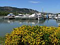
The Port de l'Épervière has 478 boat berths. It is the largest river port in France. Built in 1973, it is part of a 17-hectare (42-acre) leisure park. It has received the Blue Flag award for its quality services.
The river port of trade in the Drôme, also called Port of Valence, was created in 1978. It is in Portes-lès-Valence, south of Valence. It covers 41 hectares (101 acres) and has warehouses, a grain terminal, and storage sheds. Its location on the Rhône allows it to serve countries in the Mediterranean Basin and the Middle East. In 2013, work began to develop the port further.
Airport Access
| Name | Destinations | Distance |
|---|---|---|
| Valence-Chabeuil | France | 5 kilometres (3.1 mi) |
| Grenoble-Isère | Europe | 80 kilometres (50 mi) |
| Lyon-Saint-Exupéry | Europe, Africa, North America |
114 kilometres (71 mi) |
The Valence-Chabeuil Airport is in Chabeuil, 5 kilometers (3 miles) from Valence. It is open for national commercial flights and private planes. However, it no longer has regular flights to Paris. The airport has three runways. The terminal building is 530 square meters (5,700 sq ft). There is also a flying club and a helicopter company at the airport.
Grenoble–Isère Airport is 80 kilometers (50 miles) northeast of Valence. It offers flights to several European cities. Lyon–Saint-Exupéry Airport is 114 kilometers (71 miles) north of Valence. It is considered the second-largest airport in the region. It connects Lyon to most major European cities. In 2013, it served over 8.5 million passengers.
Bike Sharing
-001.jpg)
Since March 28, 2010, Valence has a self-service bike rental system called Libélo. It has 160 bikes at 20 stations. You can also rent bikes for longer periods in Valence, Guilherand-Granges, and Bourg-lès-Valence.
Unlike many other bike-sharing systems, Libélo is managed by the Valence transport company. It works with the Citéa transit network.
City Layout and Neighborhoods
How Valence is Built
The old city center is based on a grid plan from Roman times. The streets in the old town still follow the same directions as ancient Roman land divisions. The city expanded eastward onto a higher terrace. To the south, the Lautagne plateau limited the city's growth. In the late 20th century, the city was again separated from the Rhône by the A7 autoroute.
To help the city expand eastward, a large expressway was built. The Valence-Chabeuil Airport has been operating since 1969.
Valence Neighborhoods

Valence has about twenty neighborhoods. Each neighborhood has an average of 3,500 people. The northern neighborhoods are mostly residential (Polygone, Fontbarlettes, le Plan, and la Chamberlière). Some are even rural (Thodure). The southern neighborhoods are generally home to middle-class families and retirees (Fontlozier, Hugo-Provence, Laprat, les Baumes, Mannet, Valence Sud, and Lautagne). However, Valensolles is a working-class area.
The central neighborhoods are busy with shops and tourists (Centre-ville, Gare, Victor Hugo, Vieux Valence, Basse ville, l'Épervière). The eastern neighborhoods are mostly residential (Baquet, Grand Charran, Petit Charran, Châteauvert, Danton, and Briffaut). The Martins neighborhood is more rural.
Some neighborhoods have a "Quarter Committee." These groups work with public institutions. They help residents share information and participate in local development projects.
To make services easier to access, Valence has five city hall branches in different neighborhoods. These branches handle some administrative services.
Housing in Valence
In 2009, Valence had 34,661 homes. Most of these (88.4%) were primary residences. Only 1.0% were secondary homes, and 10.6% were empty. About 24.1% were detached houses, and 74.7% were apartments.
About 43.1% of primary residences were owned by their occupants. This was a slight increase from 1999. The share of social housing (rented homes for lower incomes) was 16.5%.
Several organizations, like the Public Housing Office of Valence (OPH), build and manage social housing. Most of these are in working-class neighborhoods.
Future Development Projects
Valence has major projects planned for its three main terraces. These projects aim to improve different parts of the city.
One big project is to reclaim the banks of the Rhône. The A7 autoroute currently cuts off the city from the river. The idea is to bury part of the highway underground. This would make the riverbanks available for public use.
Other projects include creating a 24-kilometer (15-mile) green route along the river. This route would pass through Valence and Bourg-lès-Valence. The city also wants to renovate tourist facilities at the l'Épervière site. The Îles neighborhood is planned to become an ecodistrict with energy-efficient housing.
A new neighborhood is planned in the south of the city. It will be built on the former Hugo-Provence area. This project includes 200 new homes (half social, half private), shops, and a hotel.
Another major goal is to connect the Hauts-de-Valence neighborhoods better. This area is undergoing a €117 million urban renewal program. It includes demolishing and rebuilding 417 houses. The project also aims to create shared public spaces.
A large project costing an estimated €100 million is planned for the former Latour-Maubourg military site. It will become a city of sports and culture. It will include a new swimming pool, an exhibition hall, a media center, and a higher education center. The renovated buildings will house student dorms and schools. The city is also studying building a new convention center in the area.
City Government and Services
City Administration

Valence is governed by a municipal council. This council makes decisions for the city. The municipal council elects the mayor. Since Valence has between 60,000 and 79,999 residents, its council has 49 members. These include the mayor, 14 deputies, and 34 municipal councilors. They are elected for a six-year term.
The current mayor of Valence is Nicolas Daragon. He is a member of The Republicans party. He was elected in 2014. The city hall building, the Hôtel de Ville, was recognized as a monument historique in 2018.
Mayors of Valence (Since 1947)
| Start | End | Name | Party | Other details |
|---|---|---|---|---|
| 26 October 1947 | 24 September 1957 | Camille Vernet | Radical-Socialist | |
| 25 September 1957 | 26 March 1971 | Jean Perdrix | Radical-Socialist | |
| 27 March 1971 | 17 March 1977 | Roger Ribadeau-Dumas | RPR | |
| 18 March 1977 | 18 June 1995 | Rodolphe Pesce | PS | General Counsel |
| 19 June 1995 | 7 April 2004 | Patrick Labaune | UMP | Regional Counsel |
| 8 April 2004 | 21 March 2008 | Léna Balsan | UMP | |
| 22 March 2008 | 4 April 2014 | Alain Maurice | PS | Lawyer |
| 5 April 2014 | In progress | Nicolas Daragon | UMP | General Counsel |
City Divisions (Cantons)
Valence is the capital of the Drôme department. It is divided into four cantons, which are administrative areas.
The way Valence is divided into cantons has changed over time. The canton of Valence was created in 1801. It was divided into two in 1964, then three in 1973, and finally four in 1984. In 2015, new cantons were created. Each one includes a part of Valence and other towns.
| The Cantons of Valence |
| Canton of Valence-1 ~ Canton of Valence-2 ~ Canton of Valence-3 ~ Canton of Valence-4 |
| Cantons of the Drôme department |
Working Together: Intercommunality
Valence is the largest city in the Valence Romans Agglo. This group includes 51 towns in the region. It is responsible for public transport, economic development, sanitation, environment, sports complexes, and public libraries.
Population and Community Life
Population Numbers
The people of Valence are called Valentinois in French. In 2018, the city had 64,726 residents. Its larger urban area had 132,556 people. The wider metropolitan area had 254,254 inhabitants.
| Historical population | |||||||||||||||||||||||||||||||||||||||||||||||||||||||||||||||||||||||||||||||||||||||||||||||||||||||||||||||||||||||
|---|---|---|---|---|---|---|---|---|---|---|---|---|---|---|---|---|---|---|---|---|---|---|---|---|---|---|---|---|---|---|---|---|---|---|---|---|---|---|---|---|---|---|---|---|---|---|---|---|---|---|---|---|---|---|---|---|---|---|---|---|---|---|---|---|---|---|---|---|---|---|---|---|---|---|---|---|---|---|---|---|---|---|---|---|---|---|---|---|---|---|---|---|---|---|---|---|---|---|---|---|---|---|---|---|---|---|---|---|---|---|---|---|---|---|---|---|---|---|---|
|
|
|
|||||||||||||||||||||||||||||||||||||||||||||||||||||||||||||||||||||||||||||||||||||||||||||||||||||||||||||||||||||
| From 1962 to 1999: Population without double counting; for the years following: municipal population. Source: Ldh/EHESS/Cassini until 1999 then INSEE |
|||||||||||||||||||||||||||||||||||||||||||||||||||||||||||||||||||||||||||||||||||||||||||||||||||||||||||||||||||||||
Religions and Groups
Valence has two Catholic parishes. These are part of the Diocese of Valence. The Jewish community has a synagogue.
The Armenian community, which makes up over 10% of the population, has its own church, Saint Sahag (Isaac). In November 2017, they started building an Armenian-language daily school.
Protestants also have places of worship in Valence. These include the Reformed Church of France, the Evangelical Protestant Church, and the Salvation Army.
Fun Events and Festivals
- Valence fête le printemps (Valence spring festival): This event celebrates local farm products.
- Boulevards de chines (Boulevard of china): These are flea markets and antique fairs.
- Festival de Valence (Festival of Valence): This festival offers free concerts in the city.
- Les Féeries d'Hiver (Winter extravaganza): This includes shows and fireworks.
Health and Safety
Hospitals in Valence
Valence has two hospitals: one public and one private. Many health professionals work in the city. These include doctors, nurses, and physiotherapists. Since 2009, Valence has been part of the WHO city health network. It promotes good nutrition practices.
The Centre Hospitalier de Valence (Central Hospital of Valence) had 2,570 staff in 2013. It offers all kinds of medical care. This includes medicine, surgery, and care for mothers and children. It has a maternity hospital where about 2,326 babies are born each year. The hospital has 740 beds. In 2011, nearly 67,000 people visited the emergency room.
The Hôpital Privé Drôme Ardèche (Drôme Ardèche Private Hospital) was created in 2005. It combined two clinics. It has 361 beds across two locations. Its Emergency Department is open 24/7. In 2013, the private hospital had 150 doctors and surgeons. It also had 180 nurses and many other healthcare workers.
Emergency Services
The firefighters of the Drôme department (SDIS 26) have 2,735 staff. This includes 316 professional firefighters and 2,419 volunteers. Their headquarters are in Valence. In 2013, the Drôme firefighters responded to 28,551 calls. The main fire station is in Valence. There are also seven other fire stations in the Valence area.
The SAMU 26 is an emergency medical service. Its job is to receive and handle emergency calls in the Drôme area. It provides medical help to people who have accidents or sudden illnesses.
Education in Valence
Schools for All Ages
Valence has many schools:
- 10 middle schools (collèges)
- 4 high schools (lycées) that offer general education
- 6 vocational high schools (lycées professionnels)
- 1 technical training high school
- 1 versatile high school
- 1 industrial technology high school
- The Montplaisir Catholic private high school
Higher Education Opportunities
Valence is growing as a center for higher education in the Drôme/Ardèche area. The Valence campus is part of the Community Grenoble Alpes University. It includes the Institut universitaire de technologie (IUT). Valence is also home to the INPG engineering school (ESISAR). Many other specialized schools are also in Valence.
- Joseph Fourier University: science, technology, health, sports, and education.
- Pierre Mendès-France University: IUT.
- Stendhal University: literature and languages.
- ESISAR (National School of Advanced Systems and Networks) from Grenoble INP.
- Lycée Camille-Vernet: preparatory classes for higher education.
- Higher Technology Institute Montplaisir: preparatory classes for economics and trade.
- Regional school of fine arts.
- School of management and commerce (EGC).
- Institute for hospital nursing education.
- La Poudrière – Animation film school.
- Higher Technology Institute Montplaisir (ISTM).
Sports in Valence

- Basketball: Valence Bourg Basket is a basketball club.
- Cycling: Valence was a finish city for a stage of the 1996 Tour de France. It was also a finish for Stage 15 of the 2015 Tour de France.
- American football: The Sharks de Valence team was created in 2002. They play in France's Division 3 Championship.
- Football: Association Sportive de Valence (ASV) plays in the CFA.
- Golf: The Golf Club de Valence is in Charpey, east of the city. It has an 18-hole course. The Golf des Chanalets in Bourg-lès-Valence also has an 18-hole course.
- Handball: Valence Handball played in Division 2 of the French Championship.
- Ice hockey: The Lynx of Valence team was founded in 1976. They play in Division 2.
- Judo: The CSF Judo Valence club was started in 1950. It has 164 members.
- Roller in-line hockey: Valence Roller Hockey has a team in the French N2 Championship.
- Rugby union: Valence is home to ROC La Voulte-Valence. This team plays in the third division of French rugby.
- Squash: The Squash Club de Valence has a team that plays in the national championship.
- The Georges Pompidou Stadium is the main stadium in Valence. It has a capacity of 14,380 seats. It is also used for athletics competitions.
- Triathlon: Valence Triathlon has both men's and women's teams. They compete in the French second division.
- Ken Shin Kan is a Japanese sword school. It teaches techniques like naginata, iaido, and kendo.
- Valence ACE volleyball Club offers training for youth and adults. It has over 130 members.
Valence's Economy

Valence is a key point on major European routes. It is a gateway to the Alpine Valley for east-west travel. The Valence area has grown around innovative companies. It offers higher education, centers of excellence, and economic land. Valence's economy benefits from being close to cities like Lyon and Geneva. It also has good transport links to major European capitals.
Valence's economic growth is also helped by its rich agricultural area. It has high-tech industries with large electronics and aerospace companies. Many small and medium-sized businesses are also innovative. The city has an important university center for film and knowledge. It has major animation studios known worldwide.
The Valence area has excellent transport links. These include a railway yard, the Port of Valence (a river port), and access to the A7 and A49 highways.
Valence is home to the Chamber of Commerce and Industry of the Drôme. This organization manages the Port de l'Épervière, the Port of Valence, and the Valence-Chabeuil Airport.
In 2005, the workforce was distributed as follows:
| Agriculture | Industry | Construction | Services |
|---|---|---|---|
| 0.9% | 17.8% | 4.8% | 76.5% |
Key industries in Valence include:
- Food (fruits, vegetables, wines)
- Metallurgy
- Mechanical engineering
- Electronics / Electronic Banking / Automation
Some large high-tech companies in Valence are leaders in their fields. These include Thales (electronic systems for aviation and defense) and Crouzet/Schneider (automatic systems). SAGEM (aerospace systems) and Ascom Monetel (automatic tax payment systems) are also here.
The Maison Pic is a world-famous restaurant and hotel. It has three Michelin stars and was established in 1889.
Economic Activity Zones
The Couleures commercial area has about eighty stores. These sell equipment, home goods, sports items, and personal products.
The two Briffaut sectors in east Valence have 320 companies. This includes an automotive hub and other businesses.
The technoparks are home to one hundred companies. The Lautagne plateau, south of the city, has 40 technology companies.
The Auréats zone is Valence's oldest industrial site. It covers 120 hectares (297 acres) and has 180 companies. The Cime activity center has 86 service businesses.
Businesses and Shops
At the end of 2015, Valence had 8,183 businesses. About 71% were in the service sector. Public administration (schools, health) made up 16%. Industry was only 4% of businesses. Most businesses (92%) had fewer than 10 employees.
Income and Taxes
In 2009, the average net income was €19,609. Only 46% of households paid taxes that year.
| Tax | Communal | Intercommunal | Departmental | Regional |
|---|---|---|---|---|
| Housing Tax (TH) | 17.55% | 0.00% | 7.80% | 0.00% |
| Land tax on the built-up properties (TFPB) | 25.17% | 0.00% | 11.57% | 2.12% |
| Land tax on the non-built-up properties (TFPNB) | 49.21% | 0.00% | 42.44% | 5.28% |
| Property contribution of businesses (ex-TP) | 0.00%* | 24.27% | 0.00% | 0.00% |
Employment in Valence
In 2017, 45,489 people had jobs in Valence. Most of these (90.5%) were salaried positions. The unemployment rate in the city was 18.2%.
| Professional category | Number of jobs |
|---|---|
| Agriculture | 228 |
| Industry | 4,810 |
| Construction | 2,262 |
| Trade, transport, services | 21,281 |
| Public administration, education, health | 16,229 |
Culture and Landmarks
Historic Sites in Old Valence


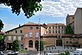
Many monuments in Valence are protected as historical sites. Most of these are in the Old Valence neighborhood. This area used to be the historic center of the city. In the 19th century, the city's old walls were replaced by wide boulevards.
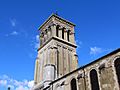
The Saint-Apollinaire Cathedral is a Romanesque cathedral. It was built in the 11th century. Bishop Gontard led its construction. It is the oldest building in the city. Some stones from the cathedral were reused from Roman buildings. The cathedral was damaged in the French Wars of Religion but was restored in the early 17th century. The church holds a monument to Pius VI, who died in Valence in 1799.
The Maison des Têtes was built between 1528 and 1532. It has a Renaissance facade with carved heads. These heads represent things like winds and fortune. This house shows the change from Gothic to Renaissance style. Its corridor has busts of Roman emperors. It has been a historical monument since 1944.
The Museum of Fine Arts of Valence is the only museum of its kind in Drôme. Its collections include paintings, drawings, sculptures, and decorative arts from the 16th to 20th centuries. It opened in 1850 and moved to the former bishop's palace in 1911. The museum was expanded and reopened in December 2013. It has 35 rooms across five floors.
The Pendentif is a building inspired by the Renaissance. It was likely a tomb built in 1548. After the Revolution, it became a drinking spot. The city bought it around 1830. It was one of the first monuments listed as a national historical monument.
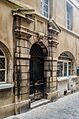
The Maison du Drapier is a 13th-century house. It still looks medieval despite later restorations. It probably belonged to a rich cloth merchant. The ground floor was for business, and the upper floors were for living.
The Maison de la Pra is a 15th-century mansion. It belonged to Claude Frère, a wealthy merchant.
The Maison Dupré-Latour dates from the 16th century. It has a remarkable staircase tower. It was built by the Genas family, who got rich from the salt trade. In 1760, François Dupré-Latour bought the building. It was given to the city in 1993 and has been a historical monument since 1927.
The Moorish house, known as Mauresque à Ferlin, was built in 1858. It has an oriental design.
The Church of Saint-Jean-Baptiste (11th and 12th centuries) is in the old town. It is at the highest point of the city. It is believed to be one of the first Christian worship places in Valence.
The temple of the Abbey of Saint-Ruf was once a Roman priory chapel. The Order of the Canons Regular of Saint Ruf started in Avignon. They became important in reforming the clergy.
The église Notre-Dame (Church of Our Lady) was built in the mid-19th century.
The Italian theater dates back to 1837. It was built between 1886 and 1887. The ceiling is painted to look like a dome. It shows four types of theater: drama, comedy, opera, and vaudeville. The theater was renovated in the 1990s. It has 390 seats.
The Abbaye Notre-Dame de Soyons is a former Benedictine women's abbey. It was founded in 1632. It has been a historical monument since 1926.
The city hall is on the Place de la Liberté. It opened in 1894. It has a belfry, which is a bell tower. This tower symbolizes the city's independence. The city hall houses the mayor's offices and administrative services.
The Armenian heritage center is a place for history and memory. It focuses on migration, conflicts, and cultures. Valence has one of the largest Armenian communities in France. The center is in the former Faculty of Law.
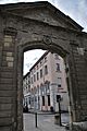
The ancienne préfecture (former prefecture) is near the Place Saint-Jean. Only its large entrance gate remains. The rest was destroyed in a bombing during World War II on August 15, 1944.
The Place des Clercs is lined with colorful buildings. It became important in the 5th century when the bishop's area was created. Shops and markets were held here. In the Middle Ages, there were two churches: the cathedral and Notre-Dame de la Ronde.
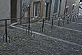
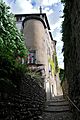
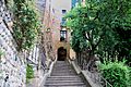
The "côtes" are picturesque paths in the upper town. They are traces of old walls. These walls protected the city from invasions and floods. People used these stairs to reach the small streets of the upper town.
Around the City

The "Boulevards de Valence" are wide promenades. They were built where the old city walls used to be. They are lined with trees and buildings.
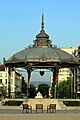
The bandstand on the Champ de Mars was built in 1860. It inspired the designer Raymond Peynet. It is now called the Peynet kiosk. It has been a historical monument since 1982.
The monumental fountain was designed by Eugène Poitoux. It dates from 1887. It is in the city center on the boulevards. In 2005, the fountain was renovated and moved slightly. A copy of its winged statue was replaced in 2006.
Jouvet Park is a public garden of 7 hectares (17 acres). It was created in 1905 and opened by President Émile Loubet. It is named after Théodore Jouvet, who donated the land. The park has over 700 trees. It also has a pet shop, a small train, and a rose garden.
The Valence-Ville station has a facade inspired by the Petit Trianon at Versailles. The station building was designed by Louis-Jules Bouchot. It has been a historic monument since October 11, 1982.
The esplanade of the Champ de Mars was once a car park. After renovation in 2001, it is now a wide, tree-lined area. From here, you can see the Château de Crussol across the Rhône.
The Philolaus water tower was built between 1969 and 1971. It is in Jean-Perdrix Park, east of the city. It has two twisted towers, 52 and 57 meters (171 and 187 feet) high. It combines function and art. In 1981, it won an award for urban art. It was recognized as "20th century heritage" in 2003.
Valence's Water Channels
Valence has a unique system of water channels. These have been part of the city since Roman times. The name Valence might come from Celtic words meaning "water-rich inhabited place." In the past, these channels were used for fishing, irrigation, washing, and powering mills. Today, they are popular places for walks.
The channels start in the eastern neighborhoods of Valence. They have a total length of 17 kilometers (11 miles). In the 13th century, monasteries controlled the channels and decided where mills could be built.
The water was used for irrigation, drinking, and washing. It was also a valuable energy source for the economy. The main channels (Charran, Thon, Moulins, and Malcontents) cross the city from east to west. They then join to form the Canal de l'Épervière, which flows into the Rhône. In the 19th century, the channels became less important and were hidden by city growth.
In recent years, the city has developed paths along these channels. These green routes are marked along several canals. The channels still water gardens today. The city also wants to encourage walking and cycling along the banks of the channels.
Parks and Green Spaces
.JPG)
The Champ de Mars esplanade is a large 3-hectare (7.4-acre) walk. It is planted with lime trees. The Peynet kiosk is in its center.
Below this terrace is the city garden, or Jouvet Park. It is named after Théodore Jouvet, who donated the land. The park has over 700 trees and a rose garden. It also has a pet shop and a small train. The park contains the city's monument to the dead.
Jean-Perdrix Park covers 26 hectares (64 acres). It is the largest park in the city. It is in the Fontbarlettes neighborhood. The park has many trees, including 400 cedars. It also has a fitness trail, playgrounds, and a large pond. The two futuristic water towers, built by the sculptor Philolaus, are reflected in the pond.
Saint-Ruf Park is the park of the former prefecture. It offers views of Ardèche and the ruins of Crussol. It connects the historic center to the old town. The entrance to the park has the portal of the Abbey of Saint-Ruf.
Marcel-Paul Park is a landscaped park of 3.7 hectares (9.1 acres). It is in the Valensolles neighborhood. It has lawns, a children's playground, and a bowling area.
The Recreation Park of l'Épervière has a marina. It also includes a 32,000-square-meter (340,000 sq ft) body of water. The park has restaurants, a campsite, a hotel, a swimming pool, and a tennis court. It also offers river cruises.
Valence has a total of 230 hectares (570 acres) of public green areas. This is more than 10% of the city's area. The main parks are:
- Jean-Perdrix Park
- Jouvet Park
- Benjamin-Delessert Park
- The Recreation Park of l'Épervière
- Marcel-Paul Park
- Park of the Trinitaires
- Park of the Polygone
- Itchevan Park
- Châteauvert Park
- Saint-Ruf Park
In 2014, Valence received the "flowery city" label with "4 flowers." This is the highest award from the National Council of flowery cities and villages of France.
Local Food Specialties
-

Dragées de Valence
-

The Suisse


- The Suisse is a Valence specialty. It is a shortcrust pastry biscuit shaped like a man. It is flavored with orange blossom and has almond powder and candied orange peel. The name and shape are inspired by the uniform of the Swiss Guards of Pope Pius VI, who died in Valence. The Suisse is traditionally eaten during Easter.
- The Dragée de Valence is a candy with praline or chocolate covered in sugar. It is made for special events like baptisms and weddings. It uses high-quality almonds from France, Spain, or Sicily.
- The Valence region is known for its fruits. These include peaches, apples, pears, apricots, figs, and red fruits like cherries and raspberries.
- Famous wines, Hermitage and Crozes-Hermitage, come from north of Valence in the Rhône Valley.
Military Presence
Valence has been a military town since 1773. The Regiment of la Fère was stationed here. Many military units have been based in Valence.
Since 1984, the 1st Spahi Regiment has been located in the Bacquet Quarter barracks.
Sister Cities
Valence is connected with these cities:
Valence also has a friendship agreement with:
 Stepanakert, Republic of Artsakh (2015)
Famous People from Valence
- Saint Félix (?–212), priest, founder of the first Church of Valence.
- Laurent Joubert (1520–1583), doctor to King Henry III of France.
- Jacques Cujas (1522–1590), professor at the University of Valence.
- Louis Mandrin (1725–1755), smuggler, died here.
- Pierre Choderlos de Laclos (1741–1803), novelist and general.
- Napoleon (1769–1821), military leader, served here when he was young.
- Pius VI (1717–1799), Pope, died here.
- Jean-Étienne Championnet (1762–1800), general.
- Jean-Pierre Bachasson (1766–1823), Count of Montalivet, statesman, and mayor of Valence.
- François-Désiré Bancel (1822–1871), politician.
- Louis Gallet (1835–1898), poet and writer.
- René Alphonse Higonnet (1902–1983), engineer and co-inventor of phototypesetting.
- Paul-Jacques Bonzon (1908–1978), writer, died here.
- Paul Ricœur (1913–2005), philosopher.
- Catherine Langeais (1923–1998), television presenter.
- Marc Aryan (1926–1985), French-Belgian singer-songwriter.
- Jacques Tardi (born 1946), comics artist.
- Alain Robert (born 1962), urban climber, grew up here.
- Éric Boisset (born 1965), children's writer.
- Anne-Sophie Pic (born 1969), master chef with 3 Michelin stars.
- Jean-François Piège (born 1970), master chef with 2 Michelin stars.
- Sébastien Chabal (born 1977), rugby union player.
- Florent Peyre (born 1980), comedian.
- Dionysos (formed 1993), rock band.
Images for kids
-
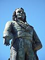
Statue of Championnet on the Champ de Mars.
-
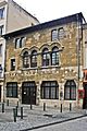
The Maison du Drapier.
-
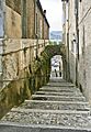
A "côte" of Valence, leaving the Place de la Pierre.
-
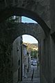
The Côte Saint-Martin. In the distance, the ruins of the Château de Crussol (Ardèche).
-
Stairs of the Côte Saint-Martin.
-
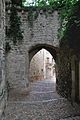
The Sylvante gate.
-
The top of the Côte Sylvante.
-
Côte Saint-Estève under the cathedral.
-
The Maison Dupré-Latour.
-
Kiosque Peynet on the Champ de Mars.
-
Bell tower of the Saint-Apollinaire Cathedral.
-
Gate of the former prefecture.
-
View of the Château de Crussol from the esplanade of the Champ de Mars.
-
Côte des Chapeliers, home of the Marquis of Veynes.
-
Côte des Chapeliers.
-
The Port de l'Épervière.


_004-001.JPG)


See also
 In Spanish: Valence (Francia) para niños
