
Image: Indonesia location map

Size of this PNG preview of this SVG file: 800 × 307 pixels. Other resolution: 320 × 123 pixels.
Original image (SVG file, nominally 1,200 × 460 pixels, file size: 854 KB)
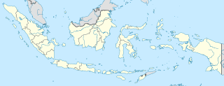
Description: Location map of Indonesia. Equirectangular projection. Stretched by 100.0%. Geographic limits of the map: N: 6.5° N S: -11.5° N W: 94.5° E E: 141.5° E Made with Natural Earth. Free vector and raster map data @ naturalearthdata.com.
Title: Indonesia location map
Credit: Own work
Author: Uwe Dedering
Usage Terms: Creative Commons Attribution-Share Alike 3.0
License: CC BY-SA 3.0
License Link: http://creativecommons.org/licenses/by-sa/3.0
Attribution Required?: Yes
Image usage
The following 30 pages link to this image:
- Adisumarmo International Airport
- Banda Aceh
- Bandung
- Batam
- Bima
- Christmas Island National Park
- Denpasar
- Depok
- Gunung Padang
- Jakarta
- Jayapura
- Kenyam
- Kupang
- Makassar
- Malaka Regency
- Mamuju (city)
- Mandiraja
- Mandiraja, Banjarnegara
- Medan
- Mojokerto
- Palembang
- Palu
- Pangkal Pinang
- Pangkalpinang
- Probolinggo
- Surabaya
- Tanjung Pinang
- Ternate
- Tidore
- Template:Location map Indonesia

All content from Kiddle encyclopedia articles (including the article images and facts) can be freely used under Attribution-ShareAlike license, unless stated otherwise.