Kupang facts for kids
Quick facts for kids
Kupang
|
|||
|---|---|---|---|
|
City
|
|||
|
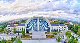
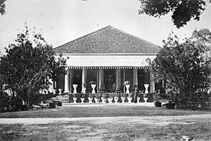
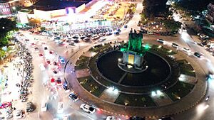
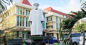
Clockwise, from above; Sasando Building, Kupang seen from above, and Kupang lighthouse
|
|||
|
|||
| Motto(s):
Lil Au Nol Dael Banan (Helong)
(Build me with a sincere heart) |
|||

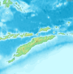
Location within East Nusa Tenggara
|
|||
|
OpenStreetMap
|
|||
| Country | |||
| Region | Lesser Sunda Islands | ||
| Province | |||
| Founded | 1886 | ||
| Area | |||
| • Total | 180.27 km2 (69.60 sq mi) | ||
| Elevation | 62 m (203 ft) | ||
| Population
(mid 2023 estimate)
|
|||
| • Total | 466,632 | ||
| • Density | 2,588.52/km2 (6,704.23/sq mi) | ||
| Time zone | UTC+8 (Central Indonesia Standard Time) | ||
| Area code | (+62) 380 | ||
| Vehicle registration | DH | ||
| HDI (2022) | |||
Kupang (Indonesian: Kota Kupang) is the capital city of the East Nusa Tenggara province in Indonesia. It was once known as Koepang or Coupang. In mid-2023, about 466,632 people lived there.
Kupang is the biggest city and port on the island of Timor. It is also part of a special trade area called the Timor Leste–Indonesia–Australia Growth Triangle. Kupang is the southernmost city in Indonesia.
Contents
History of Kupang
Early Times and European Influence
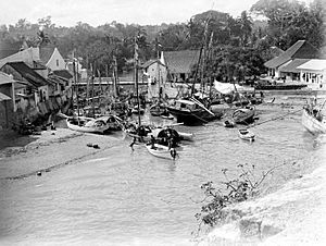
Kupang was an important port and trading spot a long time ago. This was during the time when the Portuguese and Dutch ruled. You can still find old buildings and signs of their presence in the city.
The Dutch East India Company (VOC) first came to Kupang in 1613. They had just taken over a Portuguese fort on Solor island. At that time, the city was ruled by a Raja (king) from the Helong tribe. The Helong people believed they came from Ceram in the Maluku Islands.
Kupang was a great place to control parts of Timor. From there, ships moving along the island's south coast could be watched. Also, the Koinino River gave the city fresh water.
The VOC and the Helong tribe made an agreement. But the VOC did not stay in Timor much. So, Portuguese people from Flores, called the Topasses, became very powerful in Kupang. By the 1640s, the Portuguese had a strong base there.
However, by 1646, the VOC was strong on Solor island. They made a new agreement with the local Raja of Kupang. In January 1653, the Dutch built a fort called Fort Concordia. It was on a hill near the river. Kupang then became the Dutch base to fight the Portuguese.
After some Dutch defeats, many people from nearby areas moved to Kupang. These groups were the Sonbai, Amabi, Amfoan, and Taebenu. They settled near Kupang on land that belonged to the Helong. The Helong Raja was still the "Lord of the Land." But he depended a lot on the Dutch. The Portuguese controlled most of Timor until 1749.
Dutch Rule in Kupang
The Dutch set up a government like those in Europe. It had a chief leader and a council. They managed things with the local people through regular meetings. They also dealt with nearby islands like Rote, Savu, and Solor.
Chinese traders and craftspeople settled in Kupang in the early 1700s. They quickly became a key part of the local economy. Other local groups and freed slaves (called mardijkers) also settled in the town. In 1752, about 827 Christians lived there, plus many non-Christians.
Kupang became much more important in 1749. The Dutch and their allies defeated the Topasses. This made Dutch influence spread across western and central Timor. But after 1761, Dutch power on the island weakened due to poor leadership.
Kupang was the final stop for William Bligh. He was set adrift in a small boat after the Mutiny on the Bounty in 1789. After sailing for 41 days, Bligh landed in Kupang on June 14. His journey inspired nine prisoners and two children to escape from Sydney Cove, Australia. They arrived in Kupang after ten weeks.
British forces attacked Dutch areas after France took over the Netherlands in 1795. Kupang was attacked in 1797. The British were forced out, but the town was badly damaged. Another British attack in 1811 also failed. After the British took over Java, Kupang finally gave up in January 1812. The town was given back to the Dutch in 1816 after the Napoleonic Wars ended.
In the early 1800s, Jacobus Arnoldus Hazaart was very important in Kupang. He governed Dutch Timor for three terms between 1810 and 1832. He handled things with little help from the government in Batavia. During his time, Christian missions in the city grew.
The town was opened for foreign trade in 1825. Fees were removed three years later. Kupang was popular with British and North American whalers. But this ended in the late 1800s when whaling areas moved. Kupang became a free port in 1866.
In 1917, five small kingdoms around Kupang were joined. These were the Helong kingdoms of Kupang, Sonbai Kecil, Amabi, Taebenu, and Funai. They became the self-ruling territory of Kupang. From 1918 to 1955, the Nisnoni family ruled Kupang.
Modern History and Independence
Kupang was used for planes flying long distances between Europe and Australia. The Japanese controlled Kupang from 1942 to 1945. Much of the old town was destroyed by Allied bombs.
The city saw many people wanting independence. But it stayed peaceful during the Indonesian National Revolution (1945-1949). Kupang became part of the State of East Indonesia in 1946. The city and East Indonesia were later joined into the United States of Indonesia in 1949. This was replaced by the current Republic of Indonesia in 1950.
Later, Kupang became important during the Timorese conflict. In 1967, the city became the center for the Diocese of Kupang. In 1989, it became the Archdiocese of Kupang. In April 2021, a strong storm called Tropical Cyclone Seroja badly damaged the city.
Geography of Kupang
Kupang is on the southwestern tip of the island of Timor. It is surrounded by Kupang Regency on land. The Savu Sea is on its northern side. The city covers 180.27 square kilometers of land. It also has 94.79 square kilometers of water area.
The area around Kupang does not have active volcanoes. The soil is made of non-volcanic materials like Latosol and Terra rossa. The highest point in the city is 62 meters above sea level. The land slopes gently, from 0 to 5%. Most of the city is low-lying. But there are hills in the south and southwest. These hills help create a fertile area where water collects.
Climate in Kupang
Kupang has a tropical savanna climate. This means it has very wet and very dry seasons. Unlike many places with this climate, Kupang's temperature does not change much. It stays similar between the summer (October to March) and winter (April to September).
October is the hottest month, with an average temperature of 28.8 °C or 83.8 °F. July is the coolest, with an average temperature of 26.1 °C or 79.0 °F. January is the wettest month, with about 386 millimetres or 15.20 inches of rain. August and September are the driest, with only about 2 millimetres or 0.079 inches of rain each.
| Climate data for Kupang, West Timor, Indonesia (1961-1975) | |||||||||||||
|---|---|---|---|---|---|---|---|---|---|---|---|---|---|
| Month | Jan | Feb | Mar | Apr | May | Jun | Jul | Aug | Sep | Oct | Nov | Dec | Year |
| Record high °C (°F) | 35.0 (95.0) |
34.4 (93.9) |
35.6 (96.1) |
36.1 (97.0) |
35.6 (96.1) |
34.4 (93.9) |
35.0 (95.0) |
36.7 (98.1) |
37.2 (99.0) |
38.3 (100.9) |
38.3 (100.9) |
36.7 (98.1) |
38.3 (100.9) |
| Mean daily maximum °C (°F) | 30.1 (86.2) |
30.0 (86.0) |
31.1 (88.0) |
32.4 (90.3) |
32.3 (90.1) |
31.4 (88.5) |
31.3 (88.3) |
32.5 (90.5) |
33.4 (92.1) |
33.8 (92.8) |
33.1 (91.6) |
31.4 (88.5) |
31.9 (89.4) |
| Daily mean °C (°F) | 26.9 (80.4) |
26.6 (79.9) |
27.2 (81.0) |
27.7 (81.9) |
27.4 (81.3) |
26.2 (79.2) |
26.1 (79.0) |
26.7 (80.1) |
27.7 (81.9) |
28.8 (83.8) |
28.7 (83.7) |
27.6 (81.7) |
27.3 (81.1) |
| Mean daily minimum °C (°F) | 23.8 (74.8) |
23.5 (74.3) |
23.3 (73.9) |
22.8 (73.0) |
22.3 (72.1) |
20.7 (69.3) |
20.2 (68.4) |
20.5 (68.9) |
21.2 (70.2) |
22.5 (72.5) |
23.6 (74.5) |
23.8 (74.8) |
22.4 (72.3) |
| Record low °C (°F) | 21.1 (70.0) |
20.0 (68.0) |
20.6 (69.1) |
17.2 (63.0) |
17.8 (64.0) |
15.6 (60.1) |
15.6 (60.1) |
15.6 (60.1) |
16.7 (62.1) |
18.3 (64.9) |
20.0 (68.0) |
21.1 (70.0) |
15.6 (60.1) |
| Average rainfall mm (inches) | 386 (15.2) |
347 (13.7) |
234 (9.2) |
65 (2.6) |
30 (1.2) |
10 (0.4) |
5 (0.2) |
2 (0.1) |
2 (0.1) |
17 (0.7) |
83 (3.3) |
232 (9.1) |
1,413 (55.8) |
| Average rainy days (≥ 1.0 mm) | 18.1 | 15.5 | 13.2 | 5.0 | 2.5 | 1.2 | 0.8 | 0.3 | 0.3 | 1.3 | 6.9 | 14.7 | 79.8 |
| Average relative humidity (%) | 85 | 86 | 83 | 75 | 70 | 67 | 65 | 63 | 64 | 66 | 73 | 81 | 73 |
| Mean monthly sunshine hours | 189 | 195 | 223 | 267 | 276 | 276 | 288 | 304 | 306 | 288 | 264 | 205 | 3,081 |
| Source 1: Deutscher Wetterdienst | |||||||||||||
| Source 2: Danish Meteorological Institute | |||||||||||||
People of Kupang
Kupang is the capital of a province, so many different ethnic groups live there. It is a popular place for people to move to from nearby areas. The city's population grew by 31% from 2010 to 2020. In 2020, there were slightly more males than females.
Most people in Kupang are young. About 65% of the population is old enough to work (over 15 years old). The largest age group is 20 to 24 years old. This is because many young people move to Kupang from other regions. The population grew by about 1.83% each year between 2020 and 2023.
Most people in Kupang are Protestant (326,229). Other groups include Catholic (75,804), Muslim (44,419), Hindu (6,114), and Buddhist (205). People in Kupang live for about 70 years on average. This is a bit lower than the national average but higher than the average for the province.
Economy of Kupang
The biggest part of Kupang's economy is the service sector. This includes jobs like retail, banking, and tourism. It makes up 48.29% of the city's total economic output. It also provides jobs for 79.34% of the city's workers.
The primary sector, which includes farming and mining, is much smaller. It only makes up 2.33% of the city's economy. Other important economic areas are construction (16.29%), transportation (9.42%), finance and insurance (7.38%), and real estate (3.03%).
Kupang's economy is different from nearby areas. Those areas still depend mostly on farming and getting natural resources. The amount of land used for farming in Kupang went down by 41% from 2018 to 2019. At the same time, the industrial sector grew by 11%.
Kupang has three cement plants run by PT Semen Kupang. Together, they make about 250,000 tons of cement each year. However, the local government thinks this is not enough. The province and nearby East Timor need more than 1.8 million tons of cement per year. Because of this, the government planned to take over PT Semen Kupang in 2020 to make more cement.
The city had a small price decrease (deflation) of 0.5% in 2019. The average yearly price increase (inflation) in Kupang is a bit lower than the national average. In 2018, there were 31 banks in the city. The amount of money loaned by banks grew by 53% that year. This helped the city's financial sector grow quickly. Also, 4,534 trade companies were registered in Kupang.
The city's economy grew very fast, by 10% in 2019. This was much higher than the national average. In that year, the unemployment rate was 9.78%.
How Kupang is Governed
City Districts
In 2021, Kupang was divided into six districts, called kecamatan. The table below shows the size and population of each district. It also shows where the main office for each district is, how many villages (called kelurahan) are in each, and their postcodes.
| Kode Wilayah |
Name of District (kecamatan) |
Area in km2 |
Pop'n Census 2020 |
Pop'on Estimate mid 2023 |
Admin centre |
No. of villages |
Post codes |
|---|---|---|---|---|---|---|---|
| 53.71.01 | Alak | 86.91 | 76,908 | 84,110 | Penkase Oeleta | 12 | 85231 - 85239 |
| 53.71.02 | Maulafa | 54.80 | 97,976 | 106,880 | Maulafa | 9 | 85141 - 85148 |
| 53.71.04 | Oebobo | 14.22 | 100,560 | 103,800 | Oebobo | 7 | 85111 - 85112 |
| 53.71.05 | Kota Raja | 6.10 | 57,121 | 58,960 | Kota Raja | 8 | 85111 - 85119 |
| 53.71.03 | Kelapa Lima | 15.02 | 75,486 | 77,310 | Kelapa Lima | 5 | 85228 |
| 53.71.06 | Kota Lama | 3.22 | 34,725 | 35,570 | Kota Lama | 10 | 85221 - 85229 |
| Totals | 180.27 | 442,758 | 466,612 | 51 |
City Government
Kupang is governed like other cities in Indonesia. It is a second-level administrative area. It has a mayor and a vice mayor who lead the city. There is also a city parliament that makes laws. The people of Kupang vote for the mayor, vice mayor, and members of the city parliament. However, the mayor chooses the district heads.
Politics in Kupang
Kupang is part of the 1st electoral district of East Nusa Tenggara province. This district sends 6 members to the provincial parliament, which has 65 seats. The city parliament has 40 members. These members are divided into five electoral districts. The table below shows these divisions.
The last election for the city parliament was in 2019. The next one will be in 2024. Since Kupang is the capital of East Nusa Tenggara province, it is also home to the provincial parliament building and the governor's office.
| Electoral District | Comprising | Representatives |
|---|---|---|
| Kupang 1st | Kota Raja District | 6 |
| Kupang 2nd | Kelapa Lima & Kota Lama Districts | 11 |
| Kupang 3rd | Oebobo District | 9 |
| Kupang 4th | Maulafa District | 8 |
| Kupang 5th | Alak District | 6 |
| Total | 40 | |
City Facilities
Health Services
As of 2021, Kupang has many health facilities. There are 10 hospitals, 45 community health centers (puskesmas), 15 polyclinics, and 33 pharmacies.
Two hospitals in the city are considered international-class. These are Siloam Hospital and Kupang Vertical Technical Implementation Unit Hospital. The latter is planned to be a major hospital for East Nusa Tenggara province and nearby East Timor.
The W. Z. Johannes Regional Public Hospital is owned by the city government. Army hospitals like Wirasakti Hospital and the Naval Army Hospital also provide healthcare. Kupang also has several medical laboratories. These labs test water, food, animal health, and medical samples. Two new biomolecular labs opened in 2020.
Education
Kupang has many schools and universities. In 2021, there were:
- 122 kindergartens
- 150 elementary schools
- 59 junior high schools
- 42 senior high schools
- 24 vocational high schools
- 16 higher education institutions (universities and colleges)
Oebobo District has the most schools, while Kota Lama District has the fewest. One of the most famous universities is the University of Nusa Cendana. It is in Kelapa Lima District and is the oldest university in the province. Other universities include Artha Wacana Christian University, Widya Mandira Catholic University, and Kupang State Polytech of Agriculture.
Places of Worship
In 2021, Kupang had many places for people to worship:
- 69 mosques
- 327 churches
- 7 Hindu temples
- 1 Chinese Buddhist temple
Transportation in Kupang
As of 2021, Kupang has 1,665.93 kilometers of roads. About 1,423.05 kilometers of these roads are paved with asphalt.
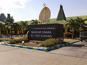
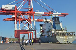
The city has an airport called El Tari International Airport. In 2019, about 936,159 people arrived and 992,048 people left through this airport. The main port in the city is Tenau International Port. In 2019, 176,888 people arrived and 204,919 people left through the port. Also, 234,945 tons of goods moved through the port in 2020.
In September 2020, Kupang started its first bus rapid transit (BRT) system. This system, called Trans Kota, helps improve public transportation, especially for students. It has four lines and runs from 8:00 AM to 4:00 PM. However, some local taxi drivers were against it. They worried that the BRT system would take away their jobs. The city also has app-based taxi services like Grab and Gojek.
See also
 In Spanish: Kupang para niños
- List of colonial Residents of Dutch Timor
- History of Timor
- List of regencies and cities of Indonesia
 | Charles R. Drew |
 | Benjamin Banneker |
 | Jane C. Wright |
 | Roger Arliner Young |


