
Highways in Puerto Rico facts for kids
   
Highway shields for primary, urban primary, secondary and tertiary sections of PR-1.
|
|
Quick facts for kids Highway names |
|
|---|---|
| Interstates: | Interstate PRnn (PRI-nn) |
| Commonwealth: | Puerto Rico Highway nn (PR-nn) |

The system of highways in Puerto Rico is like the main network of roads that helps people travel all over the island. It has about 14,400 kilometers (about 8,948 miles) of roads! This huge system is looked after by Puerto Rico's Department of Transportation and Public Works. Think of it as the island's main arteries, helping cars, buses, and trucks get where they need to go.
The roads in Puerto Rico are sorted into different types, kind of like how streets in a city might be main roads or smaller local roads. Even if a highway changes from a big road to a smaller one, it keeps the same number.
- Primary roads: These are the biggest and most important roads, numbered from 1 to 99.
- Urban primary roads: These are also important main roads, but they are found inside cities and towns.
- Secondary (or inter-municipal) roads: These roads connect different towns and are numbered from 100 to 299.
- Tertiary (or local) roads: These are smaller, local roads that help you get around neighborhoods and smaller areas. They are numbered from 300 all the way up to 9999.
Puerto Rico's Interstate Highways

Did you know Puerto Rico has its own special Interstate Highways? There are three of them, and they stretch for about 410 kilometers (255 miles) in total. Even though they are called "Interstates," they don't connect to the main Interstate Highway System in the United States. This is similar to how Interstate Highways work in Alaska and Hawaii.
However, these roads still get money from the U.S. government to help keep them in good shape. Some of these Interstate Highways are toll roads, which means you pay a small fee to use them. They also have special ramps to help drivers get on and off safely. You won't see signs that say "Interstate" on these roads; instead, they are signed with their regular Puerto Rico route numbers.
It's important not to confuse these Interstate routes with other major highways like PR-1, PR-2, and PR-3. Those are different important roads in Puerto Rico.
Here are the three Interstate Highways in Puerto Rico:
- Interstate PRI-1: This highway goes from San Juan in the north, heading southwest to Ponce. It follows parts of Puerto Rico Highway 52 and Puerto Rico Highway 18. This route is about 71.08 miles (114.40 kilometers) long.
- Interstate PRI-2: This route also connects San Juan to Ponce, but it travels along the western coast of Puerto Rico. It uses parts of Puerto Rico Highway 22 and Puerto Rico Highway 2. This is the longest of the three, at about 138.13 miles (222.30 kilometers) long.
- Interstate PRI-3: This highway goes from San Juan southeast to Ceiba. It follows parts of Puerto Rico Highway 53. This route is about 40.56 miles (65.28 kilometers) long.
Images for kids
-
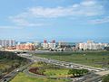
The skyline of Isla Verde, near Puerto Rico's international airport.
-
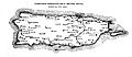
Highways in Puerto Rico that were built by Spain by 1898.
-
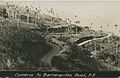
Comerio to Barranquitas Road, photographed by Attilio Moscioni between 1900 and 1917.
-
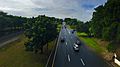
PR-2 heading away from Santurce in San Juan.
-
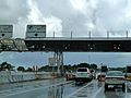
Cars going through a toll booth on PR-66.
-
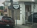
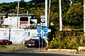
PR-1107P in Aguadilla barrio-pueblo.
-
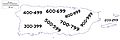
A diagram showing a tertiary road in Puerto Rico.
-
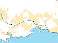
A map of "Interstate" PRI-2 and some of its connecting roads around Yauco municipality.
-
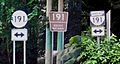
Road markers at the El Yunque National Rain Forest.
-
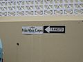
A sign for Calle Pedro Albizu Campos in Lares barrio-pueblo.
-
PR-54 West and East junction with PR-744 in Guayama.
-
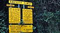
"For your safety" tips for driving in Puerto Rico sign.
-
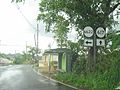
PR-145 in Torrecillas, Morovis.
-
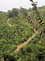
PR-438, a steep roadway, seen from Calabazas barrio, San Sebastián.
-
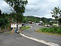
PR-435 and PR-124 highway junction in Espino, Lares.
-
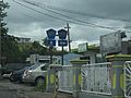
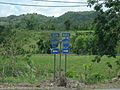
PR-6622 and PR-617 signs in Morovis.
-
Puerto Rico Highway 6685 in Manatí.


_01.jpg)


See also
 In Spanish: Carreteras de Puerto Rico para niños
