
Isle (river) facts for kids
Quick facts for kids Isle |
|
| River | |
 The Isle river in Périgueux
|
|
| Country | France |
|---|---|
| Region | Nouvelle-Aquitaine |
| Departments | Haute-Vienne, Dordogne, Gironde |
| Communes | Périgueux, Saint-Astier, Montpon-Ménestérol, Coutras, Libourne |
| Tributaries | |
| - left | Loue, Auvézère |
| - right | Dronne, Lary |
| Cities | Périgueux, Libourne |
| Source | Monts du Limousin |
| - location | Massif Central, Nouvelle-Aquitaine, France |
| - elevation | 379 m (1,243 ft) |
| - coordinates | 45°38′53″N 1°12′36″E / 45.64806°N 1.21000°E |
| Mouth | Dordogne |
| - location | Libourne, Nouvelle-Aquitaine, France |
| - elevation | 5 m (16 ft) |
| - coordinates | 44°54′56″N 0°14′56″W / 44.91556°N 0.24889°W |
| Length | 255.3 km (159 mi) |
| Basin | 7,510 km² (2,900 sq mi) |
| Discharge | for Coutras |
| - average | 61.7 m³/s (2,179 cu ft/s) |
The Isle (which is called Eila in the Occitan language) is a river in southwestern France. It flows through three different areas called Haute-Vienne, Dordogne, and Gironde. These areas are all part of the Nouvelle-Aquitaine region. The Isle river is a "tributary" of the Dordogne river. This means it's a smaller river that flows into a larger one.
Contents
River Facts: Length and Flow
The Isle river is about 255.3 kilometers (or 158.6 miles) long. Imagine a line stretching from one end of the river to the other! The area of land that drains water into the Isle river is called its "drainage basin." This basin covers about 7,510 square kilometers (2,900 square miles).
Water Flow: Discharge Rate
The amount of water that flows through a river at a certain point is called its "discharge." For the Isle river, the average amount of water flowing past a spot near Coutras is about 61.7 cubic meters every second. That's like 61 large bathtubs full of water passing by every second!
Where the Isle River Starts and Ends
The Isle river begins high up in the Monts du Limousin mountains. These mountains are part of a bigger mountain range called the Massif Central. The river starts in a small town called Janailhac in the Haute-Vienne area. At its starting point, the river is about 379 meters (1,243 feet) above sea level.
As it flows, the Isle river generally moves towards the southwest. It passes through the Haute-Vienne, Dordogne, and Gironde areas. Finally, it joins the Dordogne river in the city of Libourne. At this point, the river is only about 5 meters (16 feet) above sea level.
The Isle river flows through 2 regions and 3 departments in France. It also passes by 66 different towns and villages, which are called communes in France. Some of the main towns along the river are:
- Nouvelle-Aquitaine region
- In Haute-Vienne: La Meyze
- In Dordogne: Jumilhac-le-Grand, Périgueux, Saint-Astier, Neuvic, Mussidan, Montpon-Ménestérol
- In Gironde: Coutras, Guîtres, Saint-Denis-de-Pile, Libourne
Main Rivers Joining the Isle
Many smaller rivers and streams flow into the Isle river. These are called "tributaries." Here are some of the main tributaries that are longer than 50 kilometers (31 miles):
- Rivers joining from the left side:
- Loue - 50.9 kilometers long
- Auvézère - 112.2 kilometers long
- Rivers joining from the right side:
- Dronne - 200.6 kilometers long
- Lary - 53.7 kilometers long
Images for kids
-
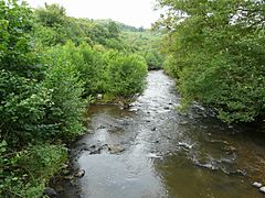
The Isle river in Jumilhac-le-Grand
-
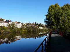
The Isle river in Périgueux
-
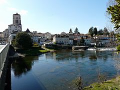
The Isle river in Saint-Astier
-
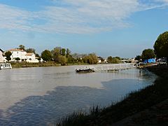
The Isle river in Libourne

.JPG)


Related pages
